
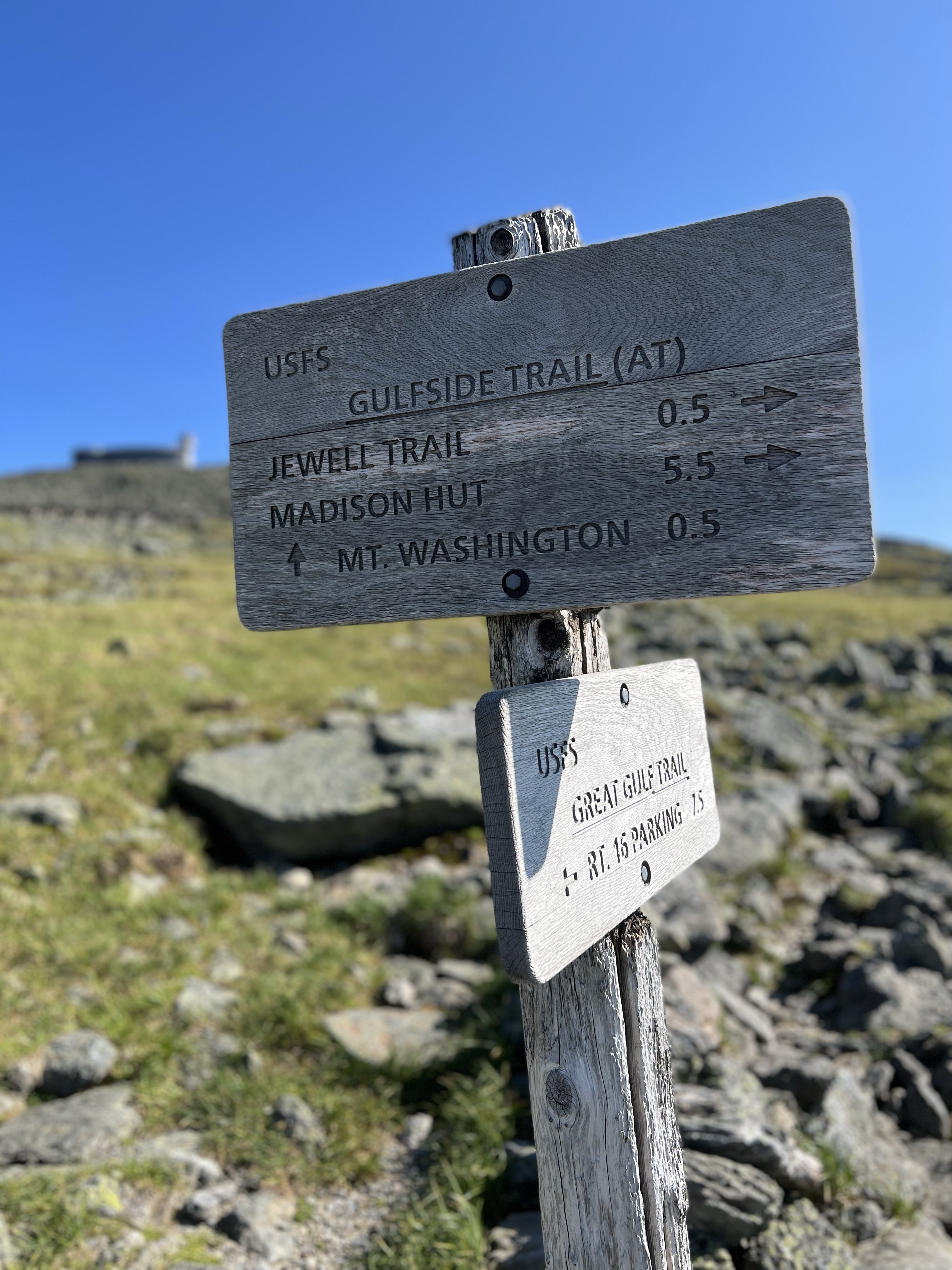
7/9/2022
I had been thinking about doing a Presidential Traverse for some time. I had even contacted a ride to transport me from my car which I’d leave at the Highland Center in Crawford Notch to my starting trailhead, Appalachia. The 20+ mile traverse is a rite of passage of sorts for those who hike the Whites of New Hampshire.
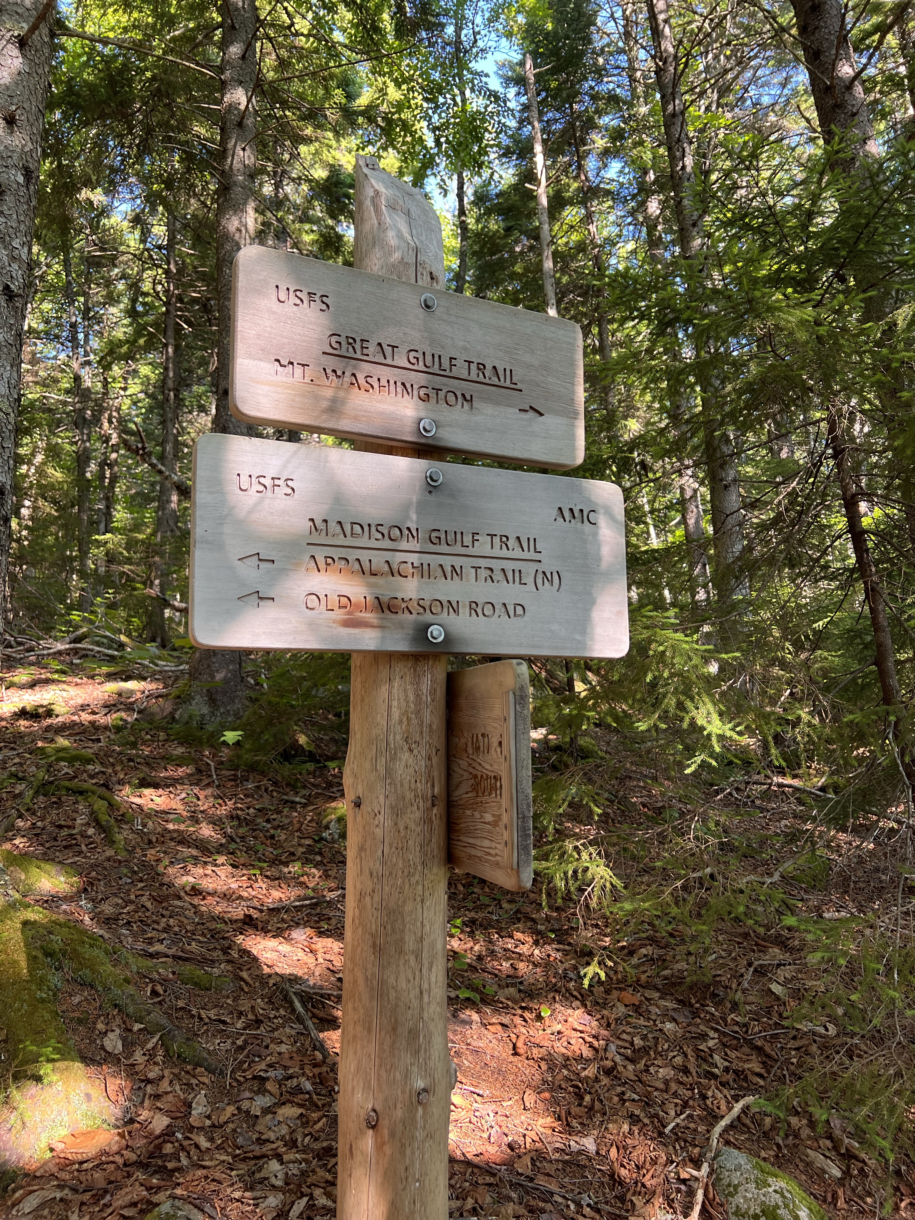
I decided that I would first attempt a Northen Presidential loop. The Northern Prezis are the toughest part of the full traverse. My plan would be to start at Pinkham Notch AMC Headquarters. Old Jackson Road to Madison Gulf Trail. Osgood Cutoff to Osgood Trail to the top of Madison. Gulf Side Trail from Madison to Airline Trail and up Mount Adams. Lowes Path down Adams back to Gulf Side. Gulf Side to Jefferson Summit Loop to the summit of Jefferson. Jefferson Summit Loop back to Gulf Side. Around Mount Clay via Gulfside all the way to Trinity Cutoff to the summit of Mt Washington. Descend Washington via Tuckerman Ravine Trail back to my car at Pinkham Notch.
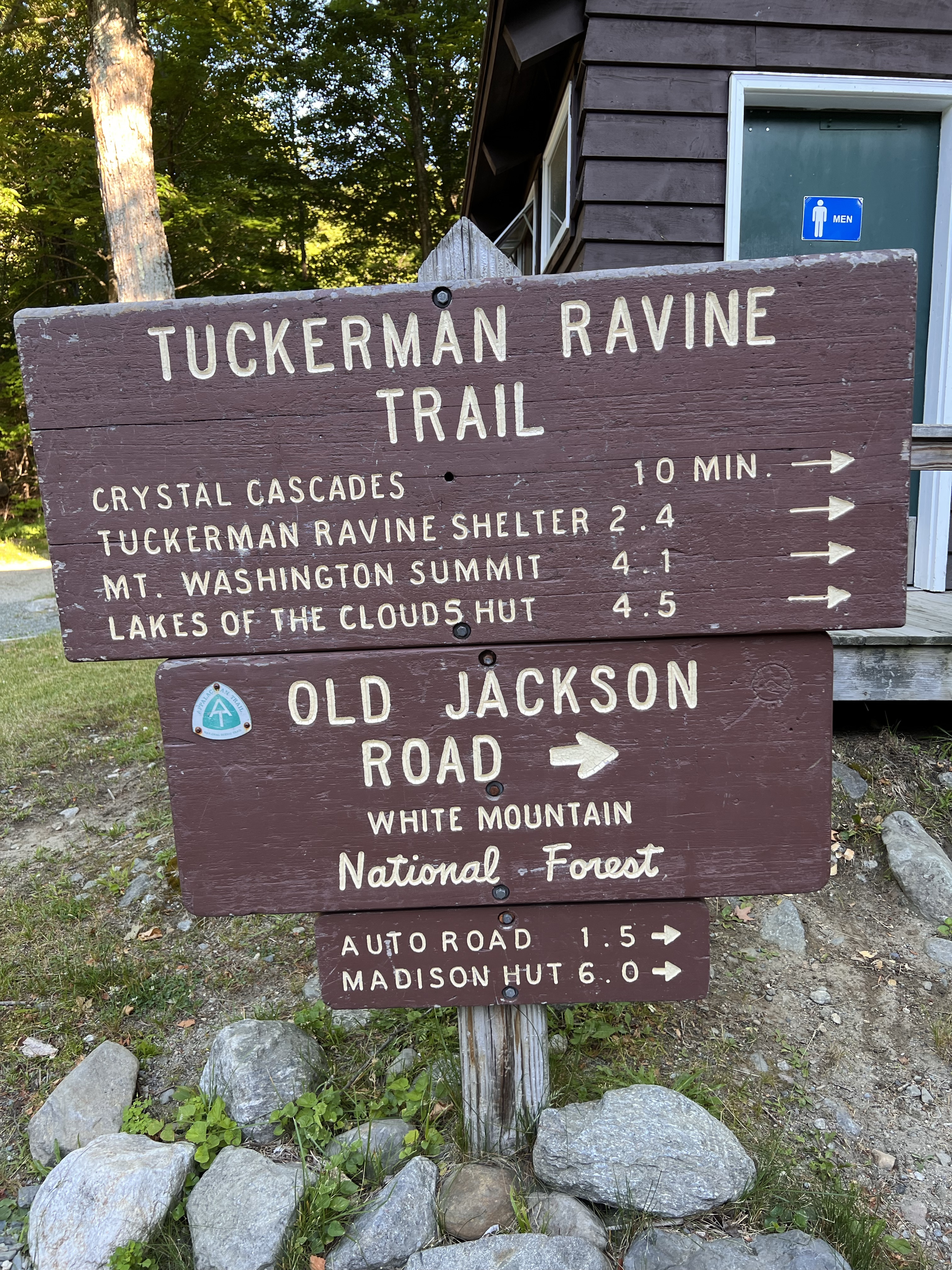
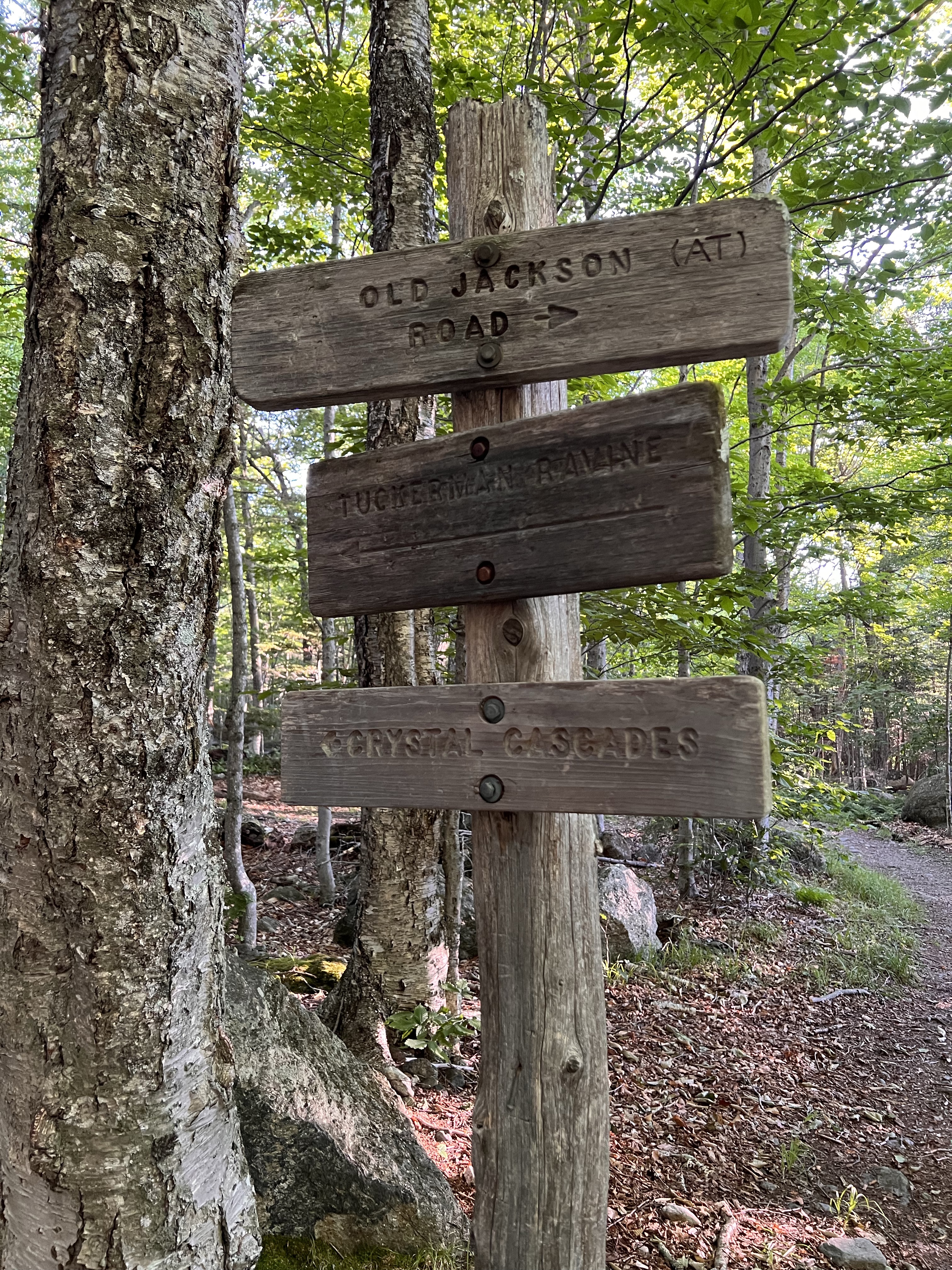
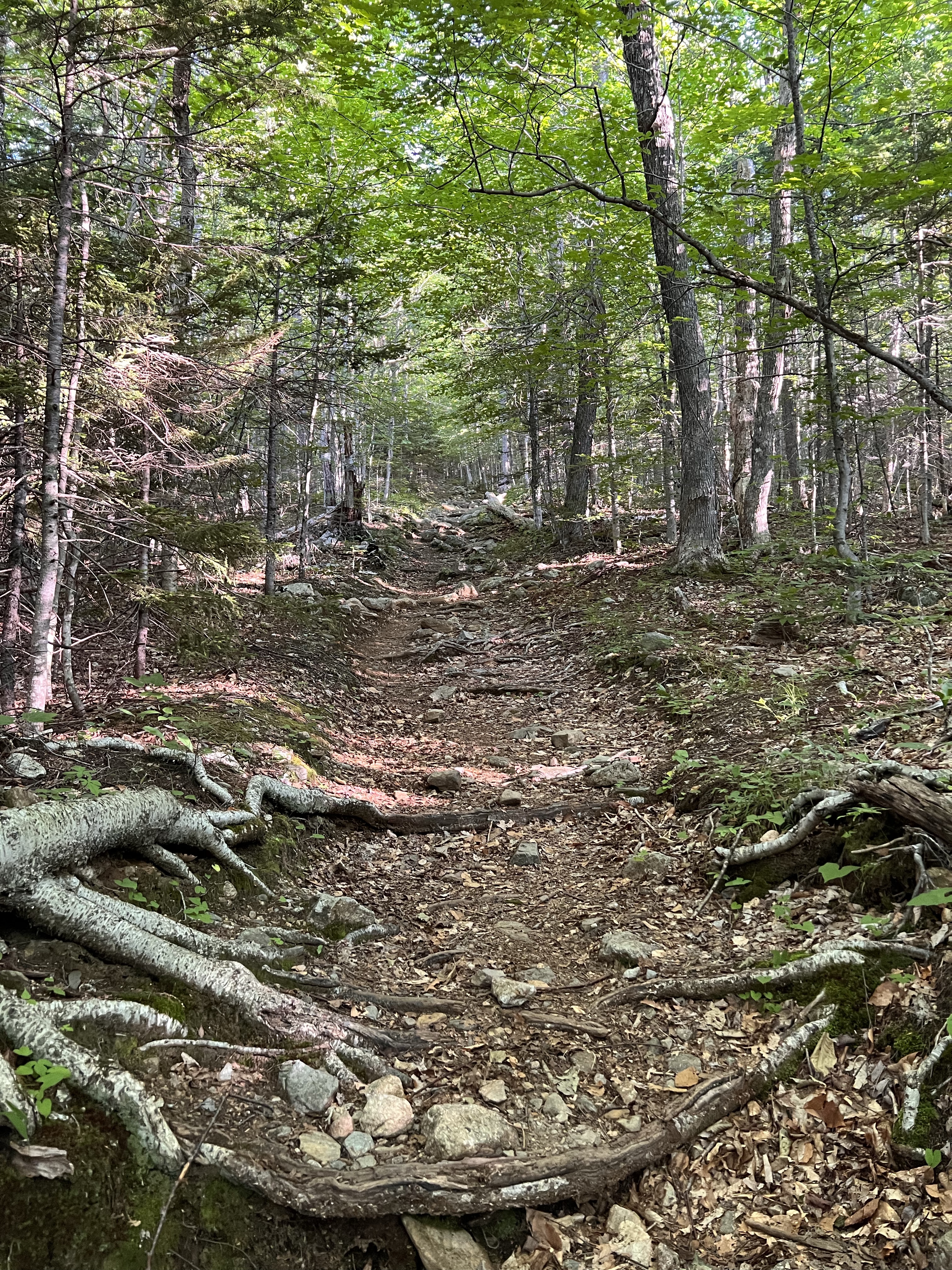
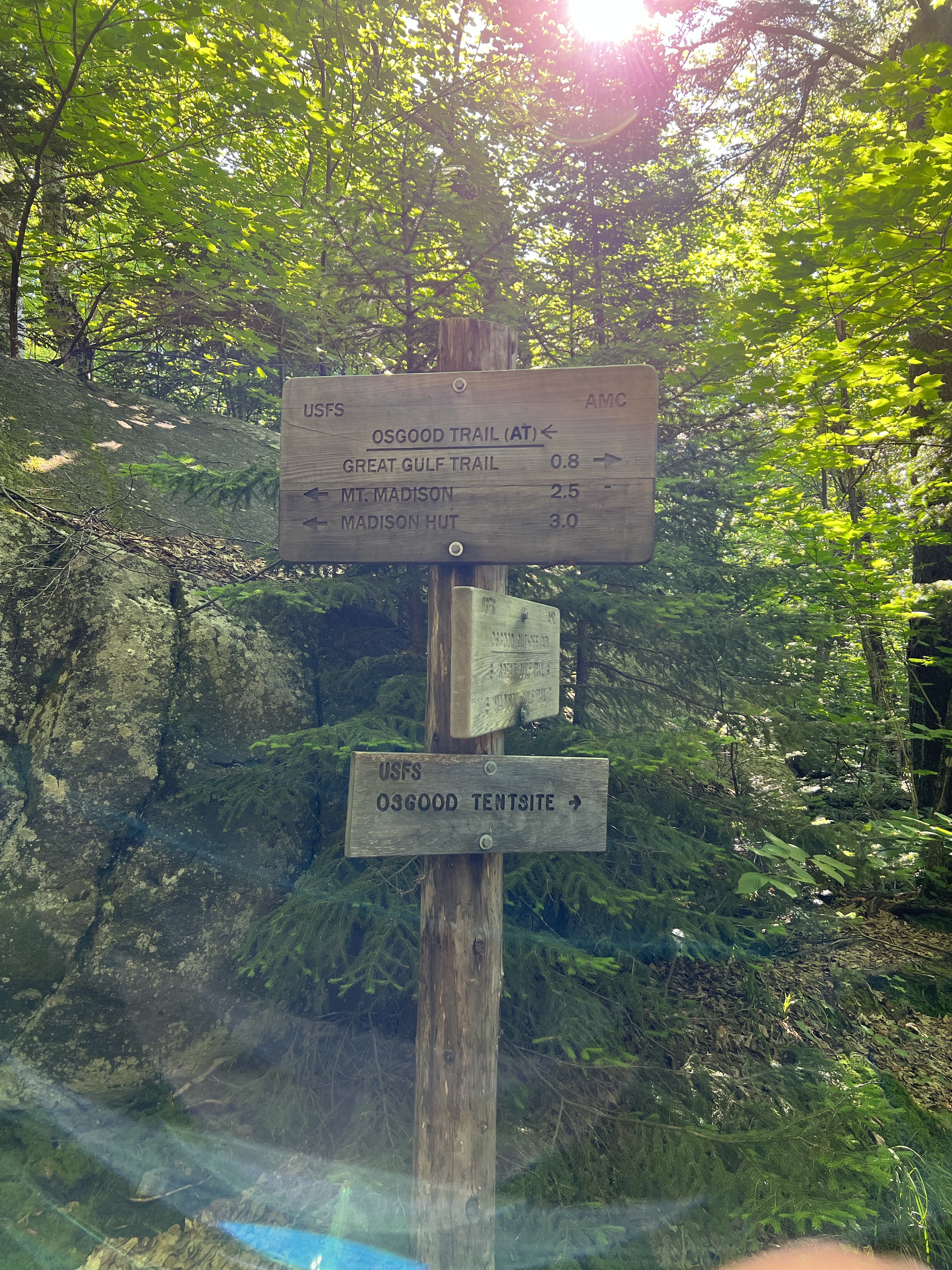
I got a late start Saturday morning and arrived at the trailhead at about 6:50am and was in the woods on Old Jackson Road trail at 7:00. Old Jackson Rd started very gradually. It took a turn to moderate grade and continued that way for a couple miles. I had heard and saw someone coming up on me. I stopped for a bit to adjust my pack and that’s when Mike (Michel) from Quebec caught up to me. As we all know I’m primarily a solo hiker. Mike seemed to want to hike alongside me. Being a reasonable person I did not ask him to move along. We chatted and time flew as we progressed on to Madison Gulf Trail and Eventually to the Osgood Cut-off at mile 4.
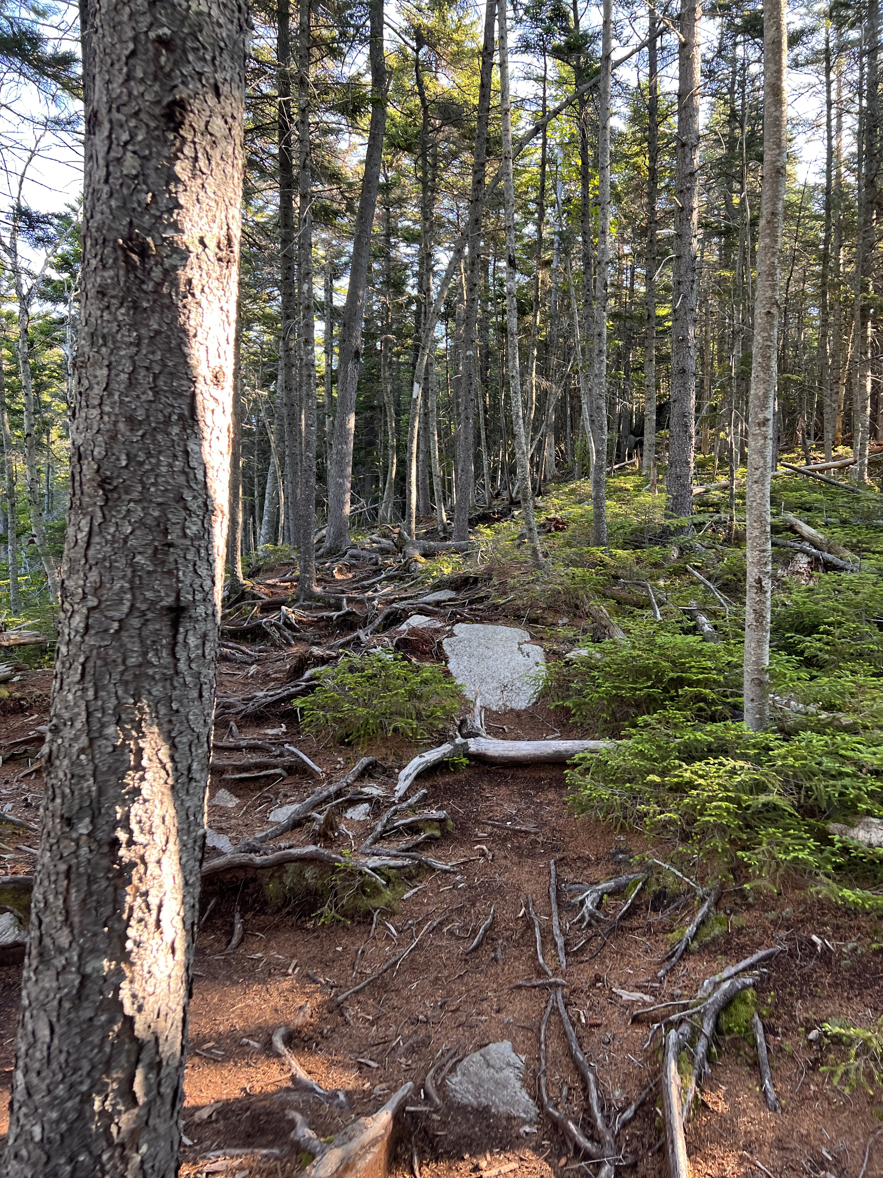
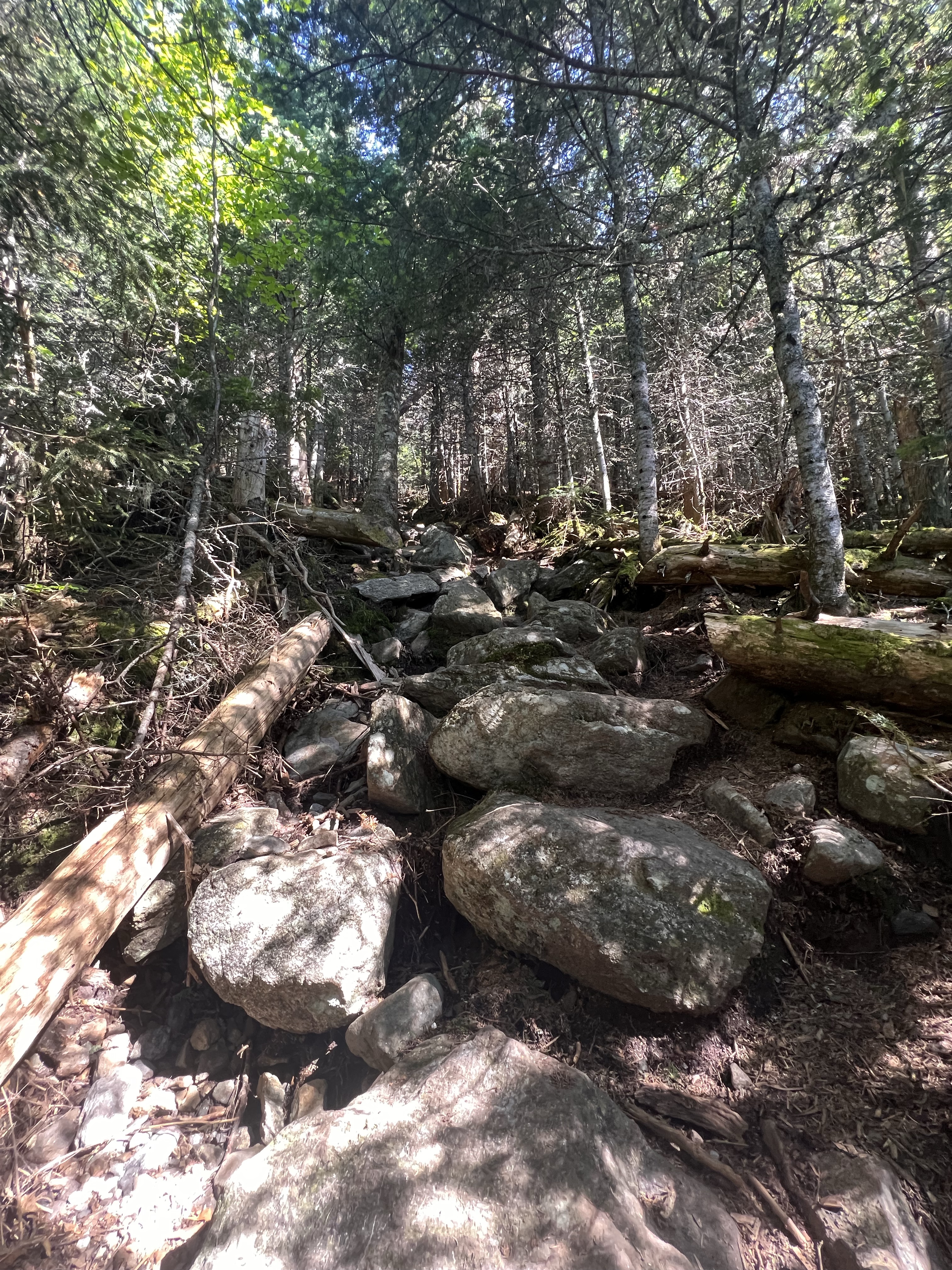
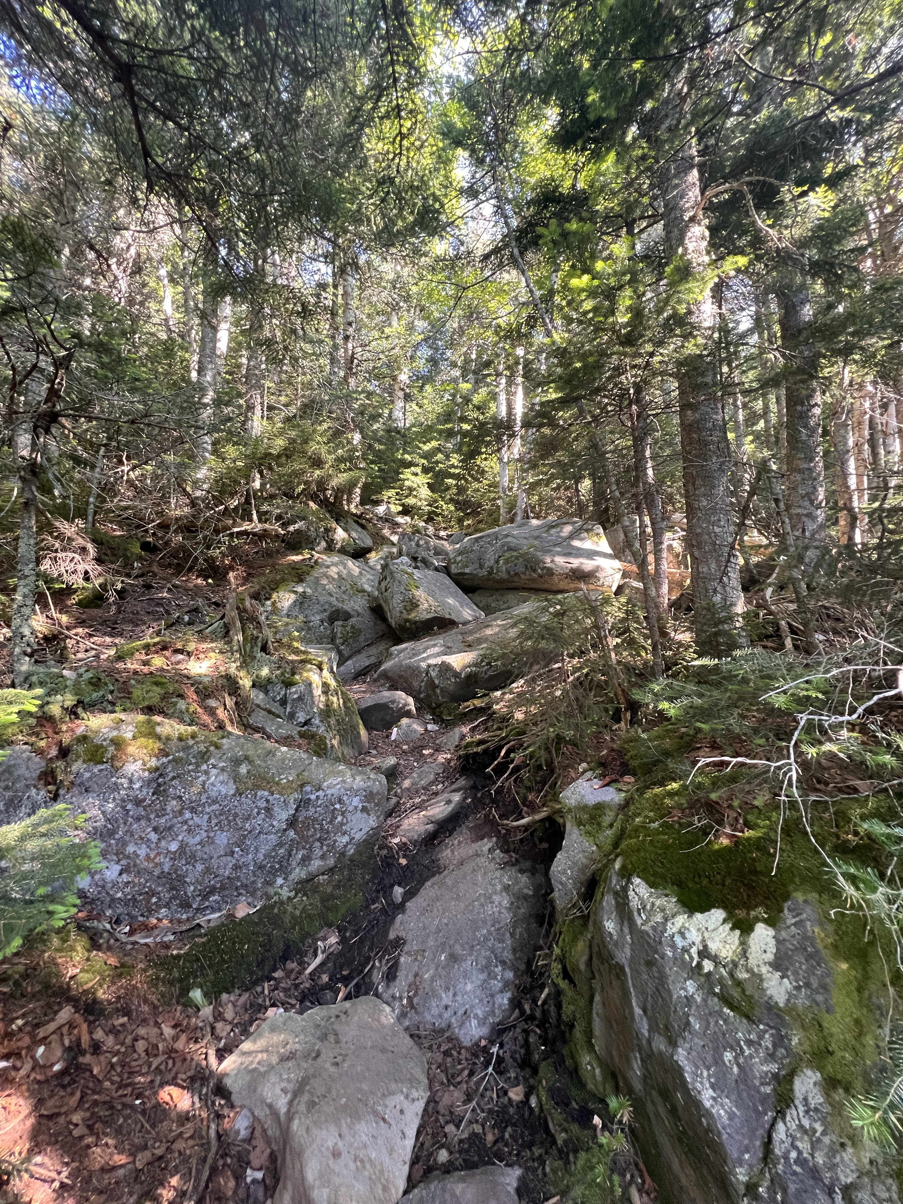
It was here, at the Osgood Cutoff/Osgood Trail junction that the trail turned upward. It got immediately steep and stayed that way for about 2.5 miles to the top of Mt Madison. My favorite place to hike is above the tree line on a ridge. As I gained elevation on the Osgood Trail I was looking forward to that point where the trees start to shrink and the trail becomes more difficult to follow as the trees and foliage lining it go away. As labored as my breathing was, as much as my thighs burned and as the sweat ran into my eyes I got an invigorating second wind as I looked southeast toward Washington, Clay and Jefferson. Then the summit of Mount Madison peeked through the remaining trees and Mount Adams rose behind it.
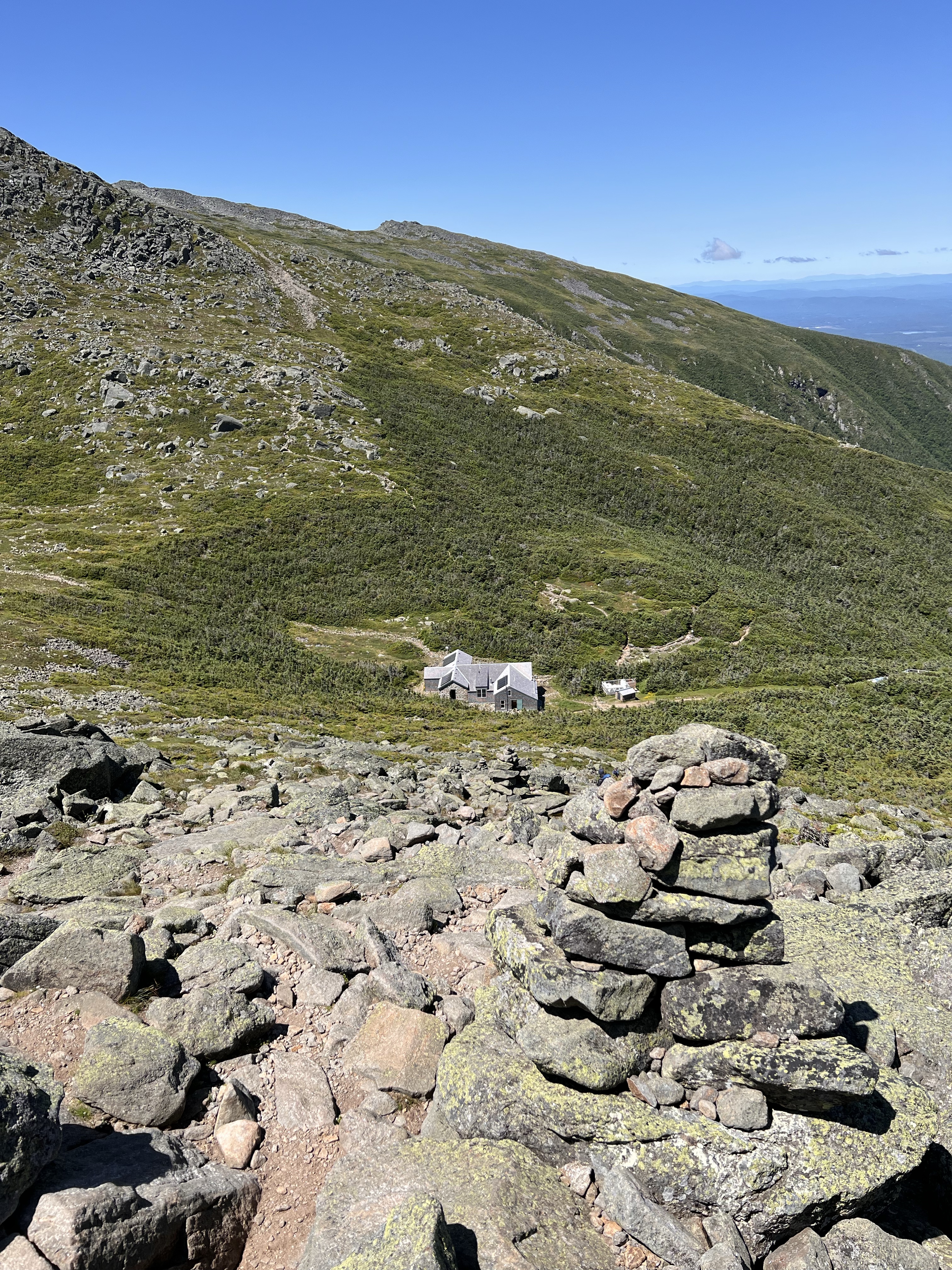
Michel and I didn’t hang around long on Madison. I took a few pictures, got a big drink of water and off we in went on the descent down to Madison Springs hut. Speaking of water, I don’t drink just straight water while hiking. Ever since I had a severe cramping incident on Mt Lafayette I have been adding Gatorade ZERO mix and a couple pinches of pink salt to my water. I think the cramps were caused by low salt and mild dehydration. Since adding salt to my water my legs haven’t come close to cramping like that.
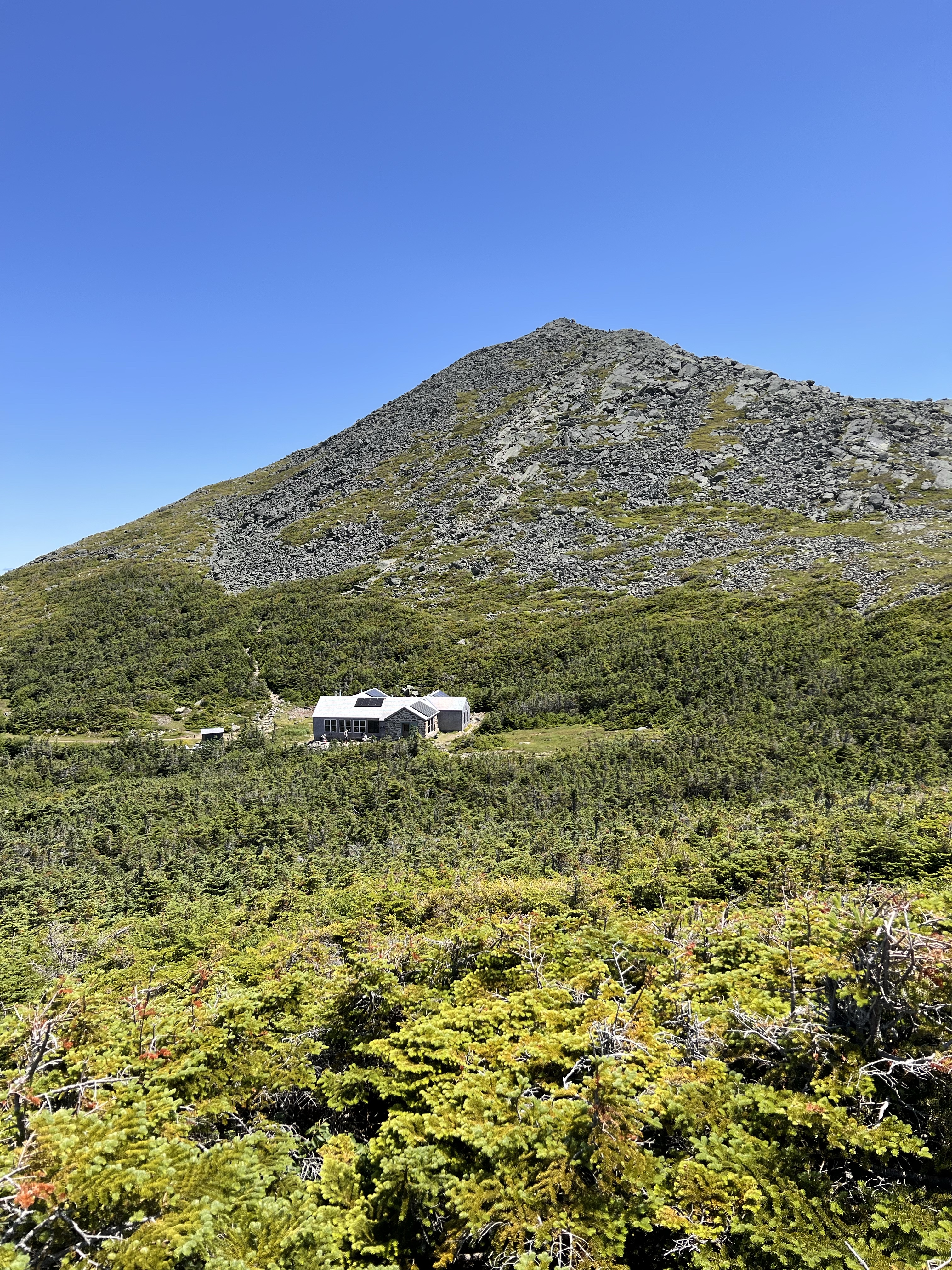
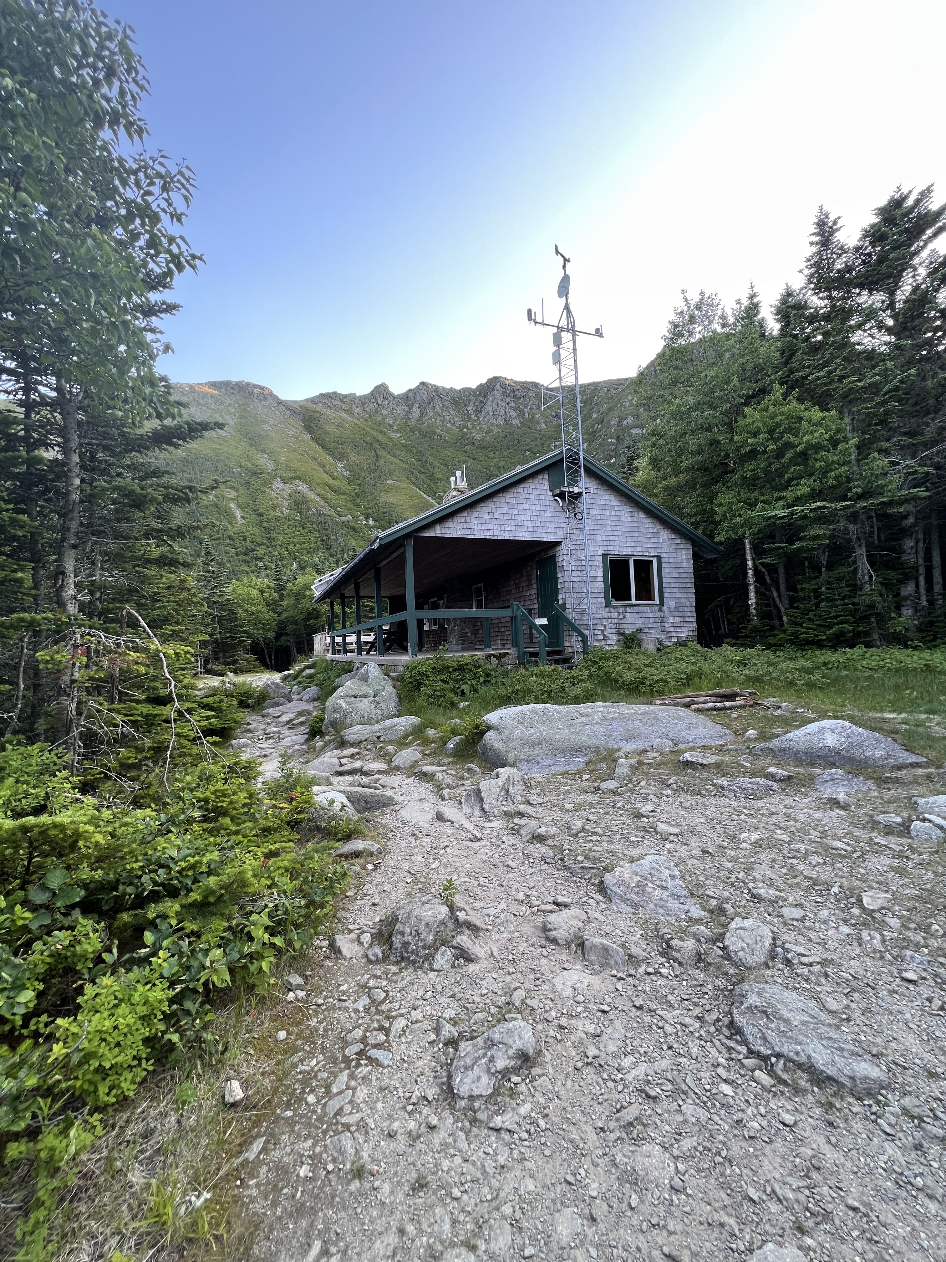
We arrived at the hut at about 11:30. I finished off a bottle of water and prepared another. My next water fill opportunity would be after Mount Adams and Mount Jefferson when I arrive at Washington a few hours from now. I went inside, had a PB&J, and browsed the map considering how I would make my way to Adams.
We left the hut at noon via Gulf Side Trail. The climb was steep immediately as we made our way around the bottom of Mount Quincy Adams. The next junction was Great Gulf and Airline Trail. Airline was the trail to take me to the top of Adams. Michel was doing the same loop as me but skipping the summits of Adams and Jefferson. We wished each other luck as I turned onto Airline and he continued on Great Gulf.
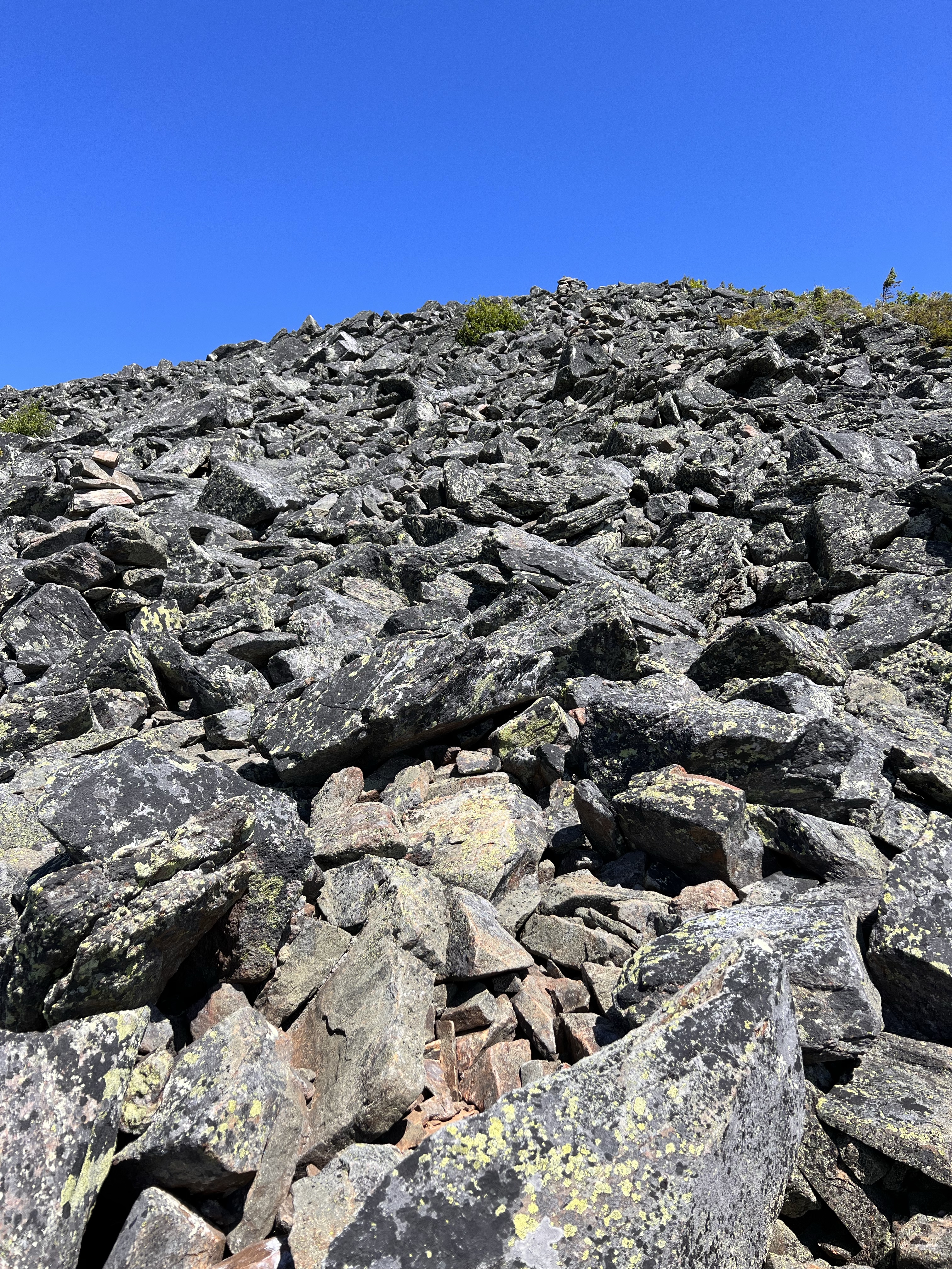
Airline Trail up Adams in my opinion is one of the steepest ascents I have done. It’s a real leg destroyer. After the junction, the ascent is gradual as the trail continues to skirt around Mount Quincy Adams. After a long section of huge boulders, the trail relaxes a bit and then goes UP, STRAIGHT UP. I’d say this really steep section is about 3/4 of a mile to the summit of Mount Adams. At several times I found myself using both hands and I climbed.
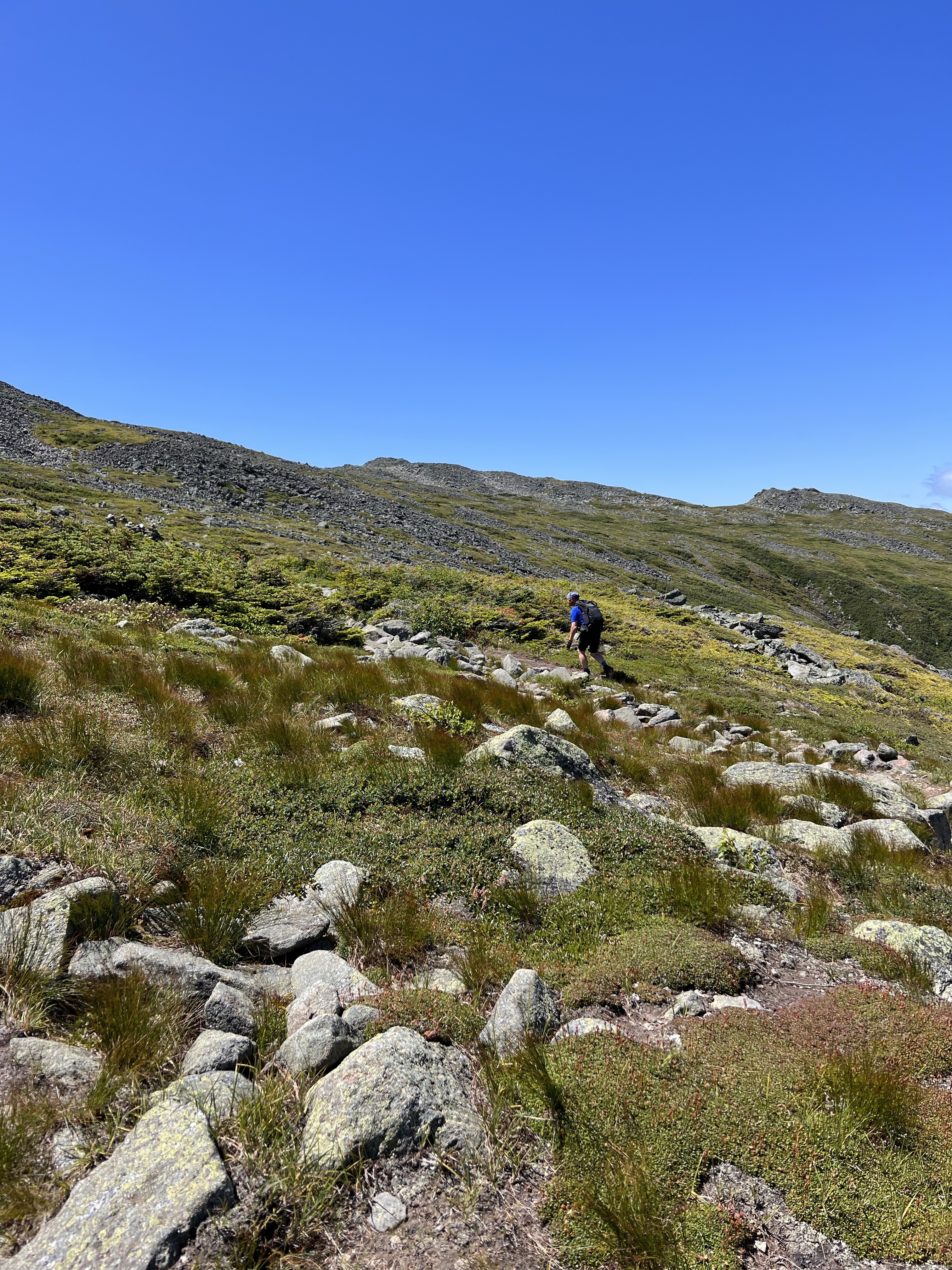
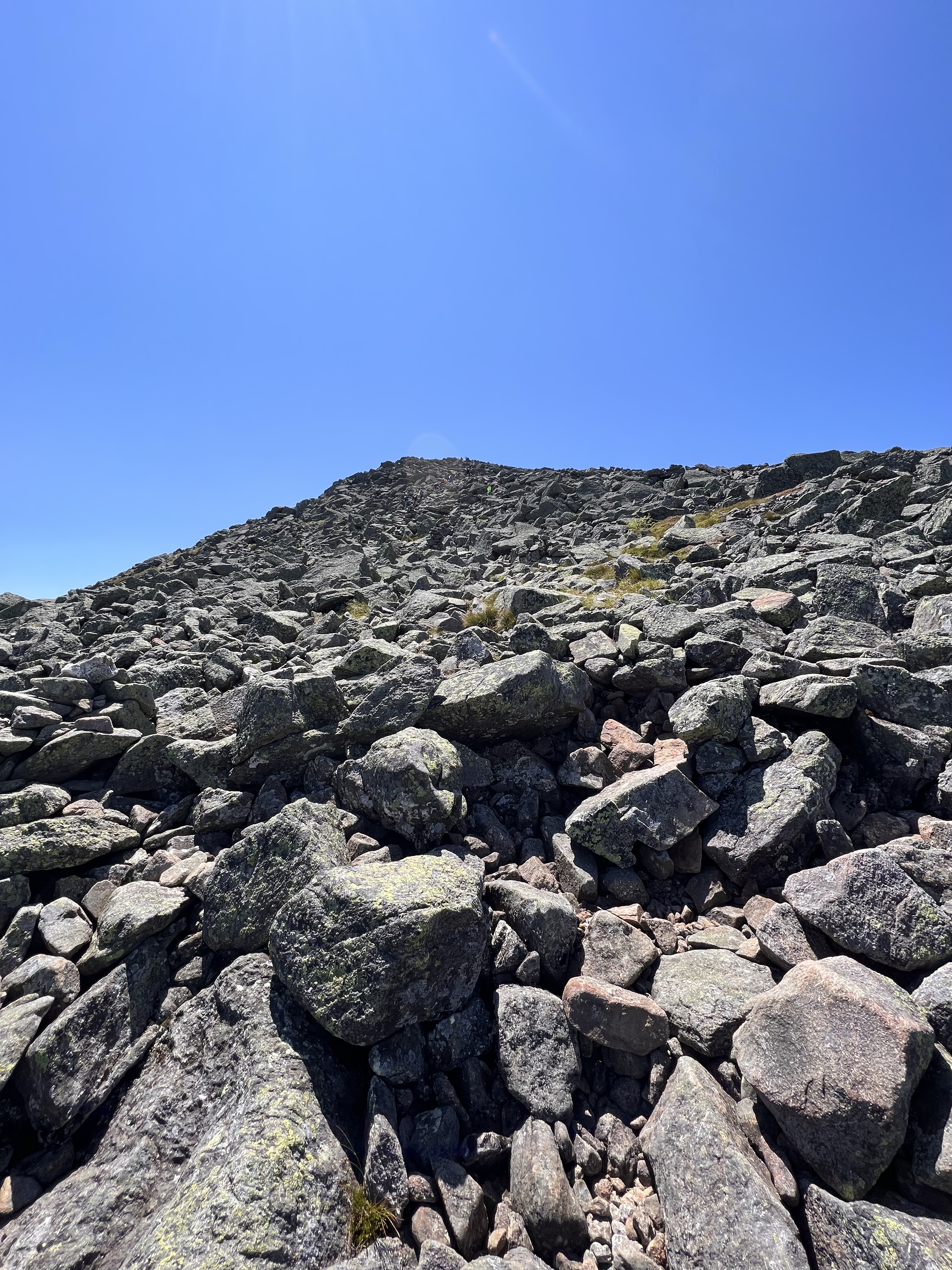
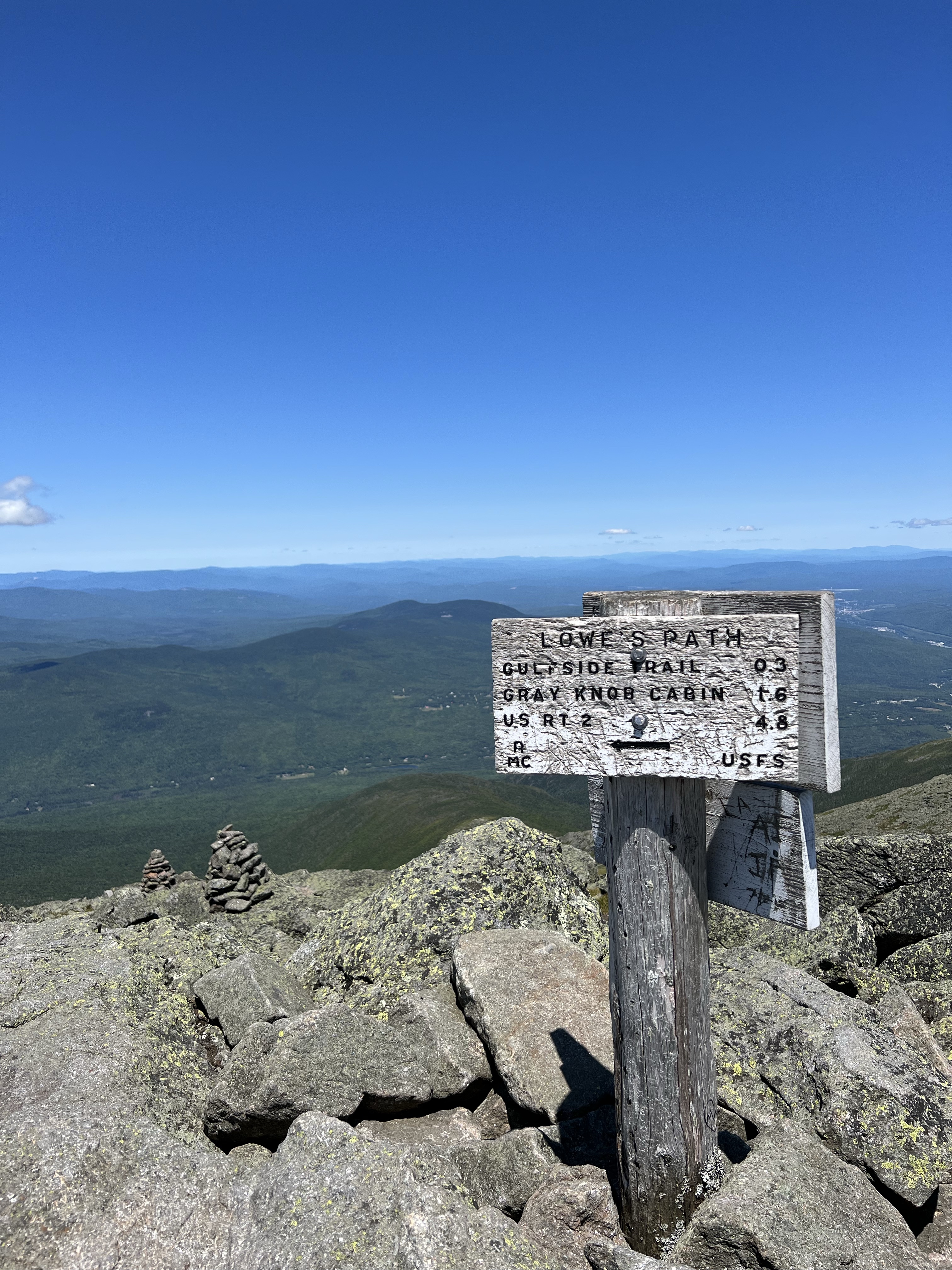
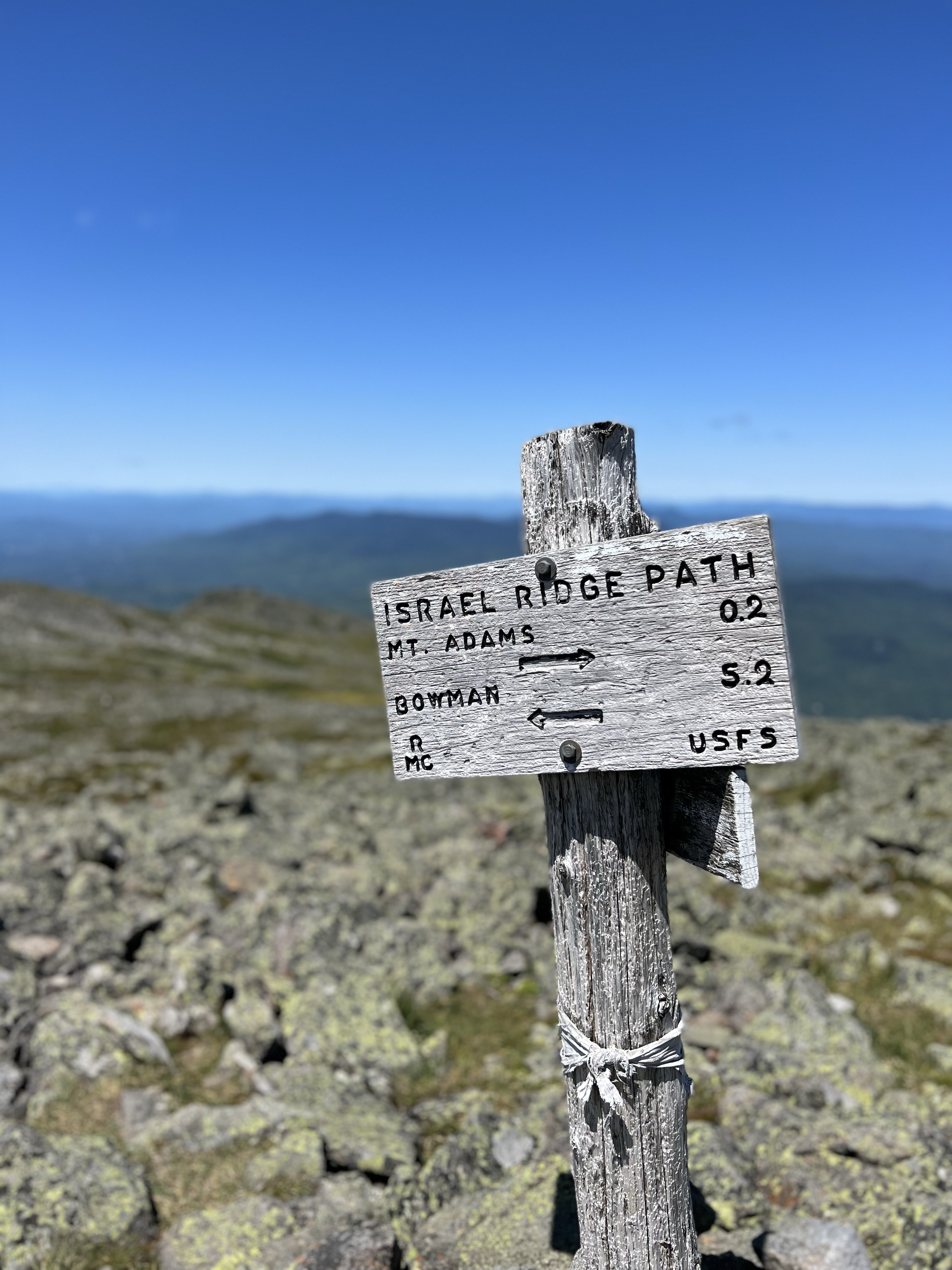
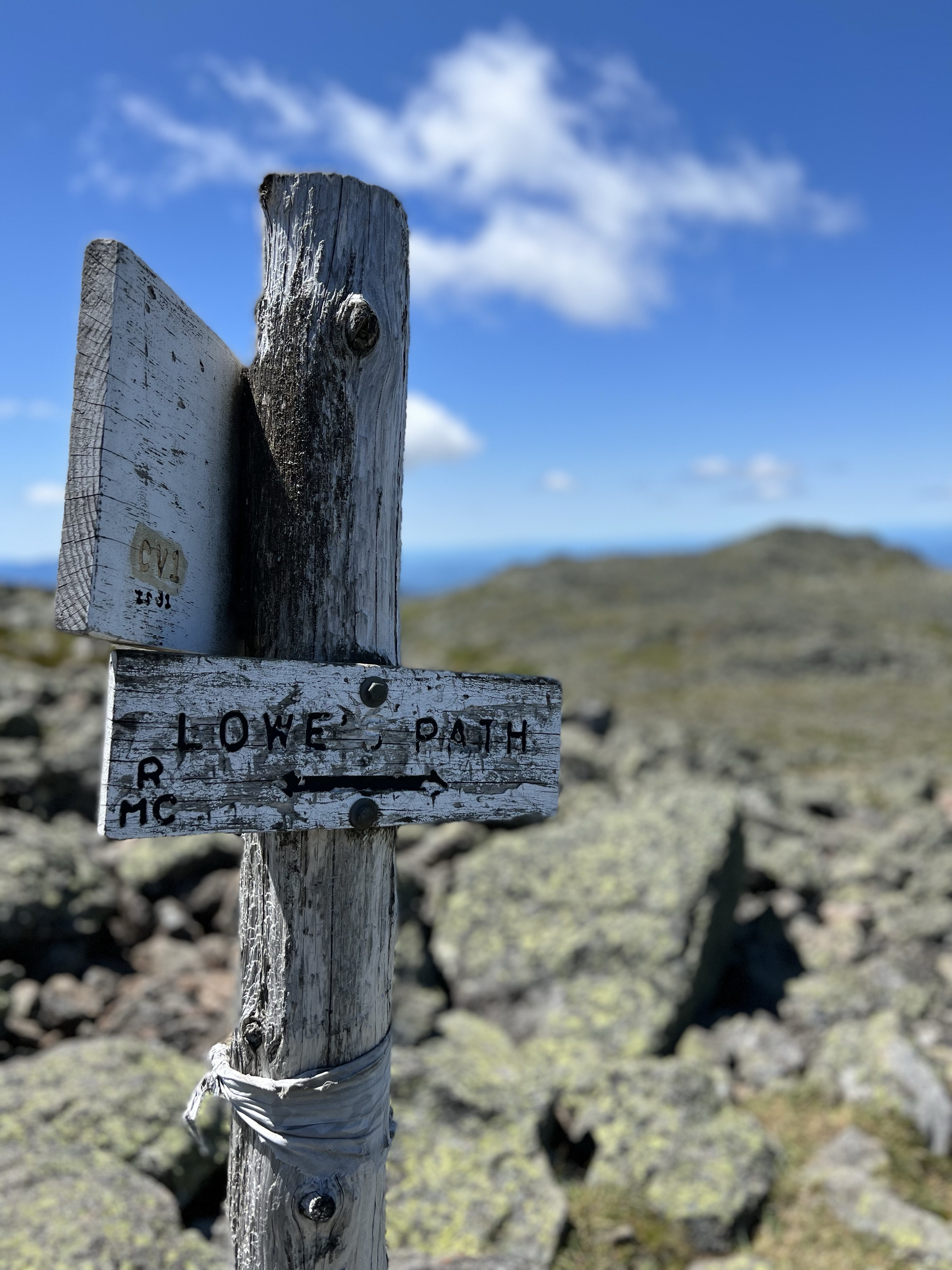
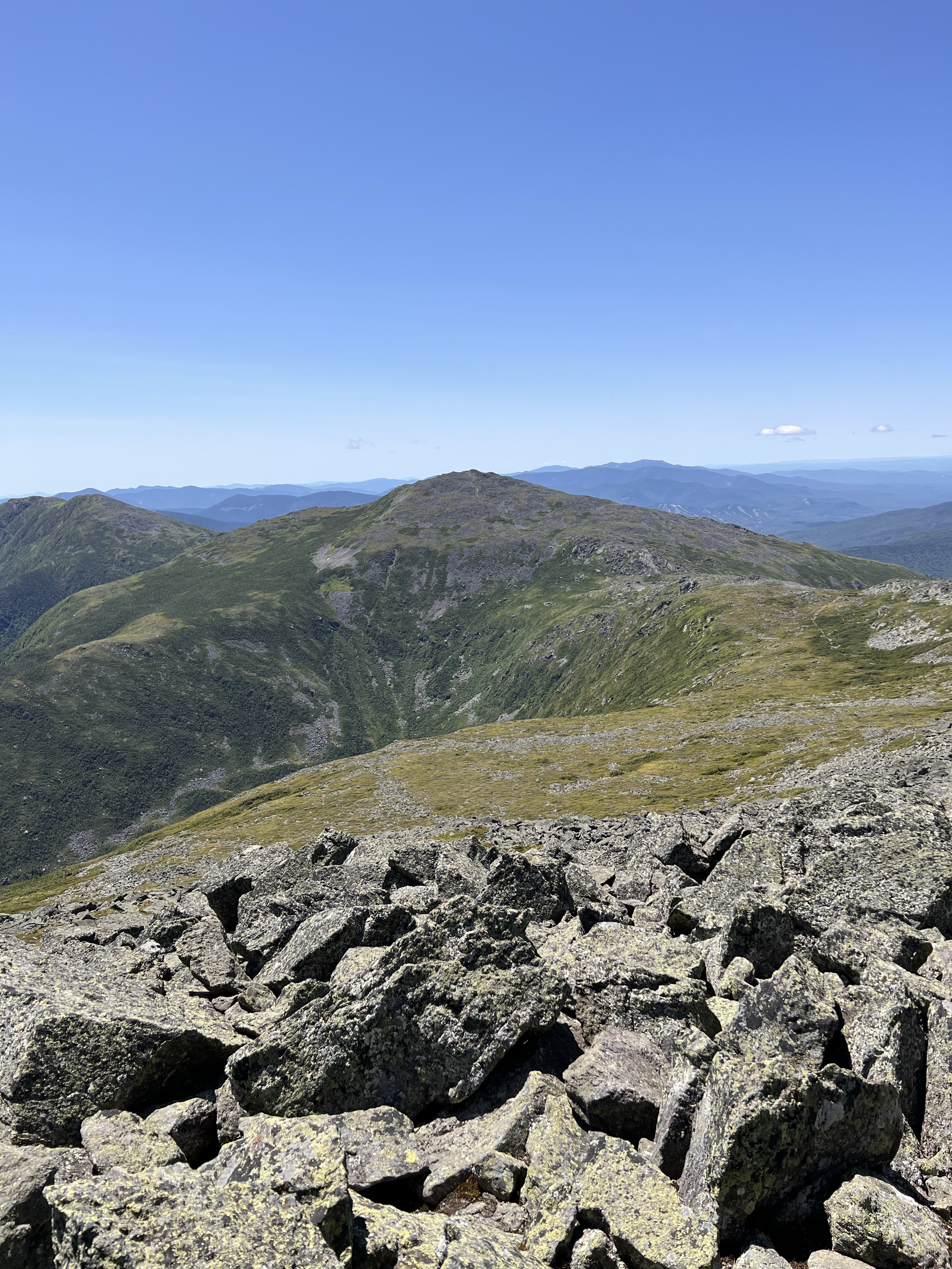
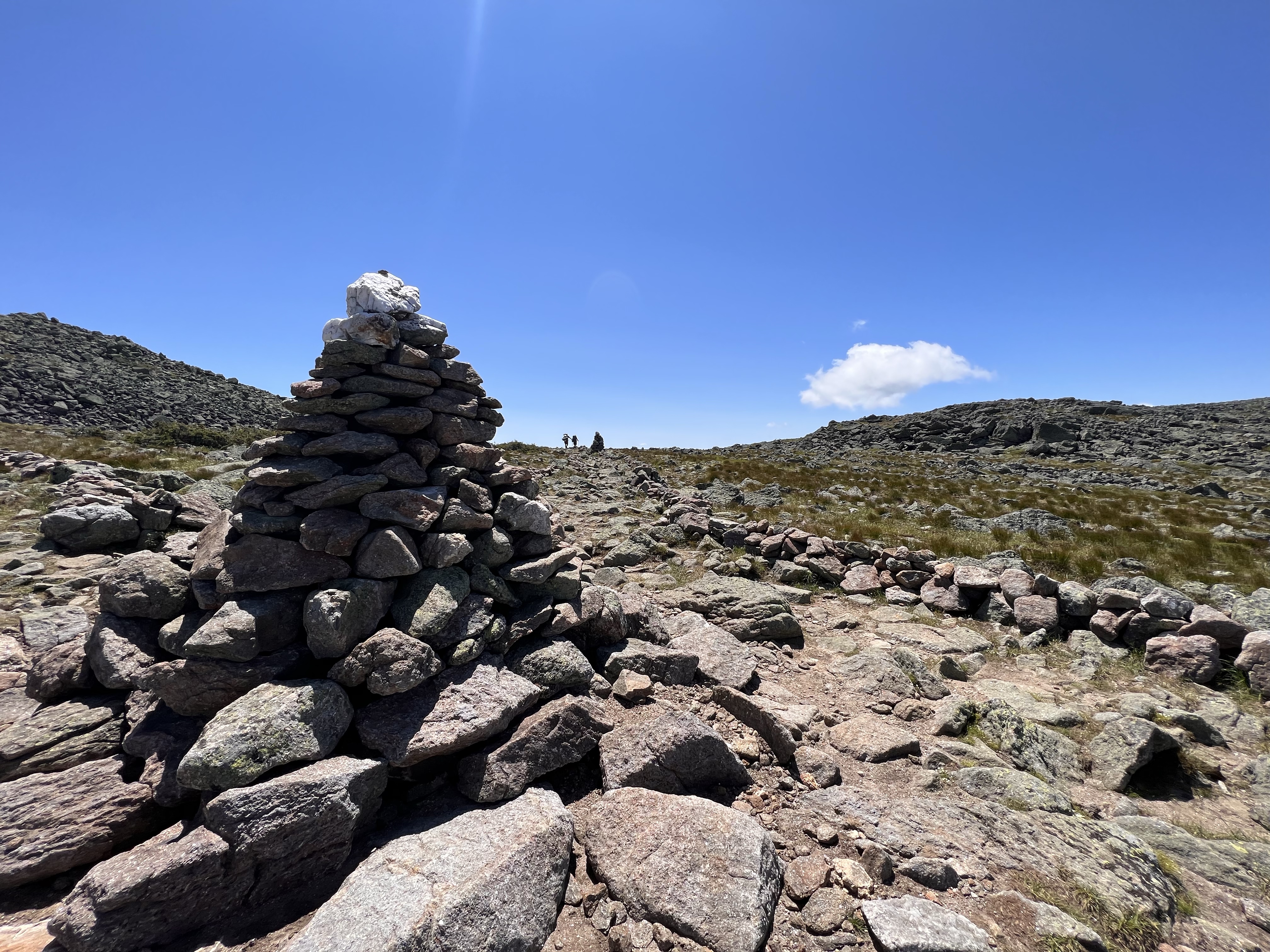
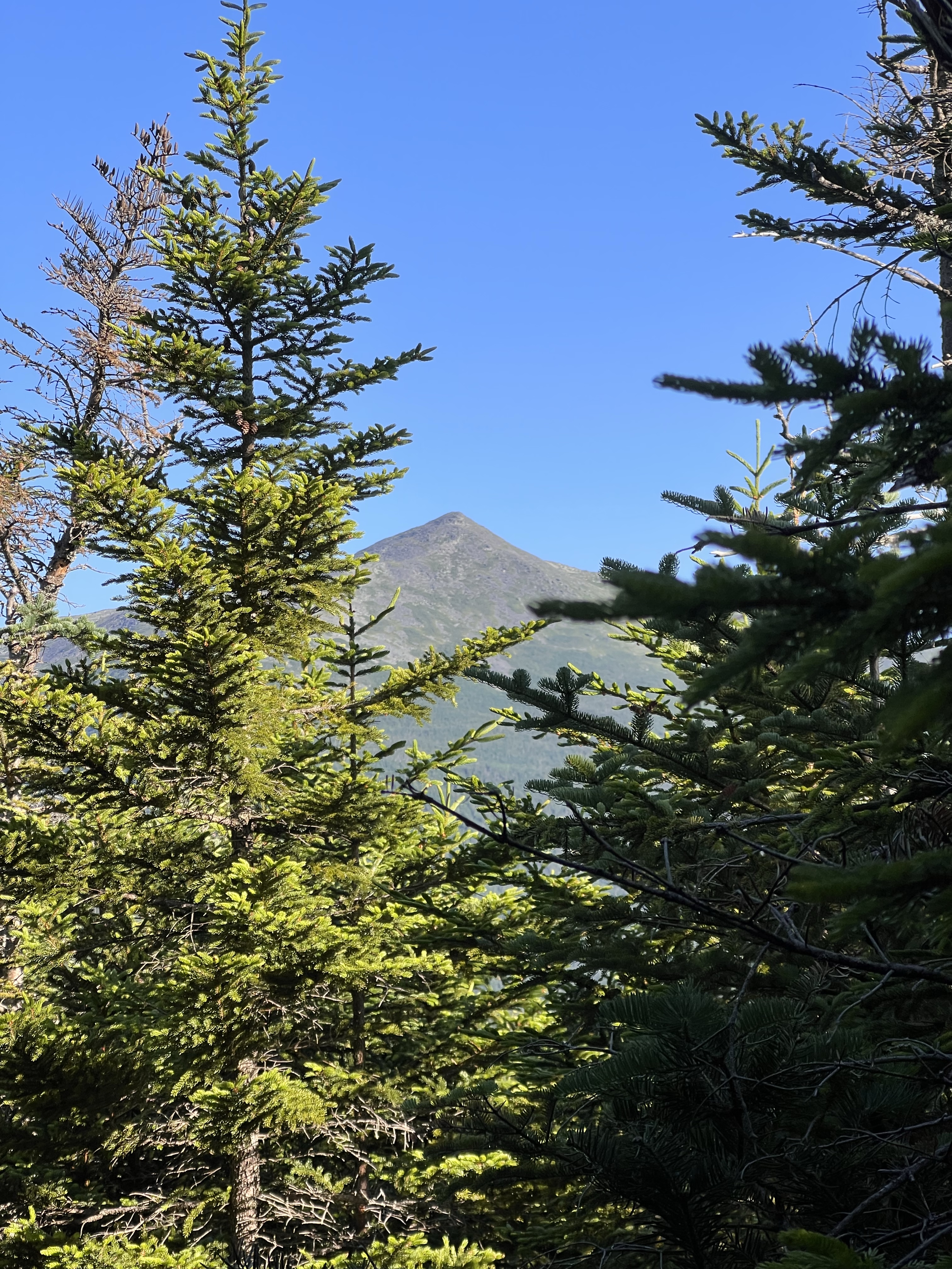
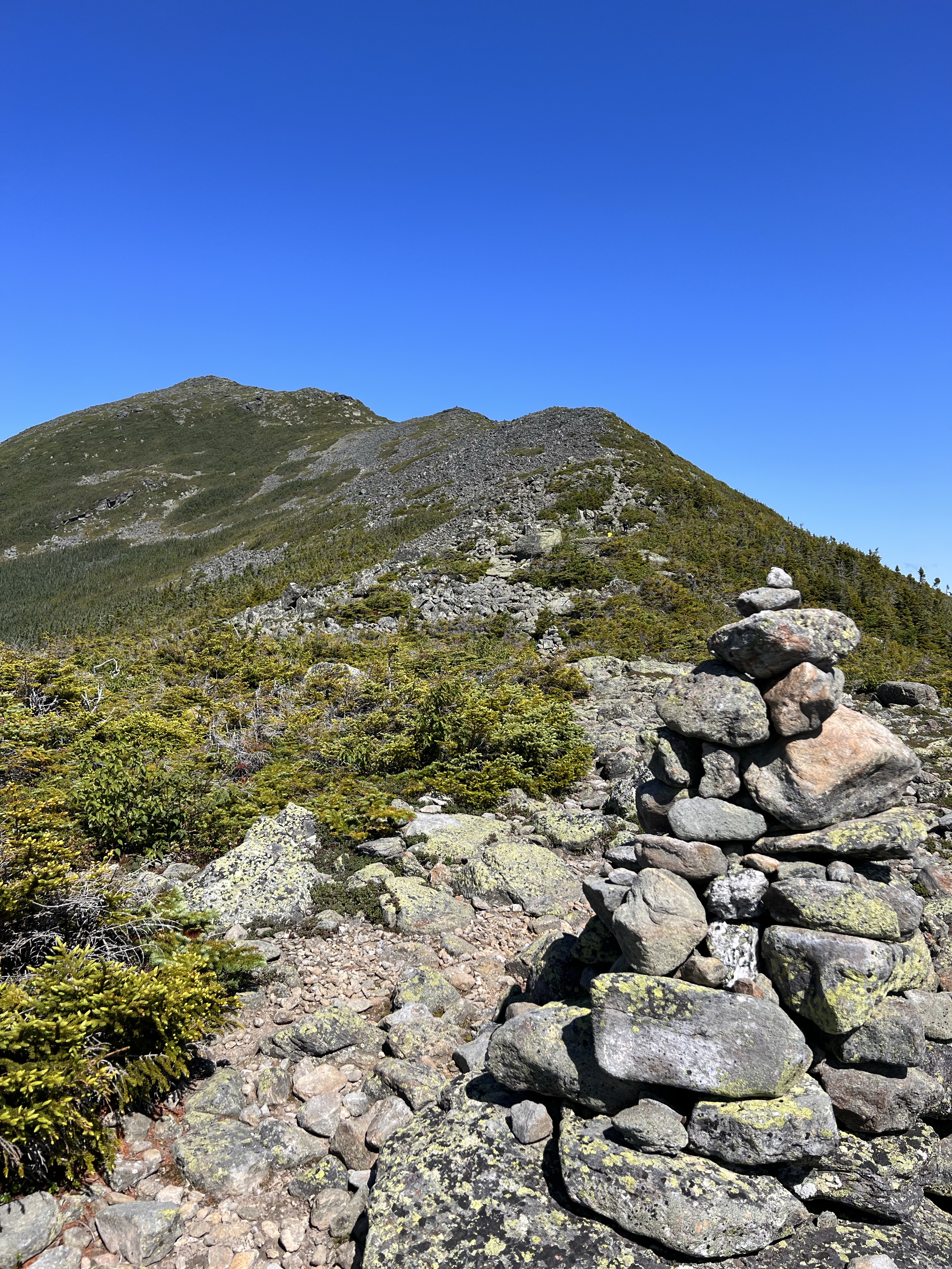
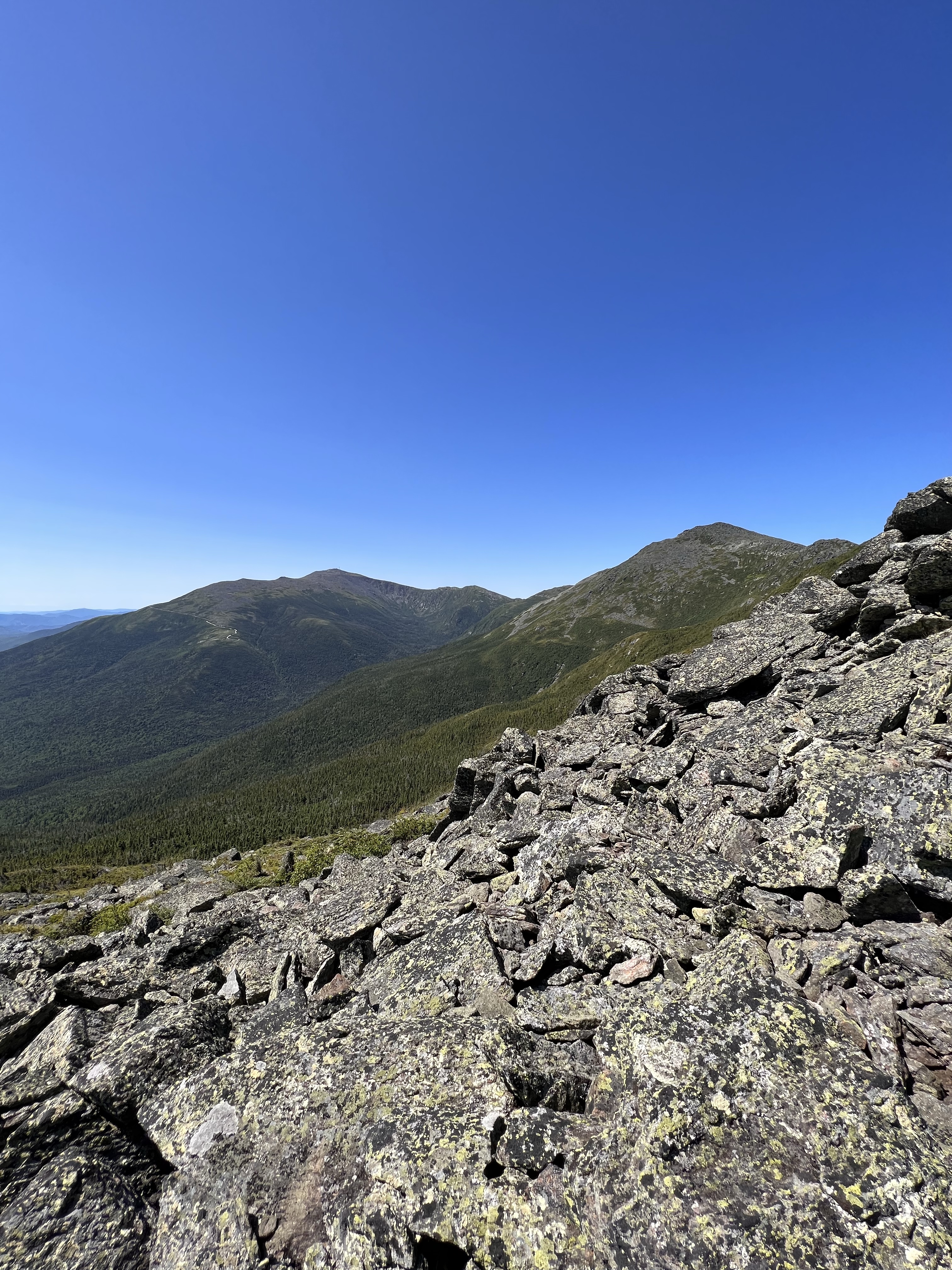
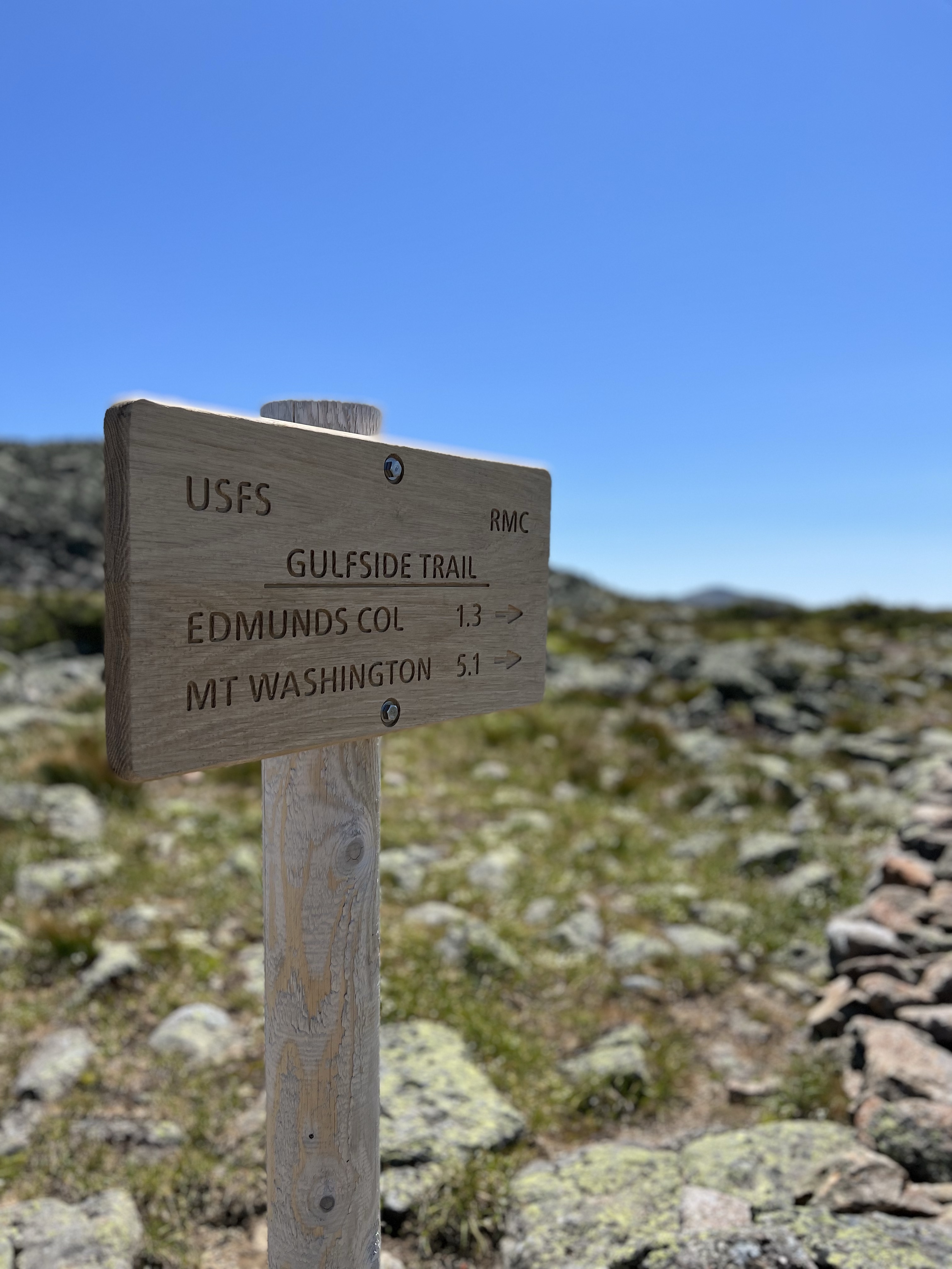
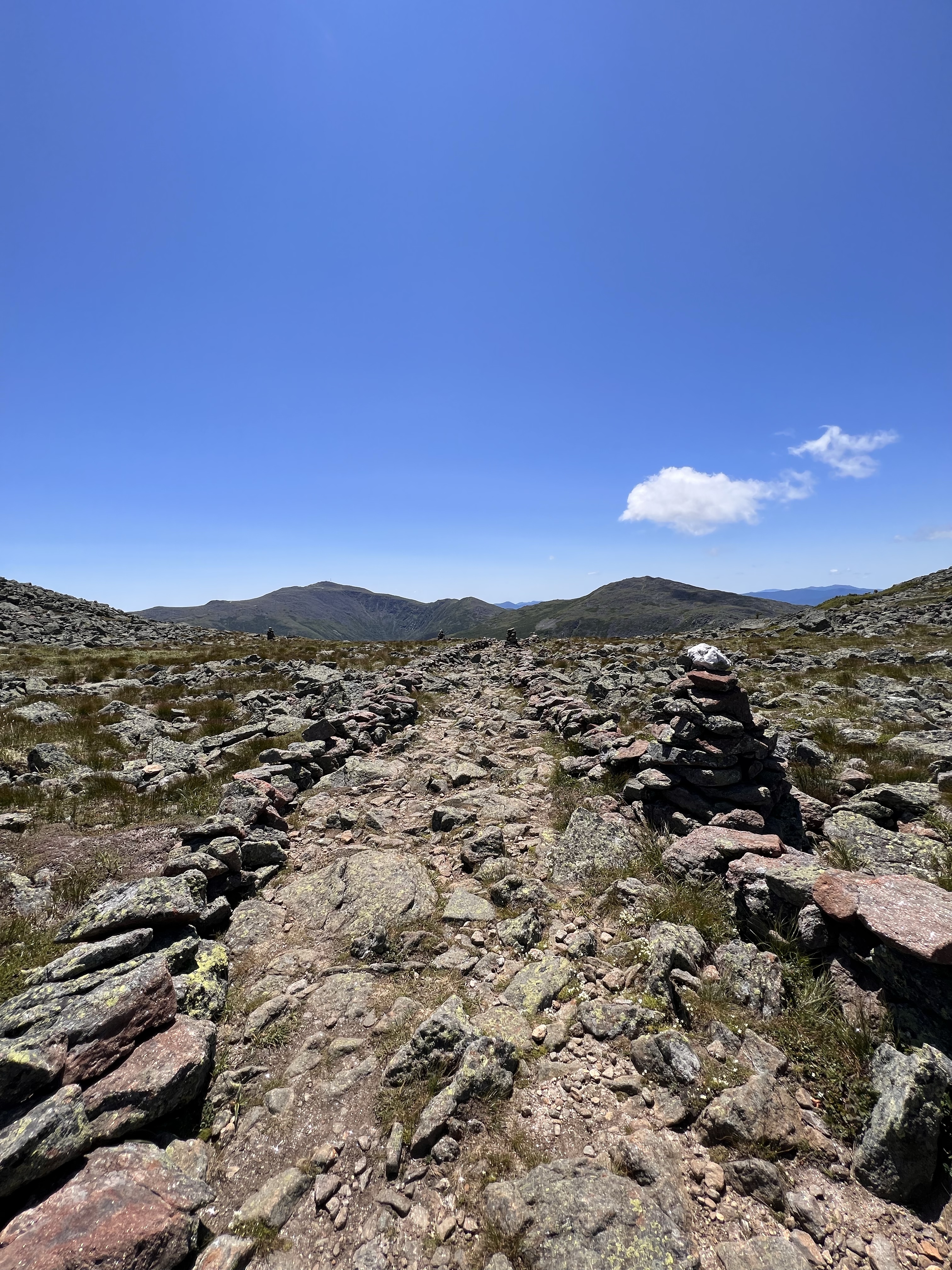
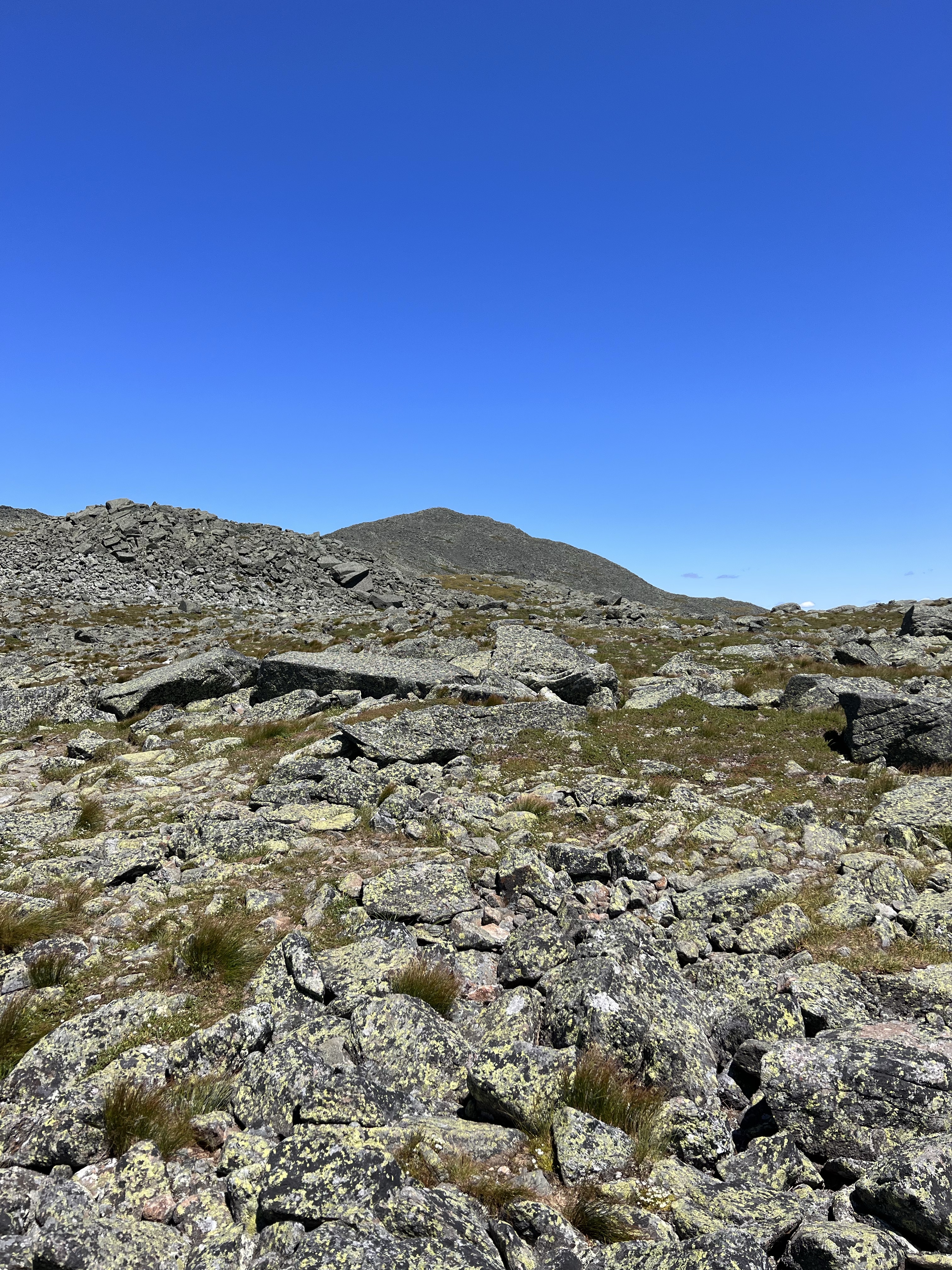
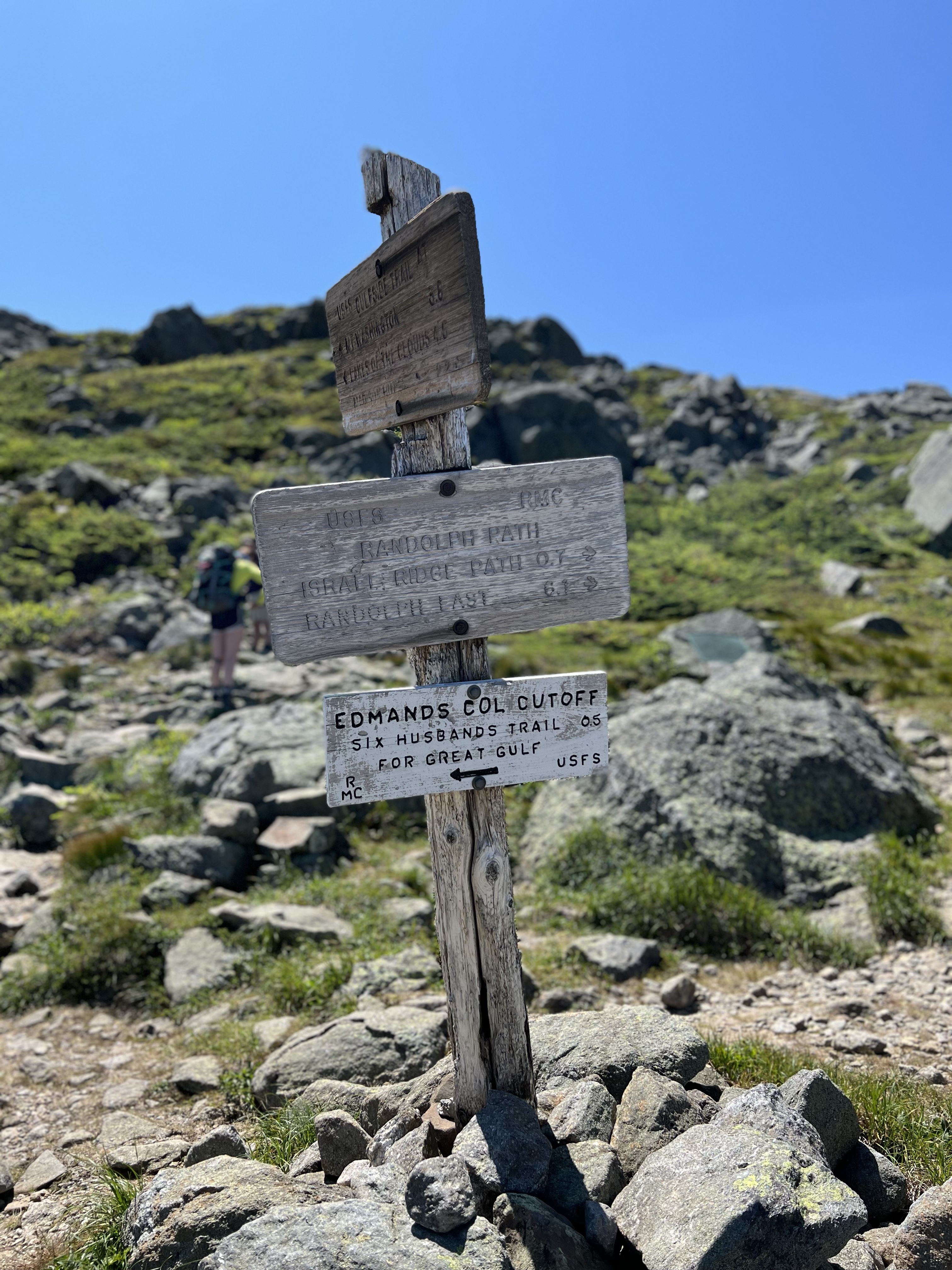
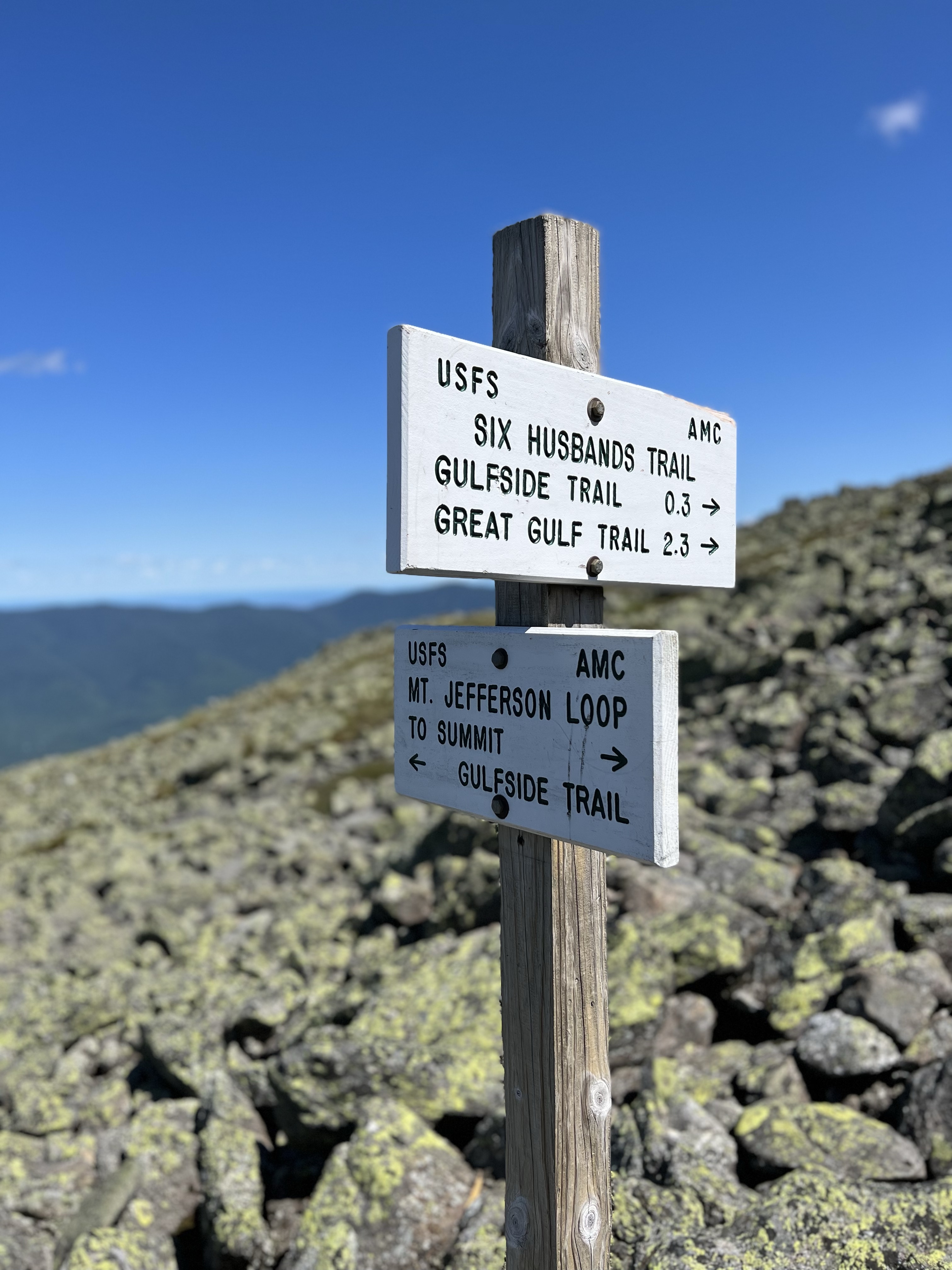
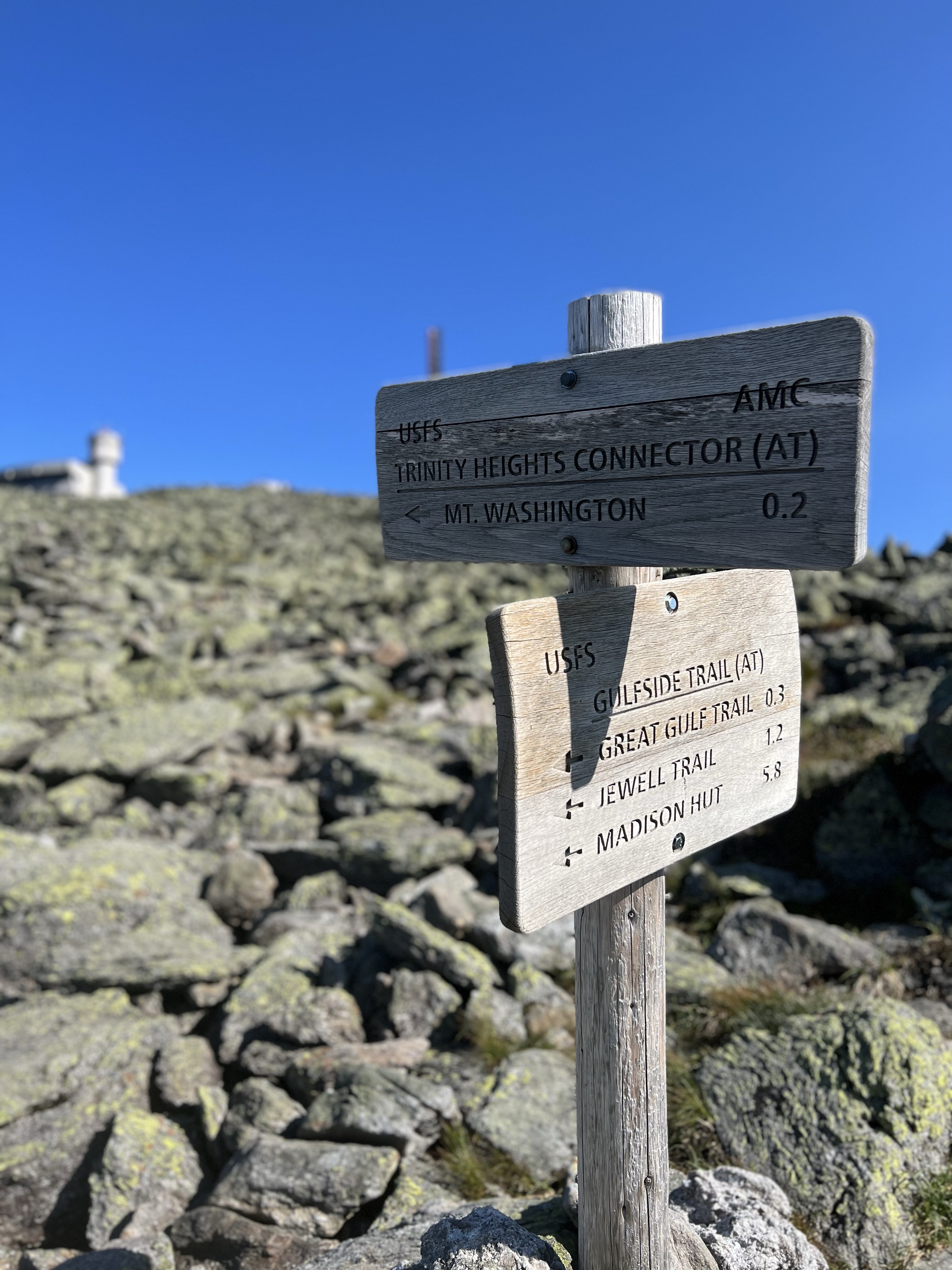
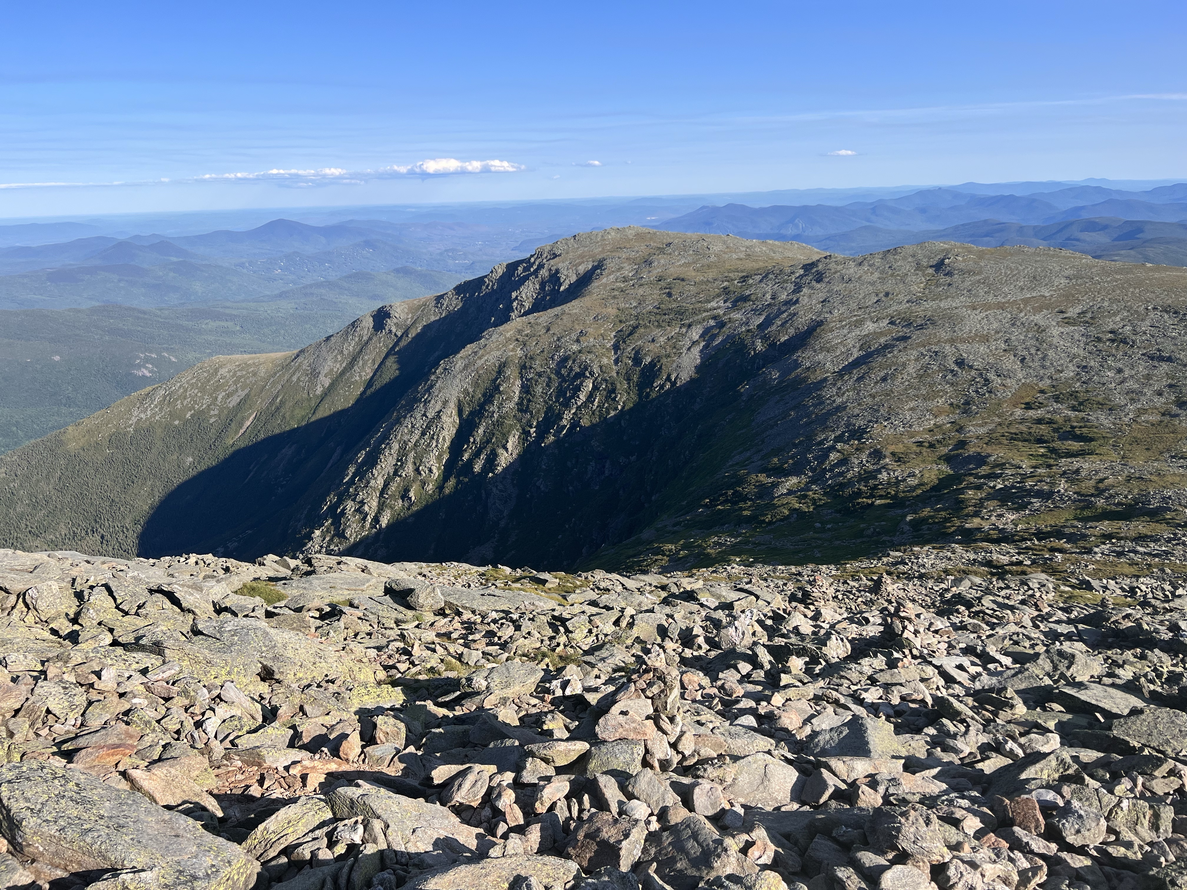
From the summit of Adams I had commanding views of Great Gulf, Mt Jefferson, Mt Clay and Mt Washington. Not only is it beautiful but it told the story of how much I had bitten off. i still had options. I could descend Adams and skip Jefferson, heading straight to Washington. I didn’t linger long on Adams and with these thoughts rolling around in my head, I headed down Lowes Path toward Gulf Side Trail. I was quickly at the junction and turned left toward Jefferson. This section felt pretty long. It is a beautiful section with Adams Five and Jefferson looming in the distance while traversing stone lined trail. You have to really pay attention as this trail is all loose rock. If not looking down, you’re going to twist an ankle. I rambled on for around 2 miles I think and found myself on Adams Five, a minor peak along the ridge. A moderate dip down and it was up a bit to Edmands Col. Went straight at the col and ran into the Jefferson Summit Loop/Gulf Side Junction. Was I going to bypass the 5660′ summit of Jefferson?
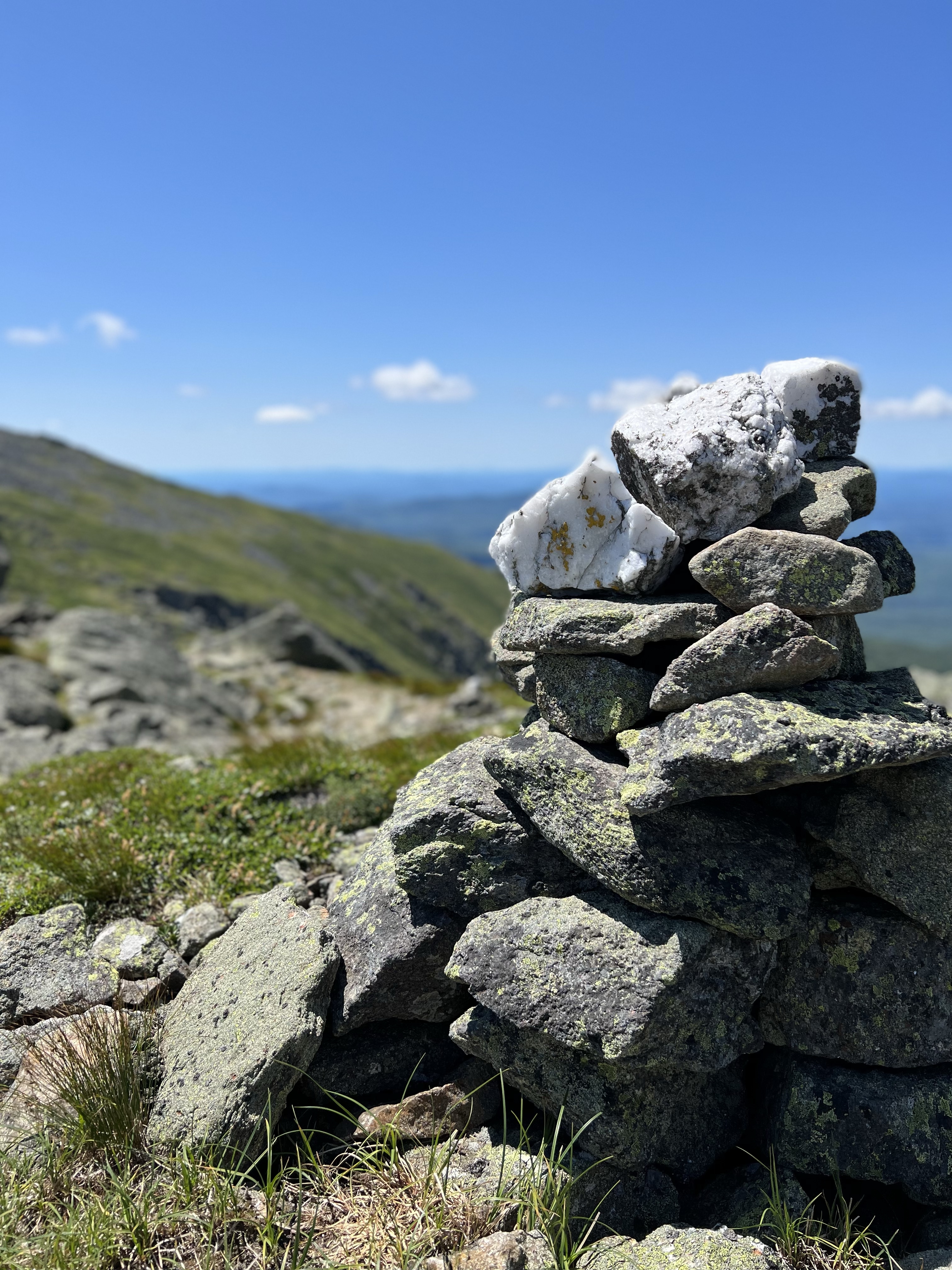
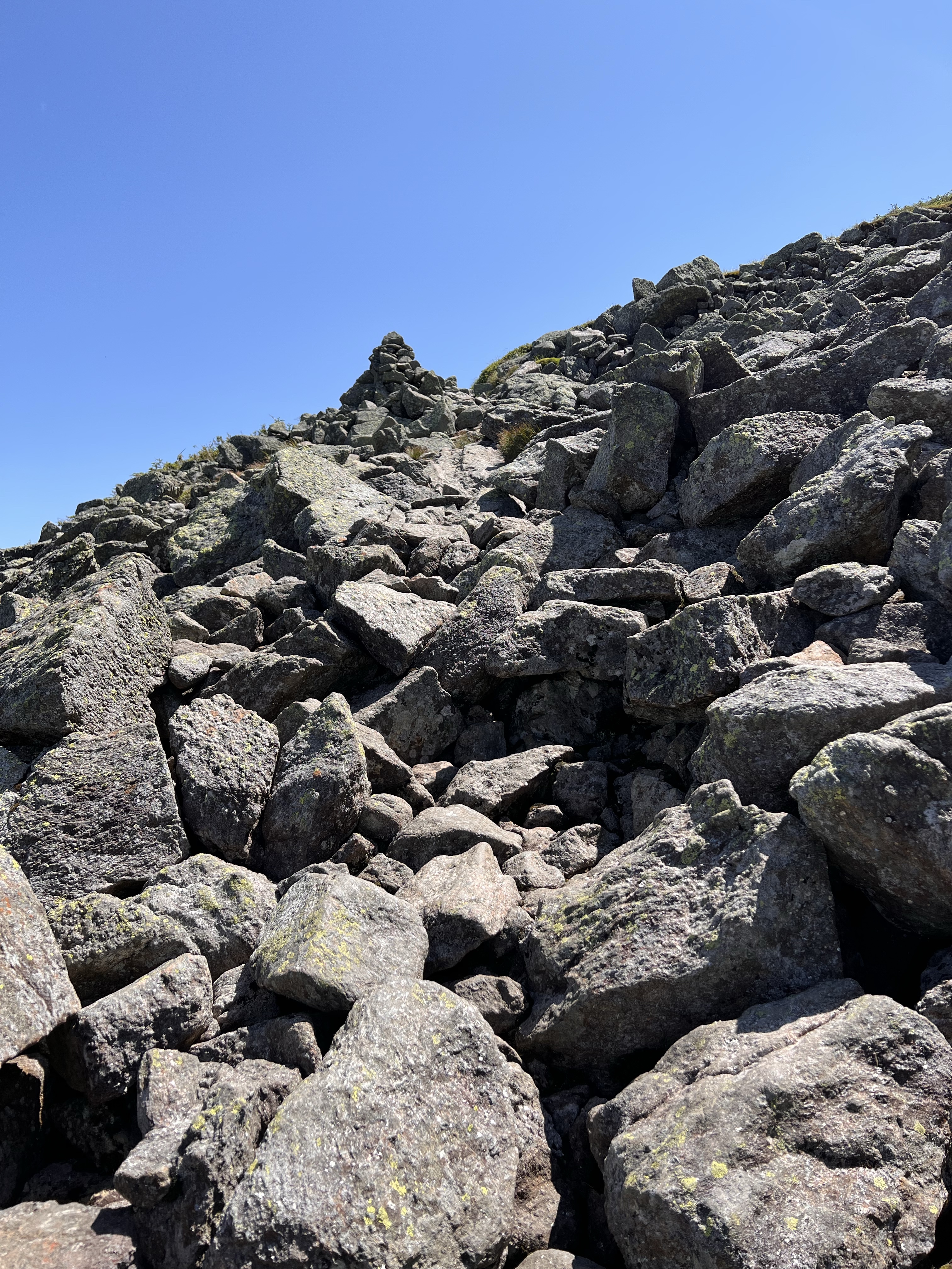
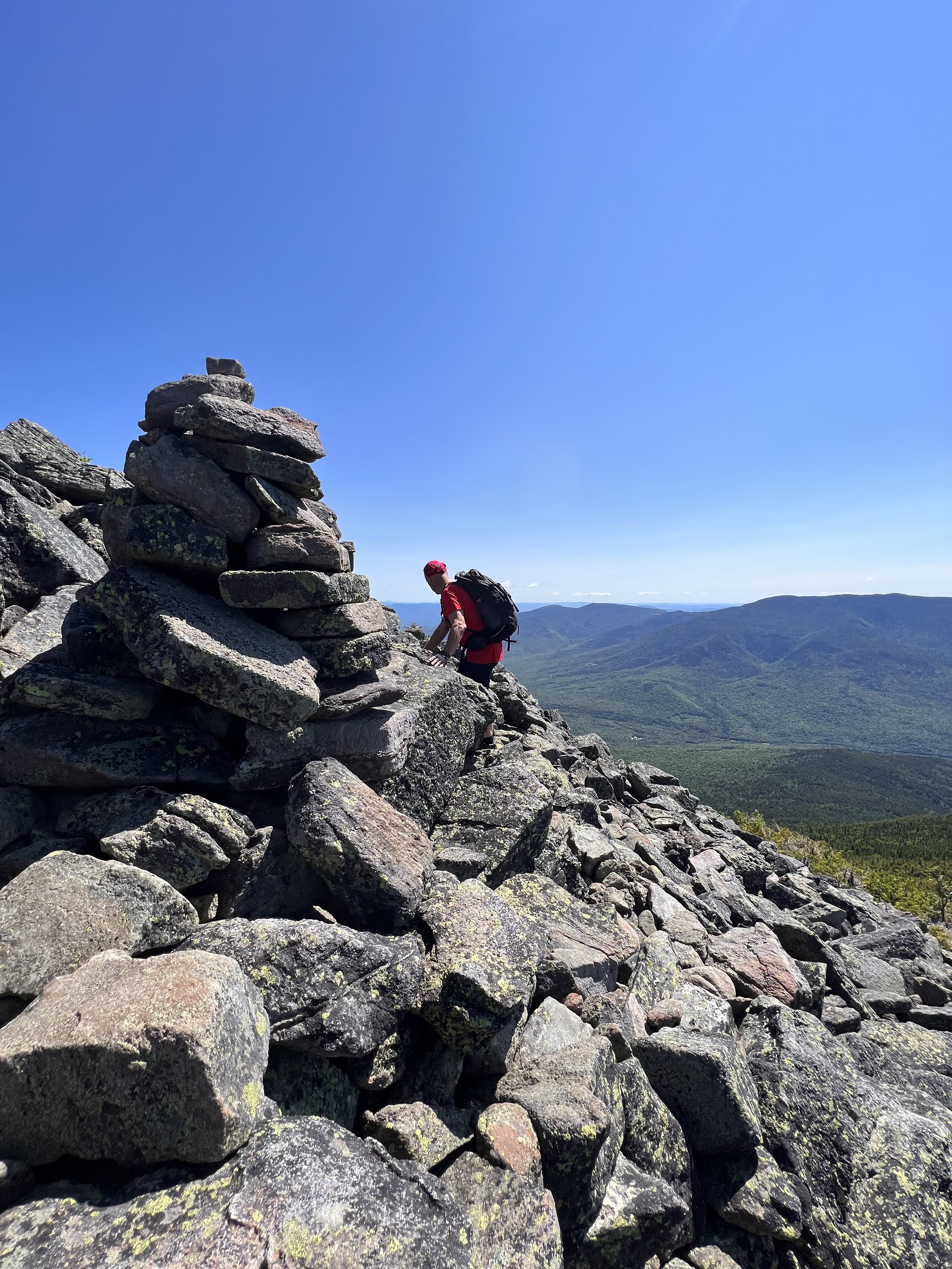
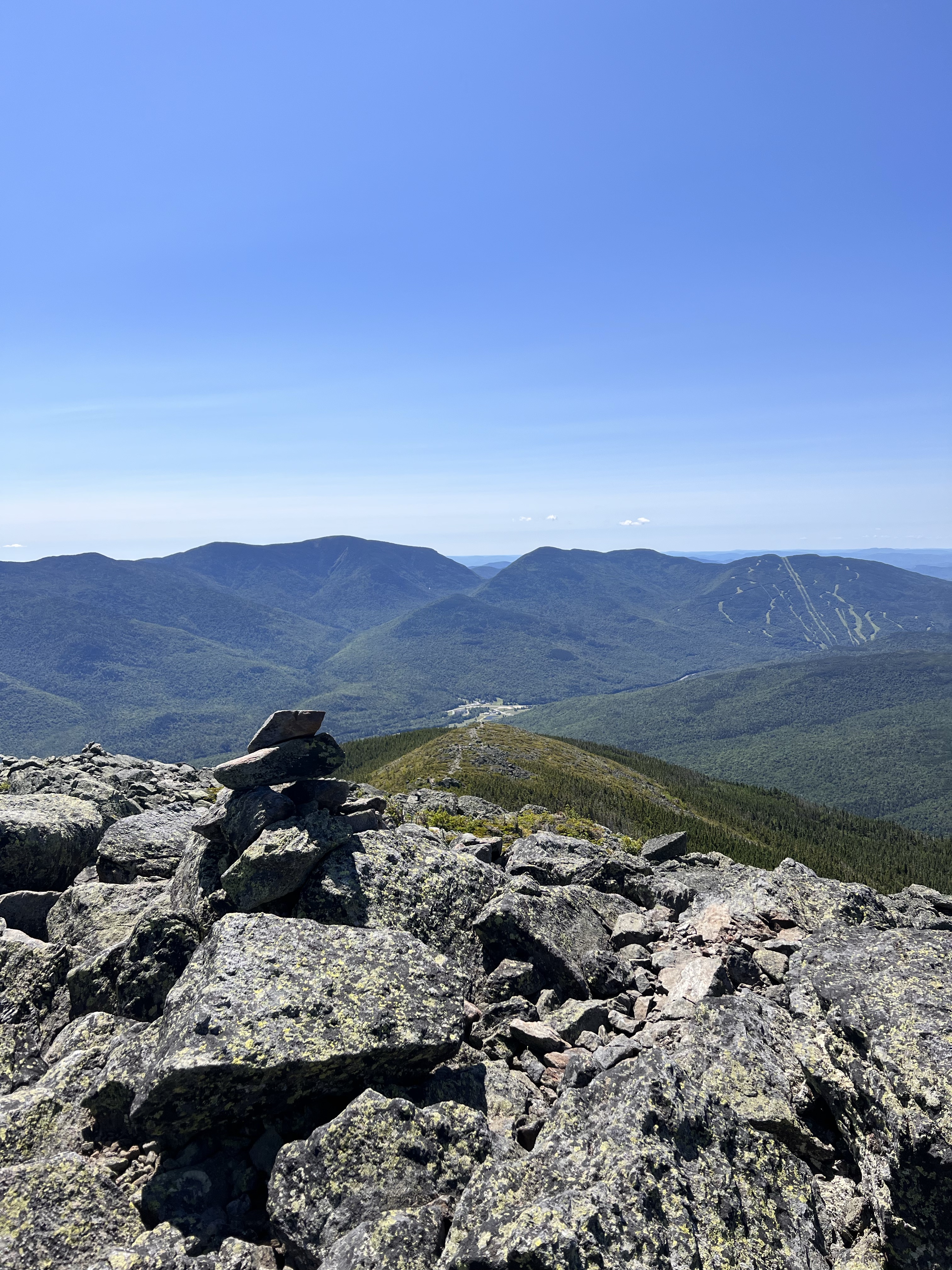
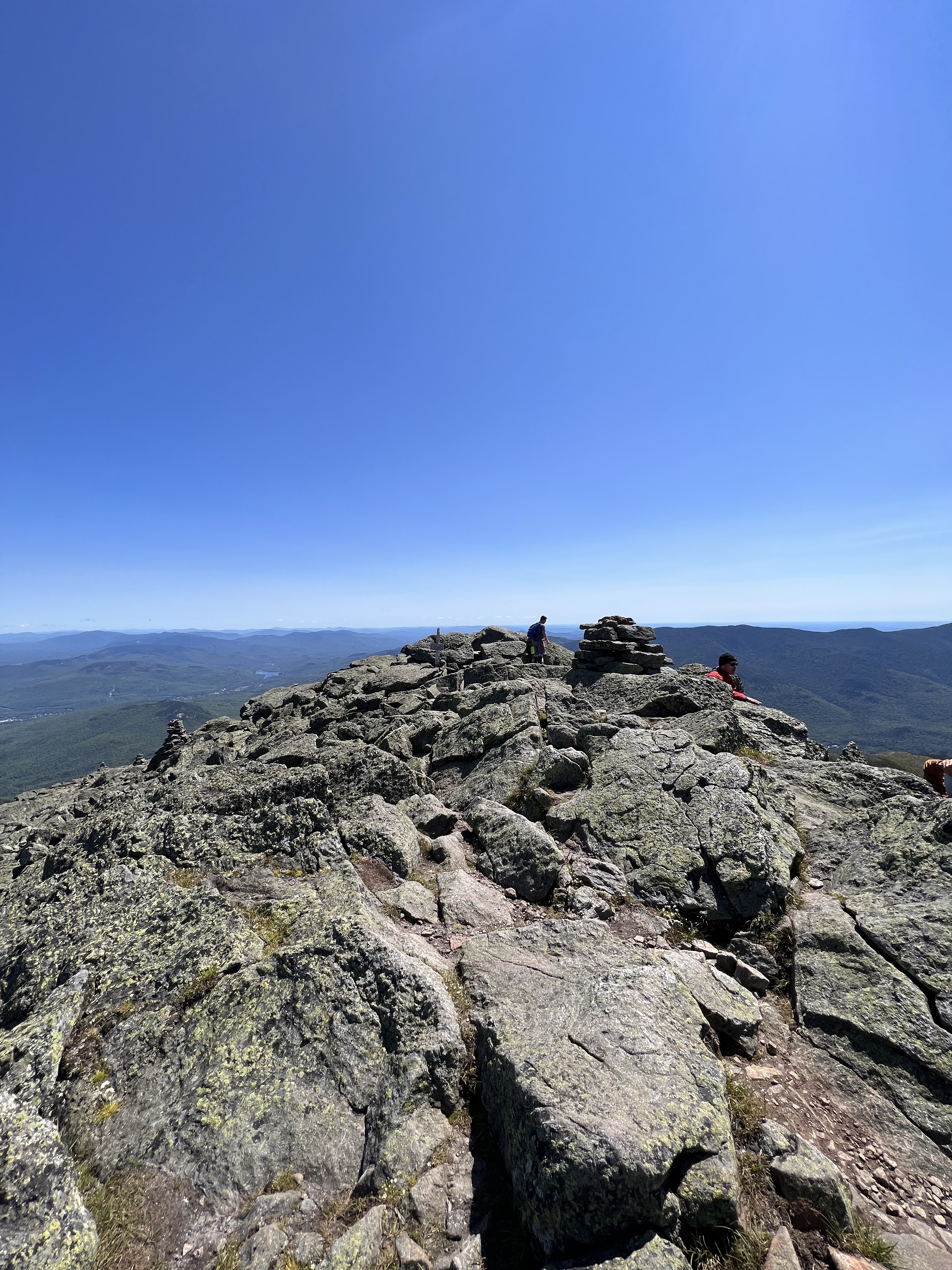
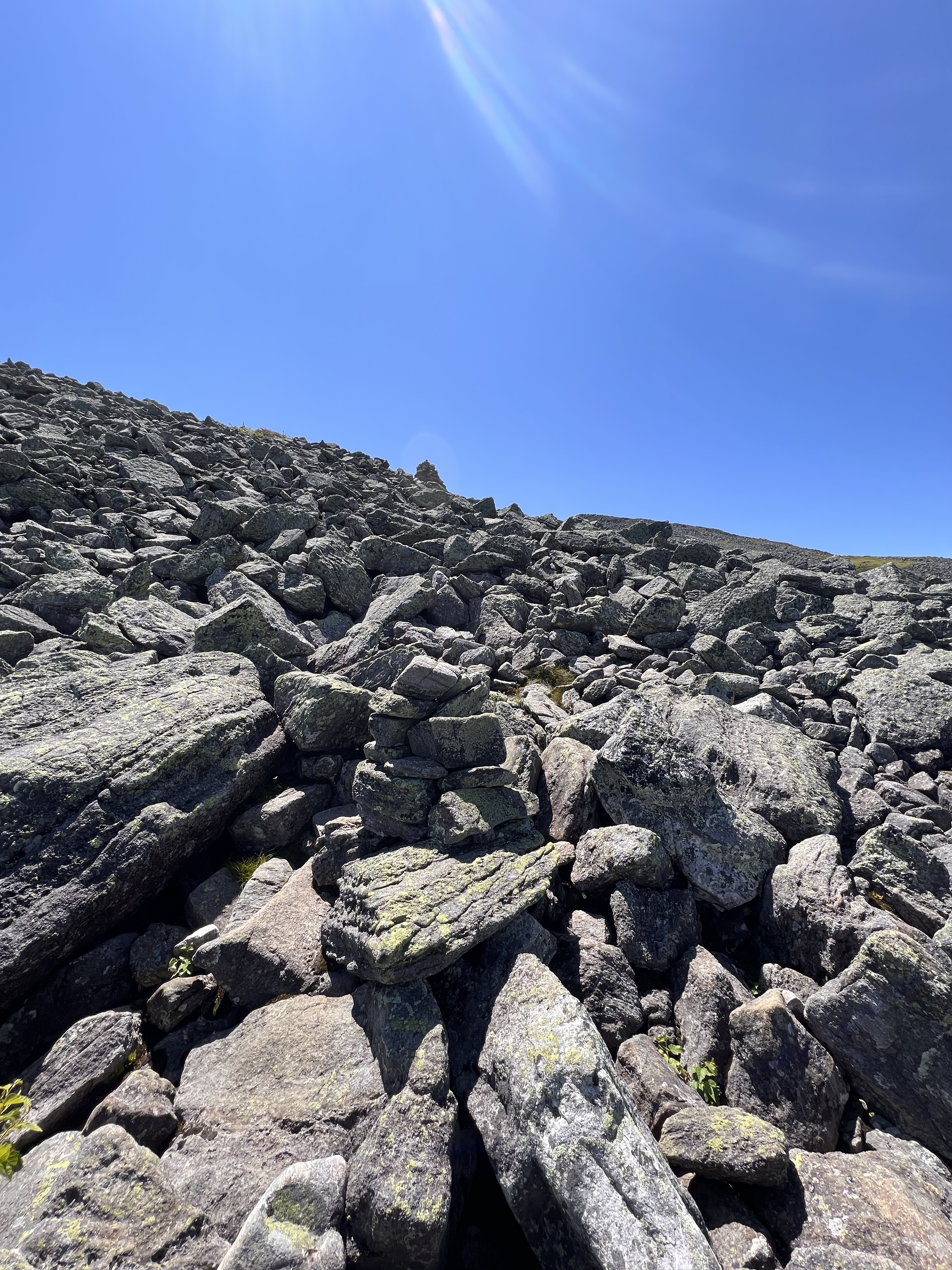
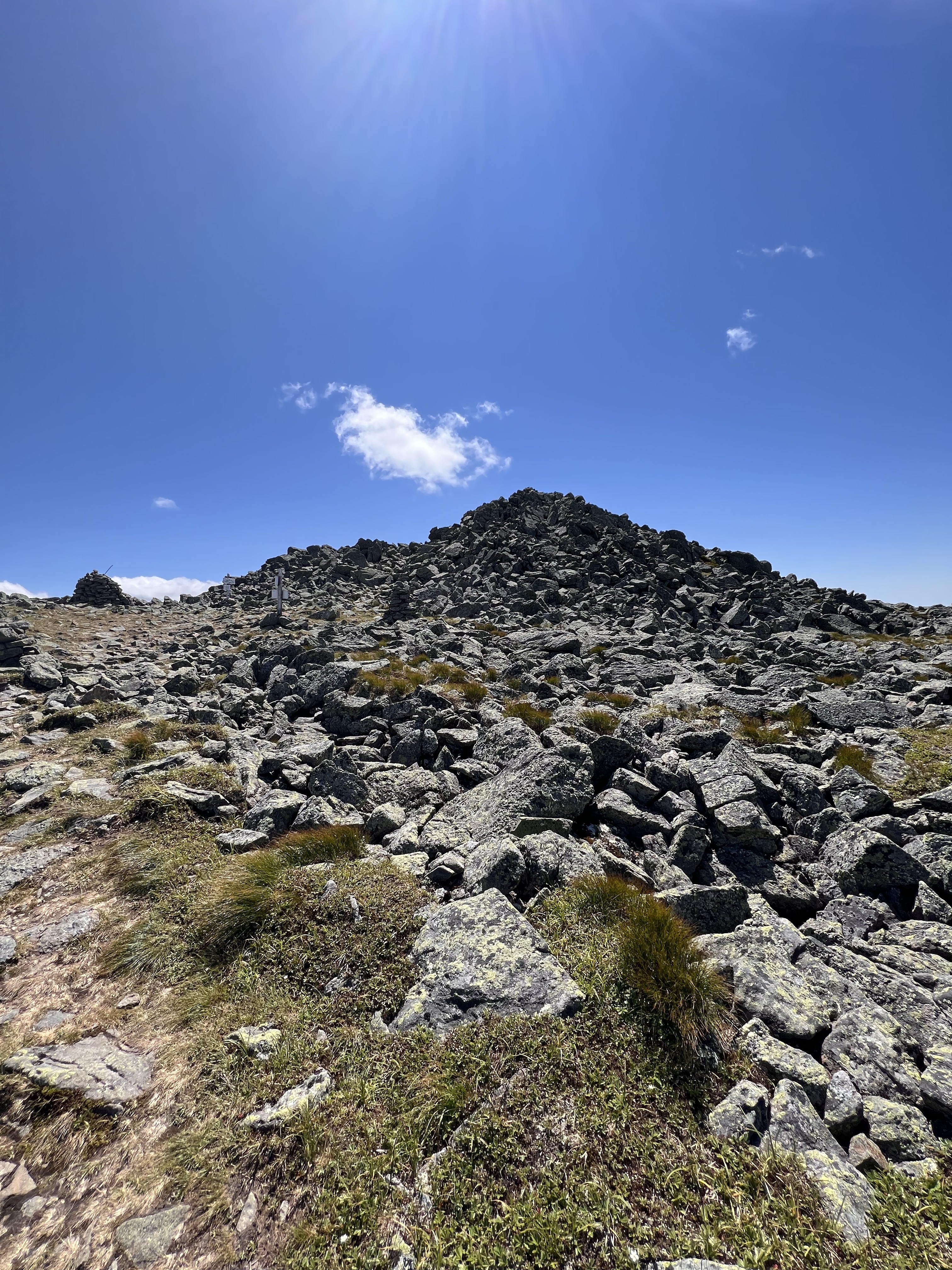
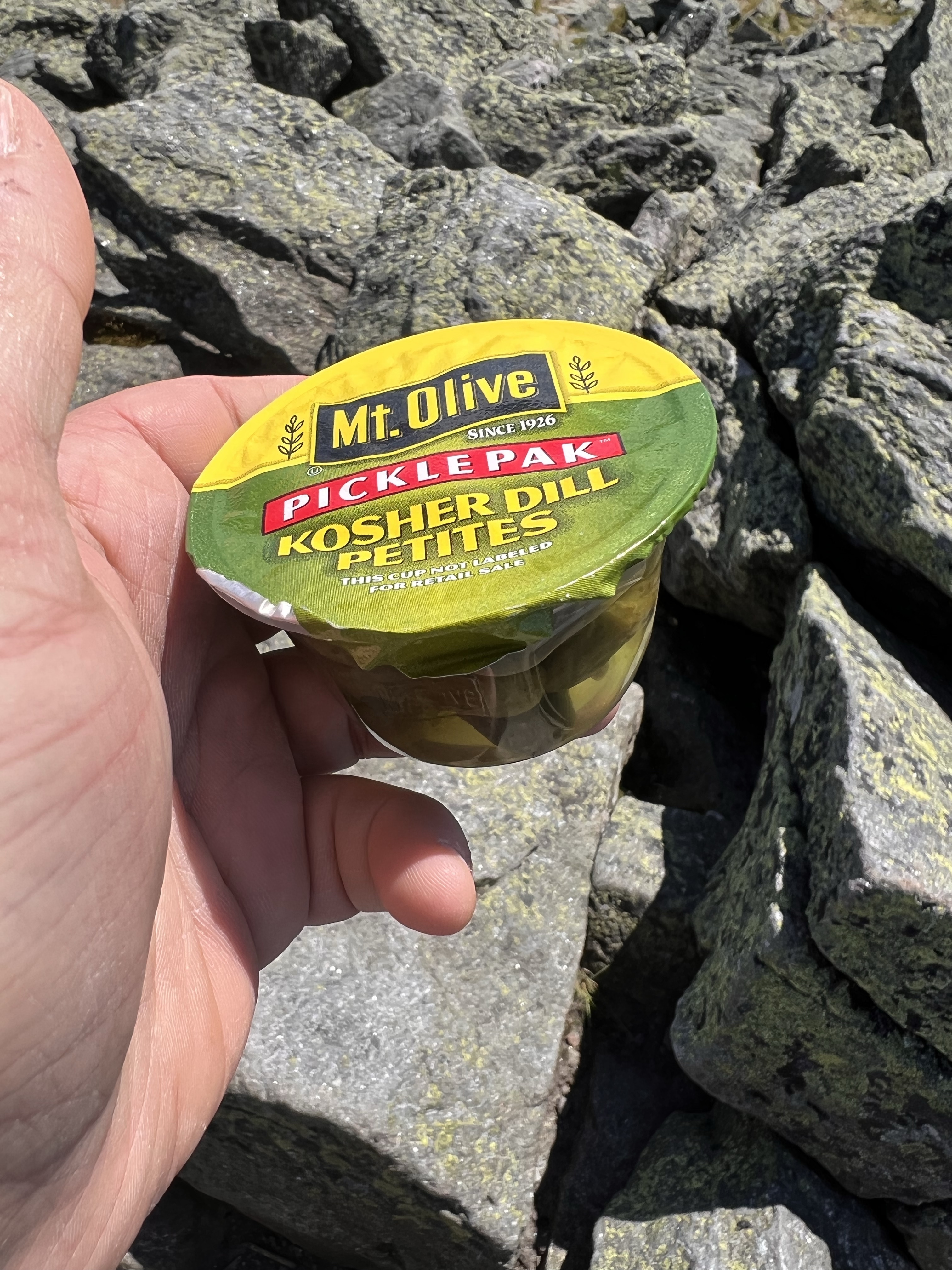
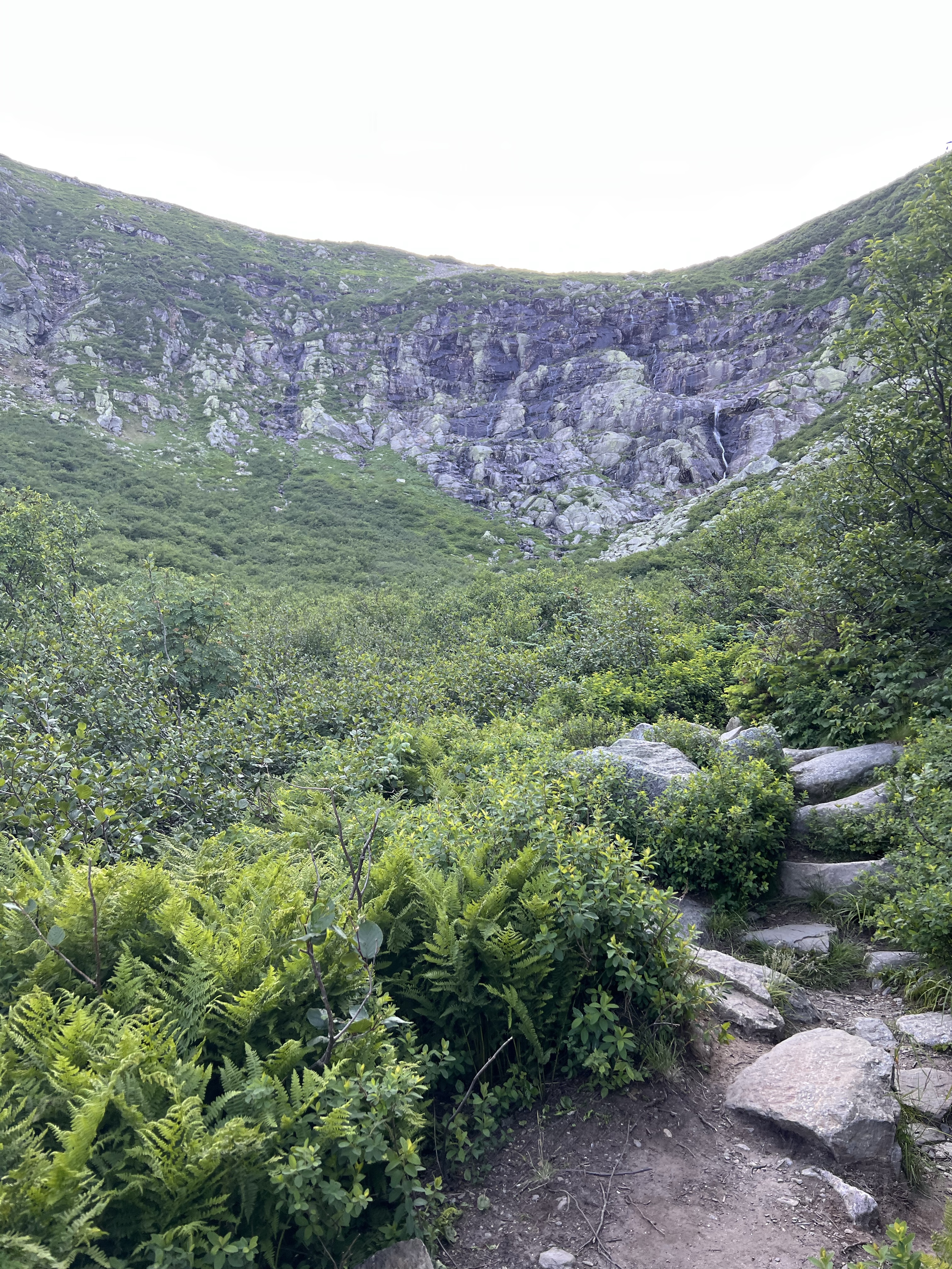
I didn’t get up at 3am and drive 2.5 hours to skip Jefferson! I continued up the side of Jefferson via the Jefferson Summit Loop trail. Anyone who has climbed Jefferson knows what a challenging pile of rocks it is. This was my first time going up this side. It’s just as hard if not harder than coming from Mt Clay. I pushed hard, drank a ton of water, and arrived at the 4-way junction about 50 feet below the summit. I scrambled up the last few feet and was on top at 2:45. I dropped my pack for a bit and grabbed some pickles and an apple from my pack. I can’t say enough about the value of pickles and pickle juice while hiking! They make my legs feel new, even at this halfway point along my 20 mile trek. ** Mt Olive makes these cool pickle juice shots and pickle snack packs**. Here are some pics from the summit area of Jefferson.
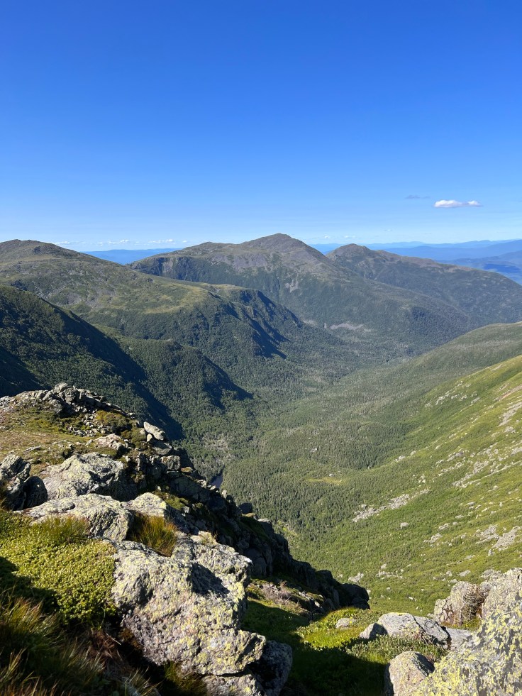
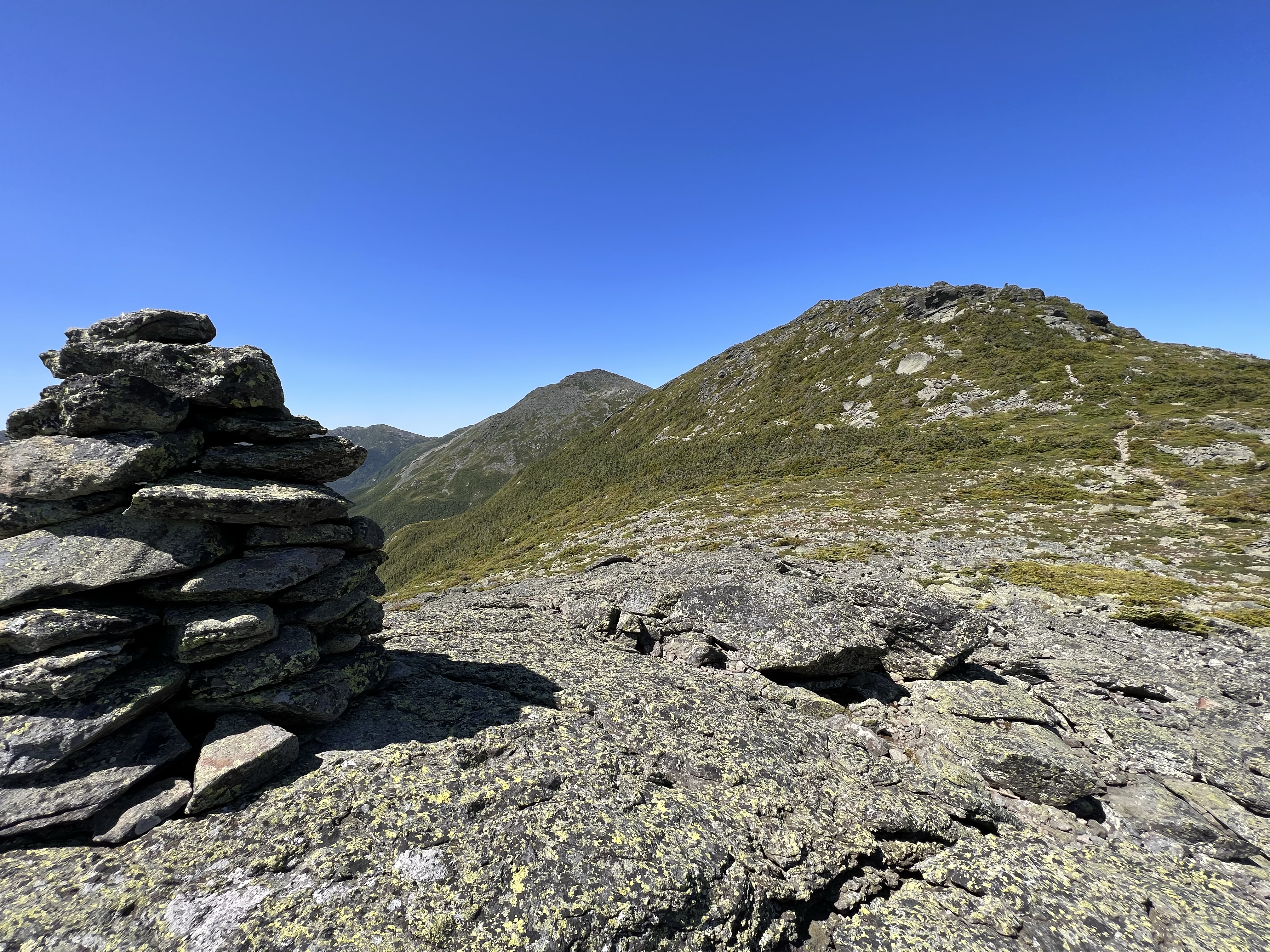
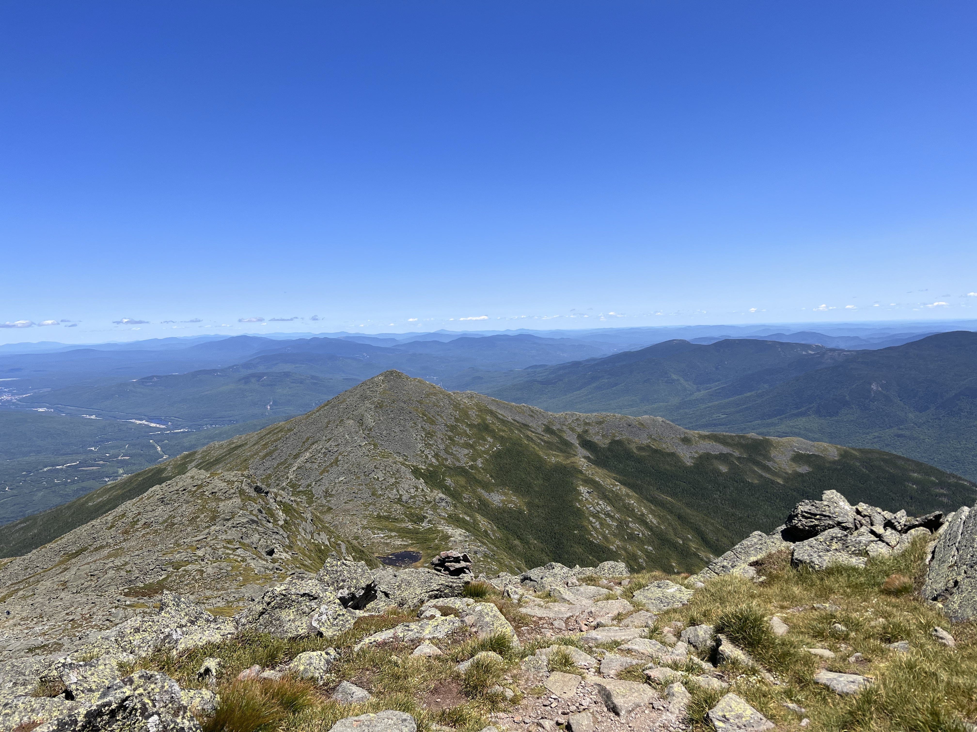
I rested on Jefferson for about 15 minutes before putting my pack back on and heading down the summit loop destined for the Gulf Side Trail once again. Next up is Mt Clay. Clay is not a 4000 footer but I did climb it the last time I was up here. Given the miles and elevation I was in for on this hike, I chose not to take the Clay Summit Loop and stuck on Gulf Side, skirting up the side of clay without going over the top. This walk toward Jewel Junction is so long. This was a low point of the hike for me. I was feeling it. I am about 12 miles in at this point and already climbed Madison, Adams and Jefferson. I was determined though. The views in this area are spectacular.
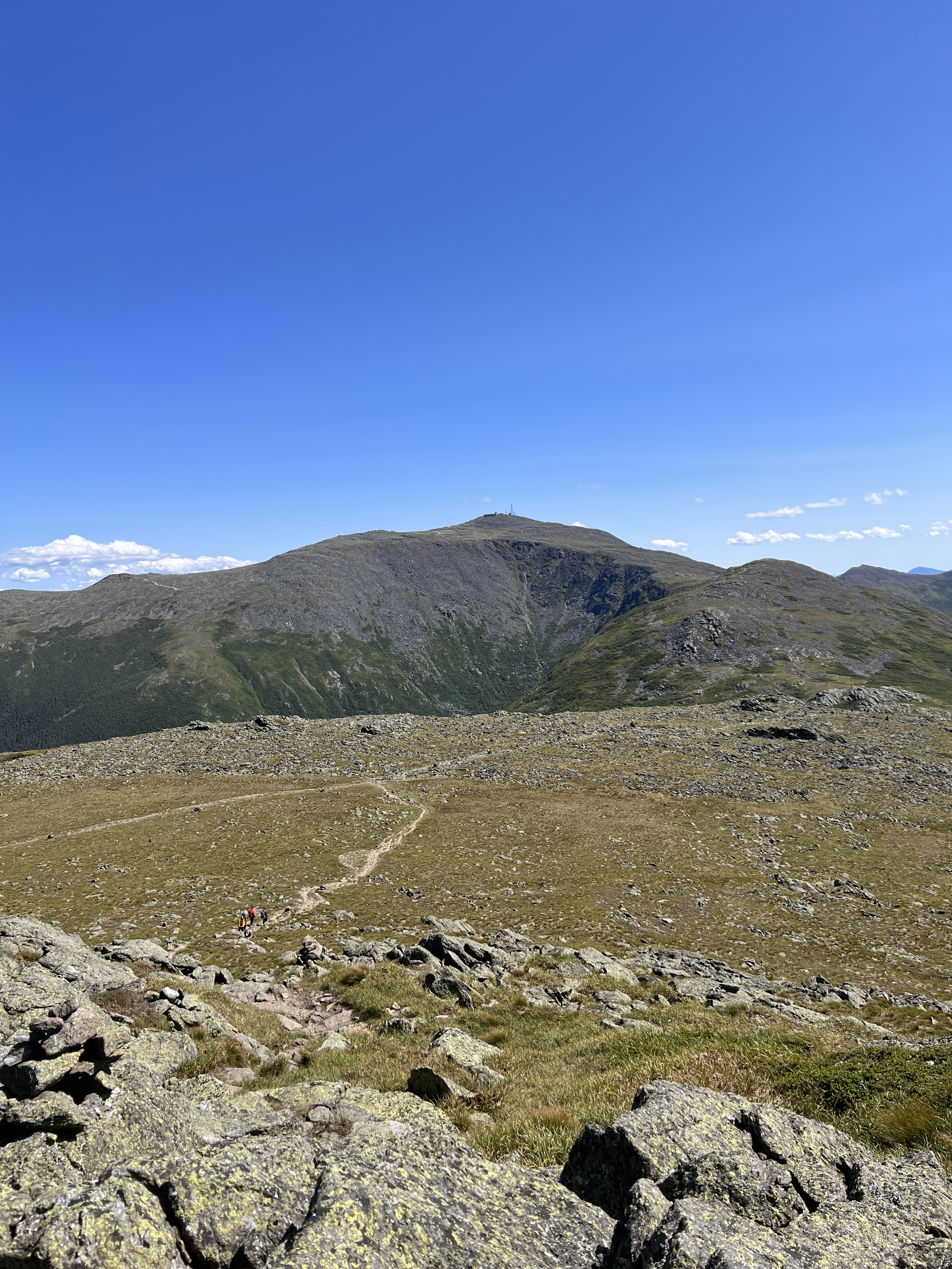
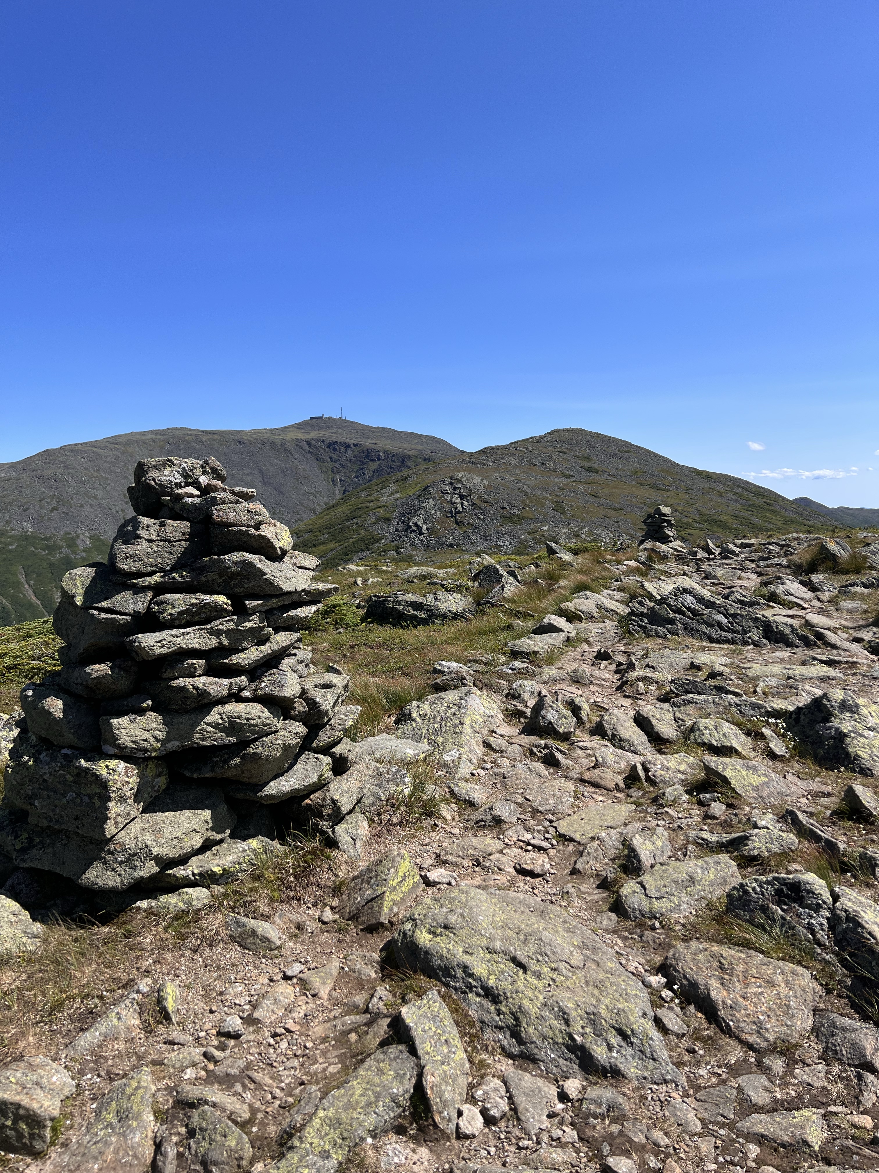
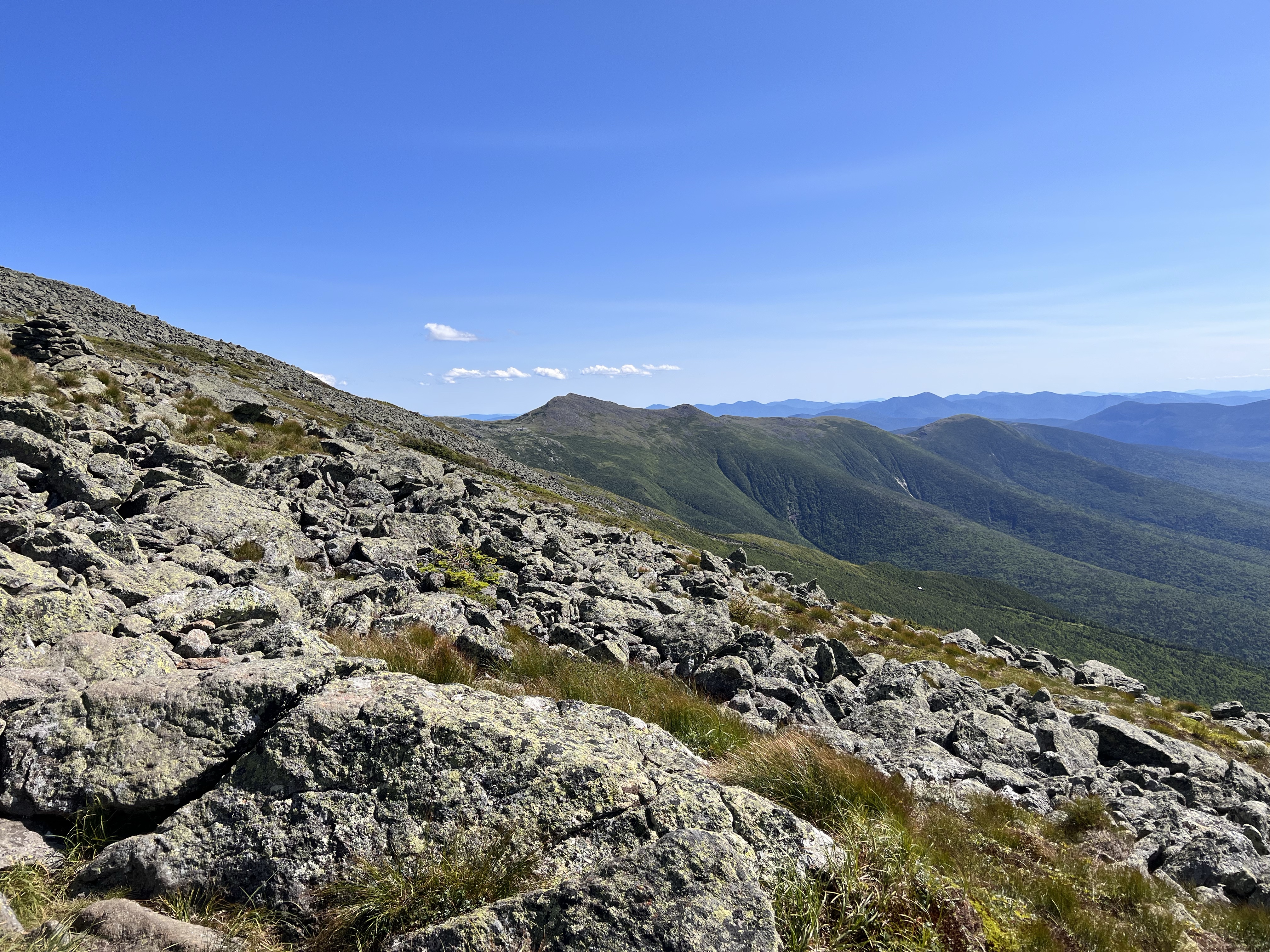
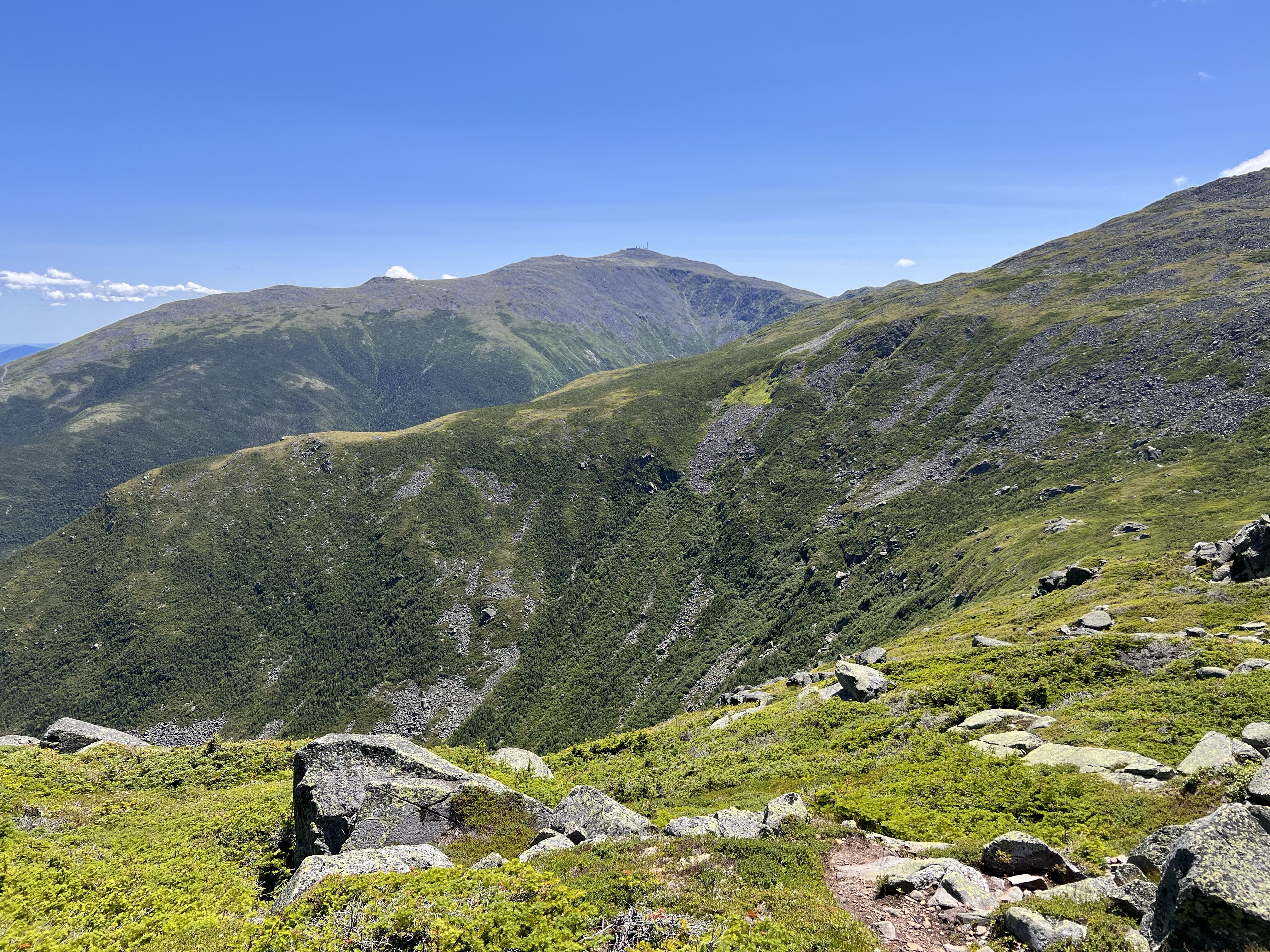
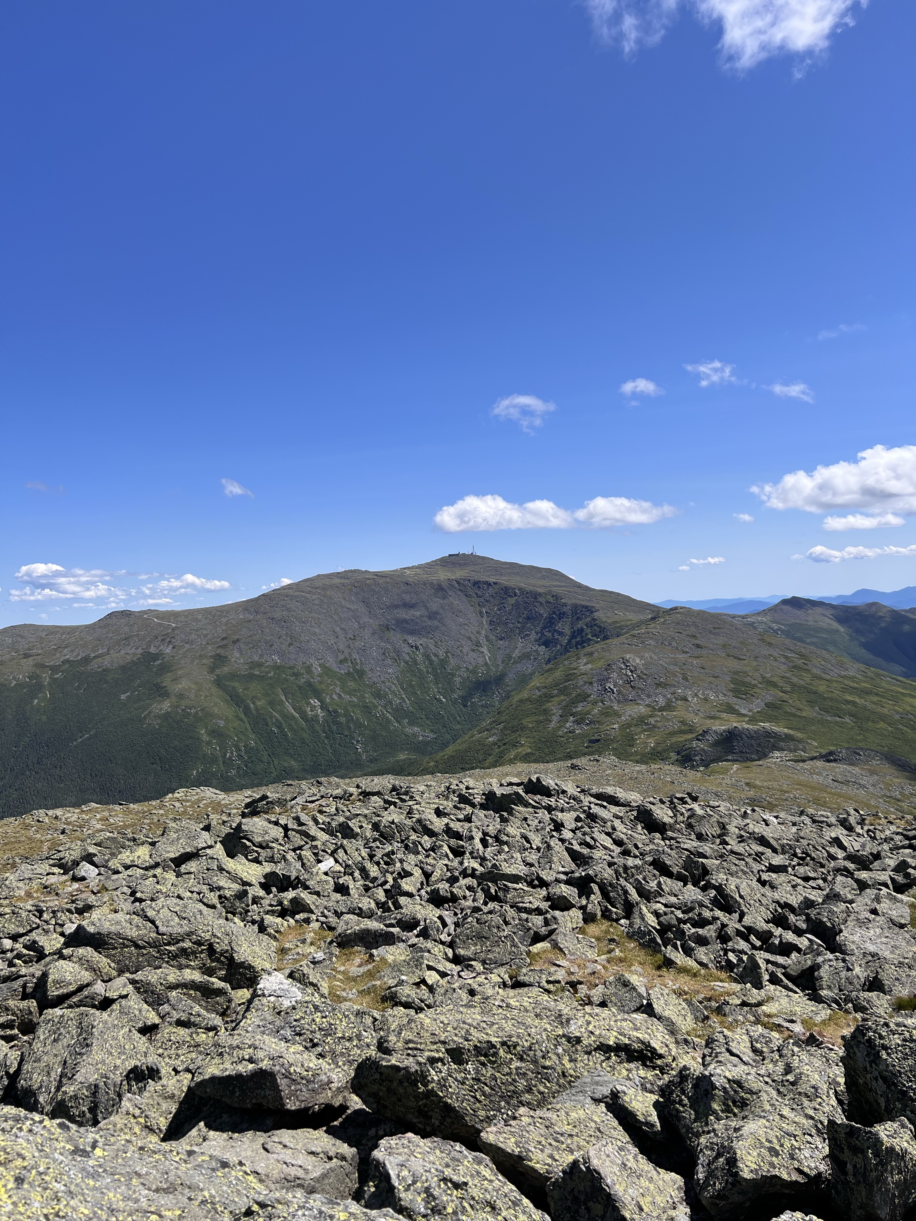
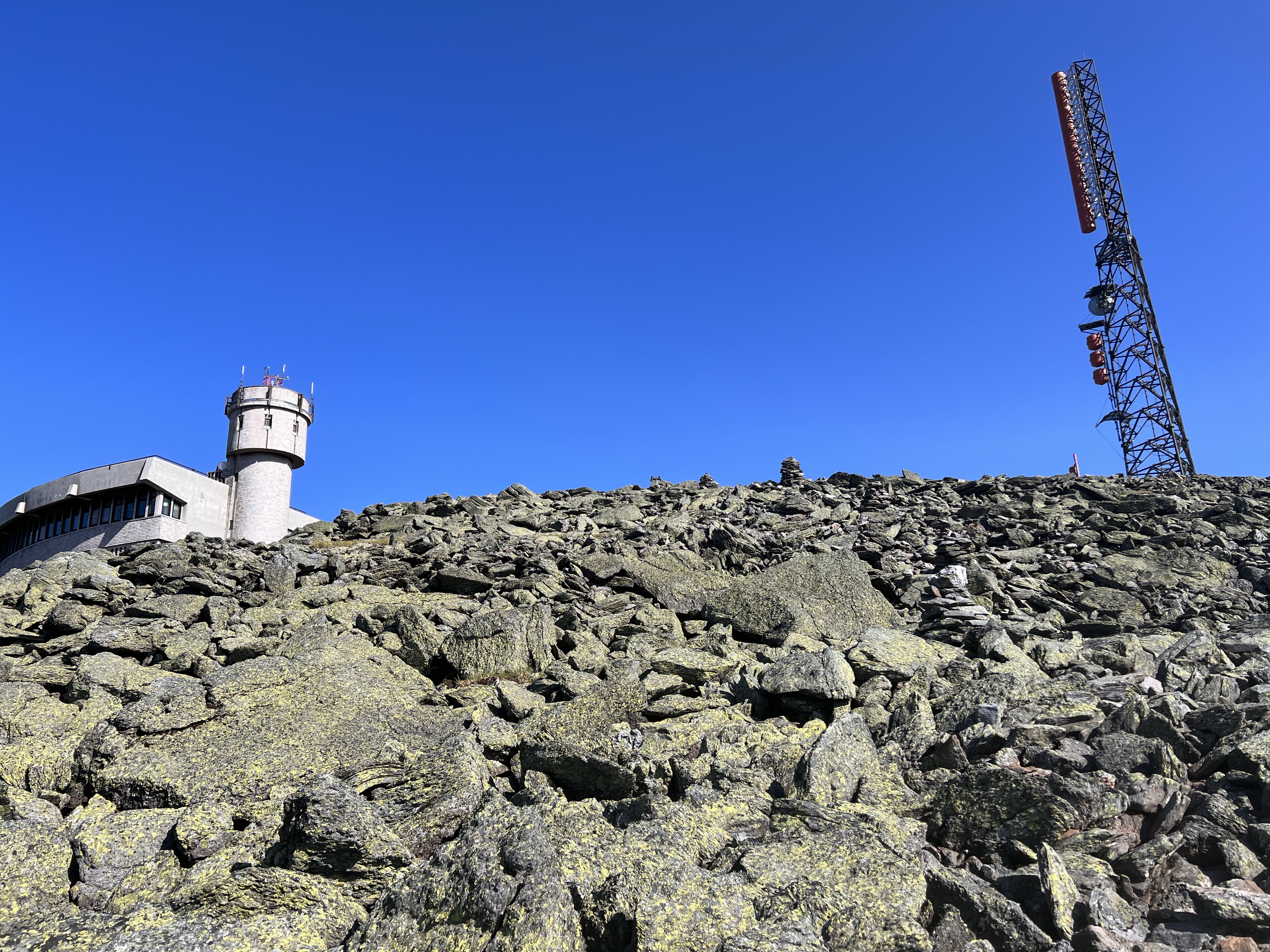
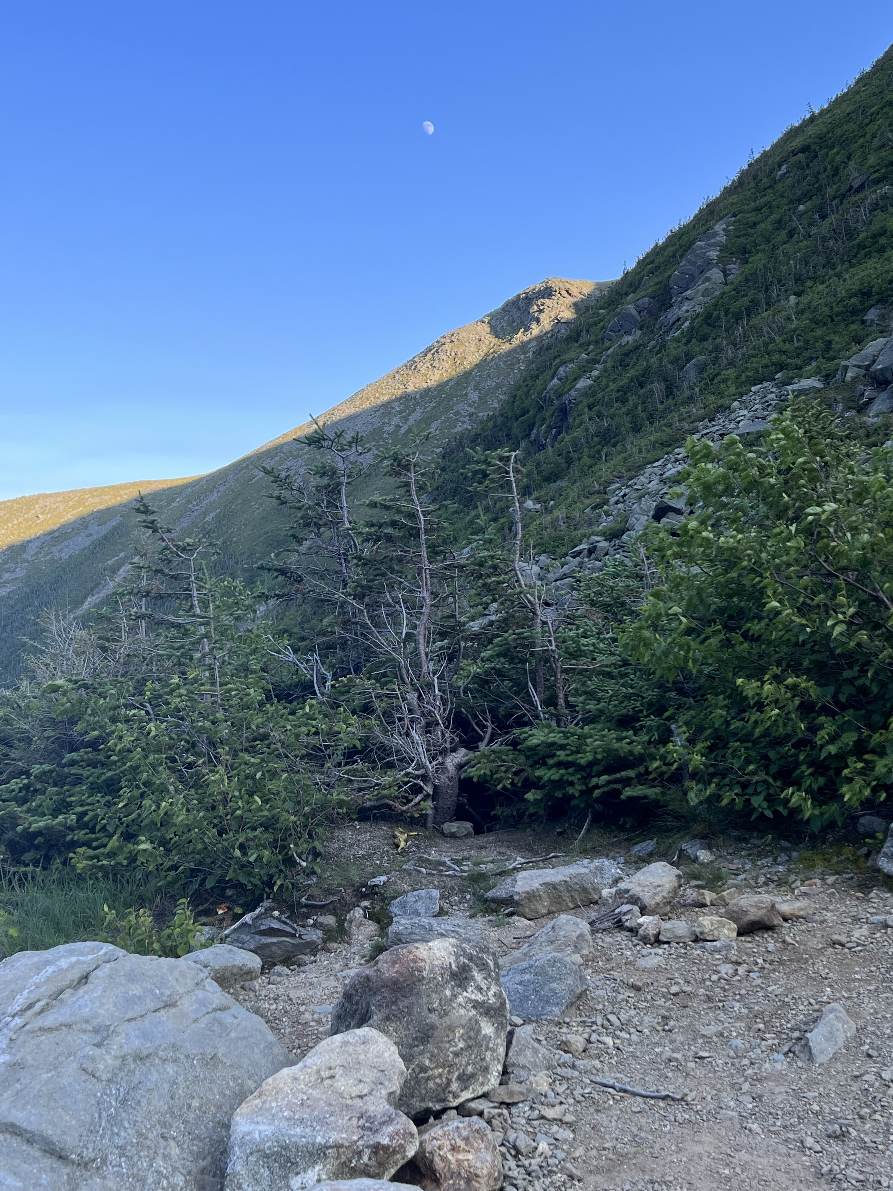
I rounded Clay at the junction Jewel. Adrenaline kicked is as I was on my last ascent of the day. To my left were amazing and inspirational view of Great Gulf. I was looking back from the terrain I had covered. In the distance was Madison, NH’s 9th highest peal. Then the second highest peak in NH, Adams. And just before Washington was the third highest peak in the state, Jefferson. I was now on the shoulder of the highest, Mt Washington at 6,288′.
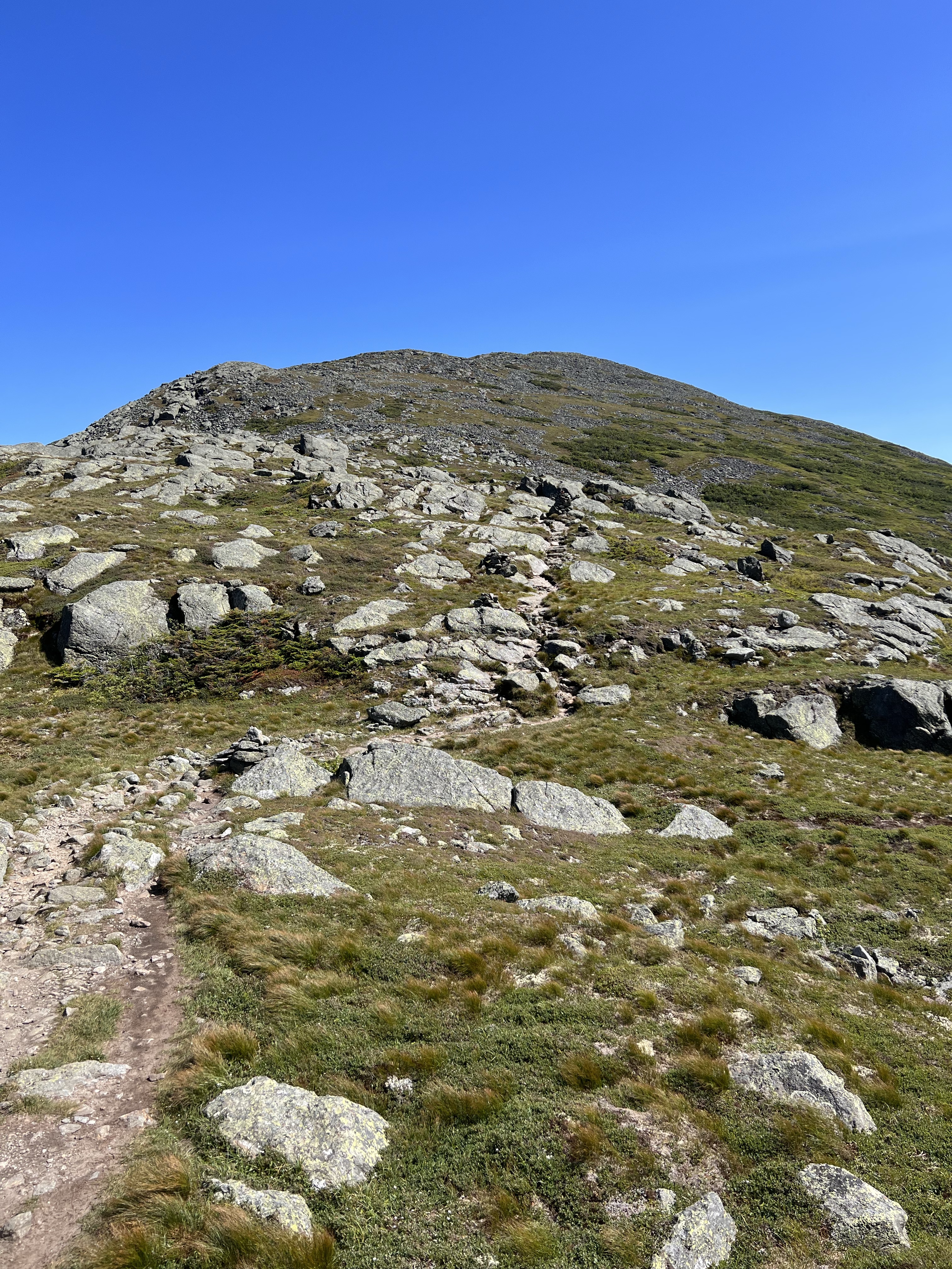
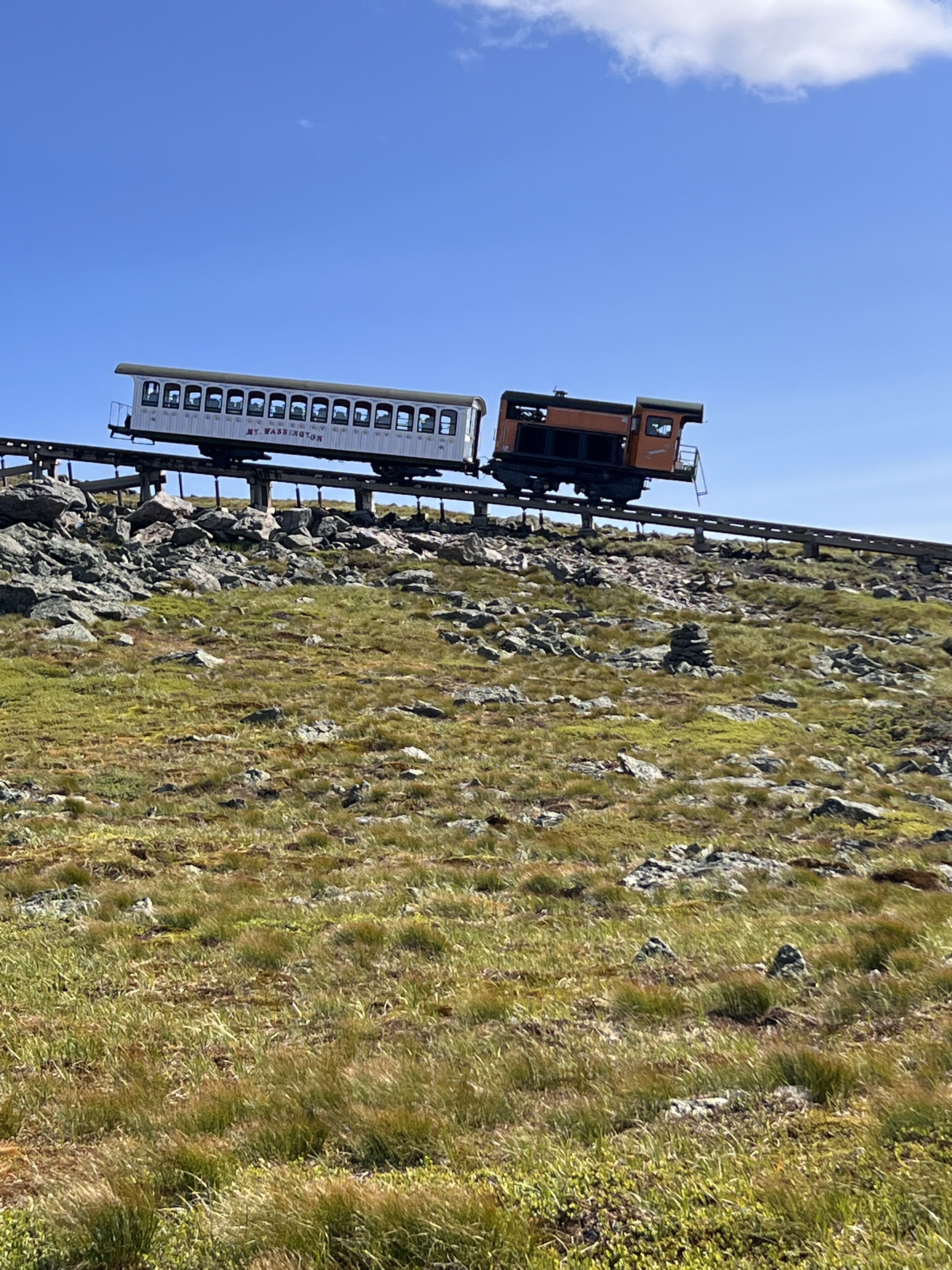
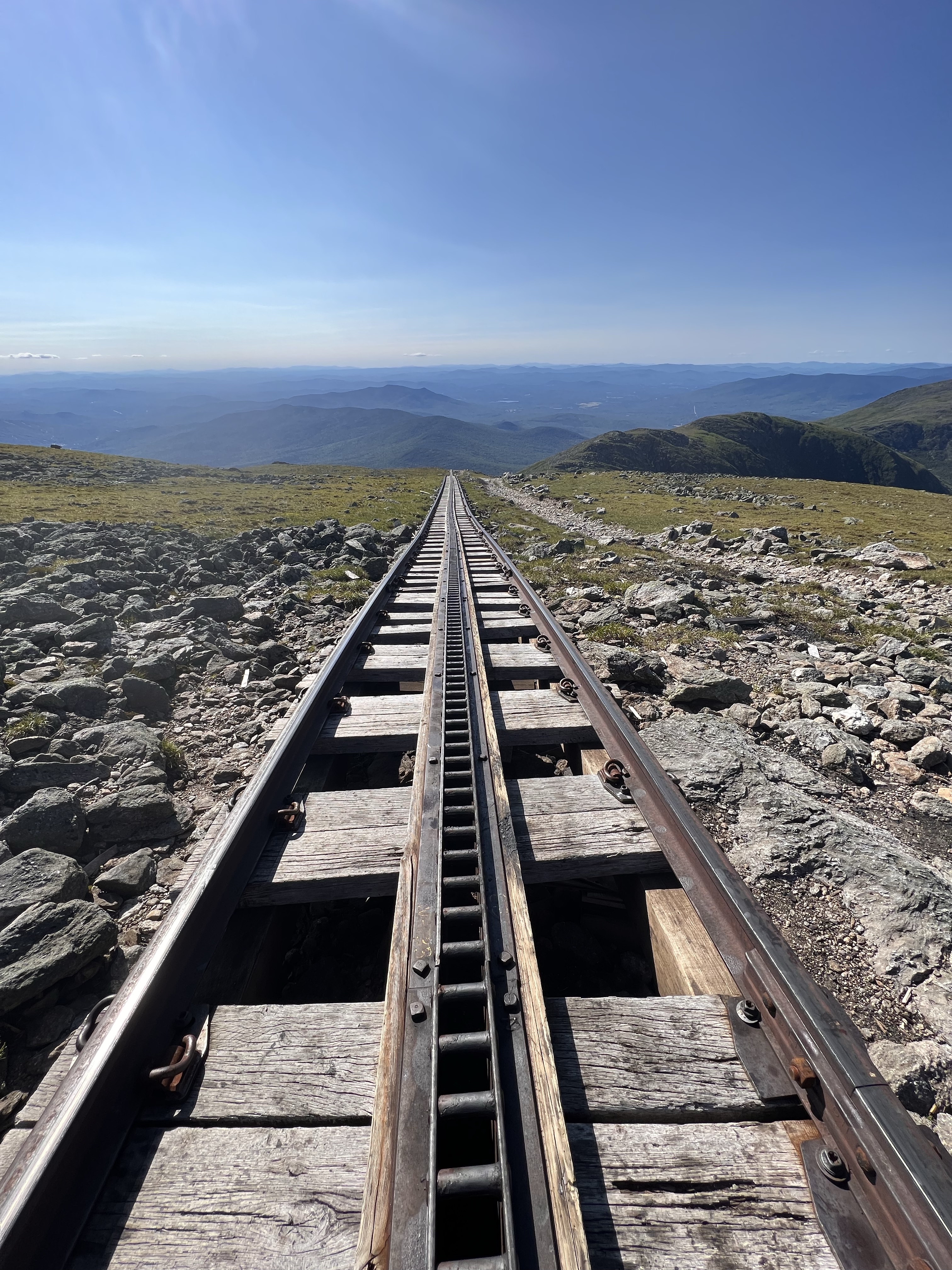
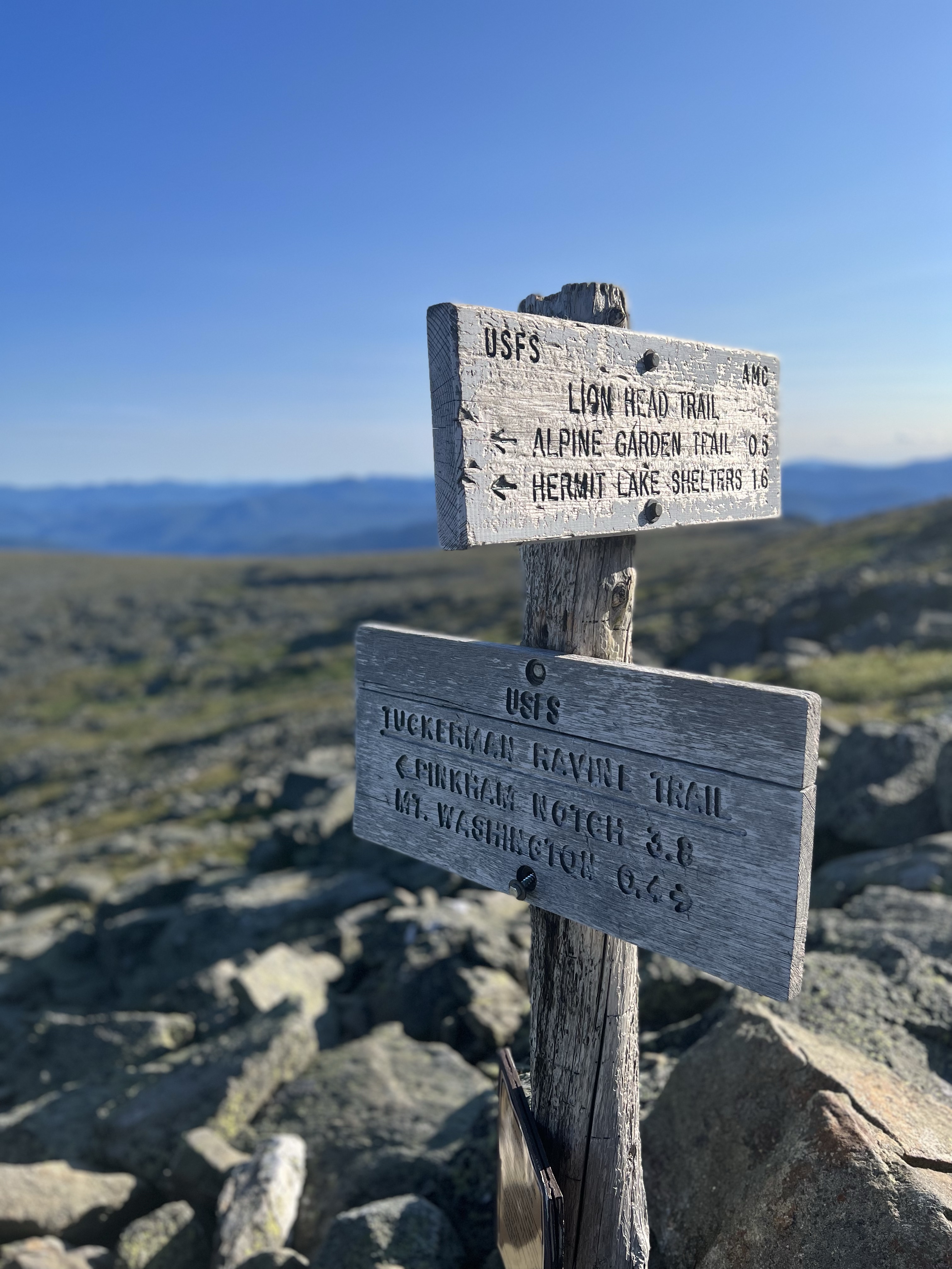
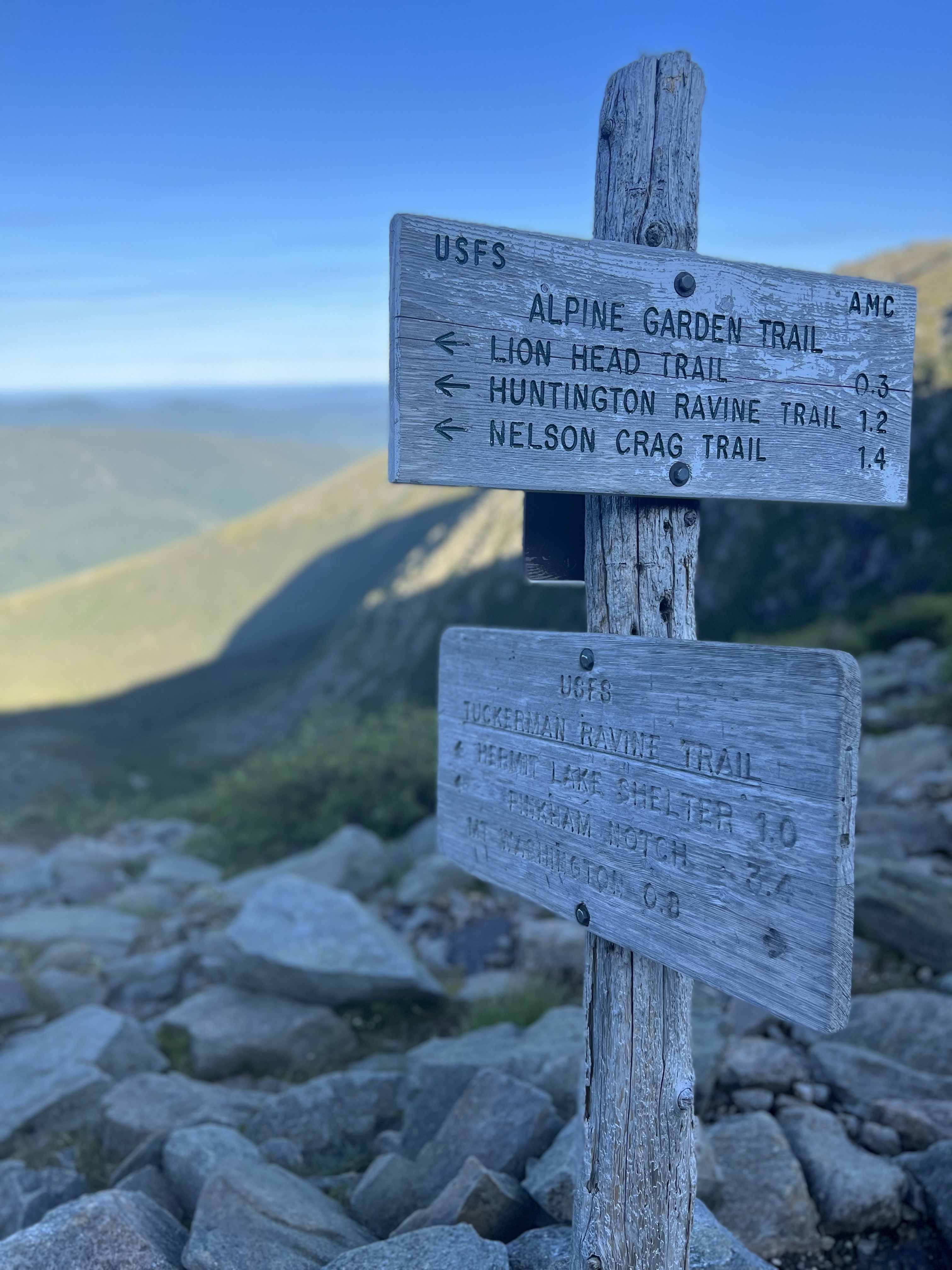
I encountered a few hikers descending the trail as I worked my way up the shoulder of Washington. Some seemed a little out of place as they very nervously made their way along the side of Great Gulf. There are spots with very precipitous drop offs. I get nervous myself on some trails but there was not time for that. I was running low on gas, needed a break and was hoping my tracker would not die before I got the top. I was paralleling the Cog Railway for a bit and a train on descent was visible. It’s fun to wave back at the passengers looking at the crazy guy walking up the mountain. I crossed the Cog tracks and was soon at the Trinity cutoff junction where I make the turn for the final .25 miles to the top.
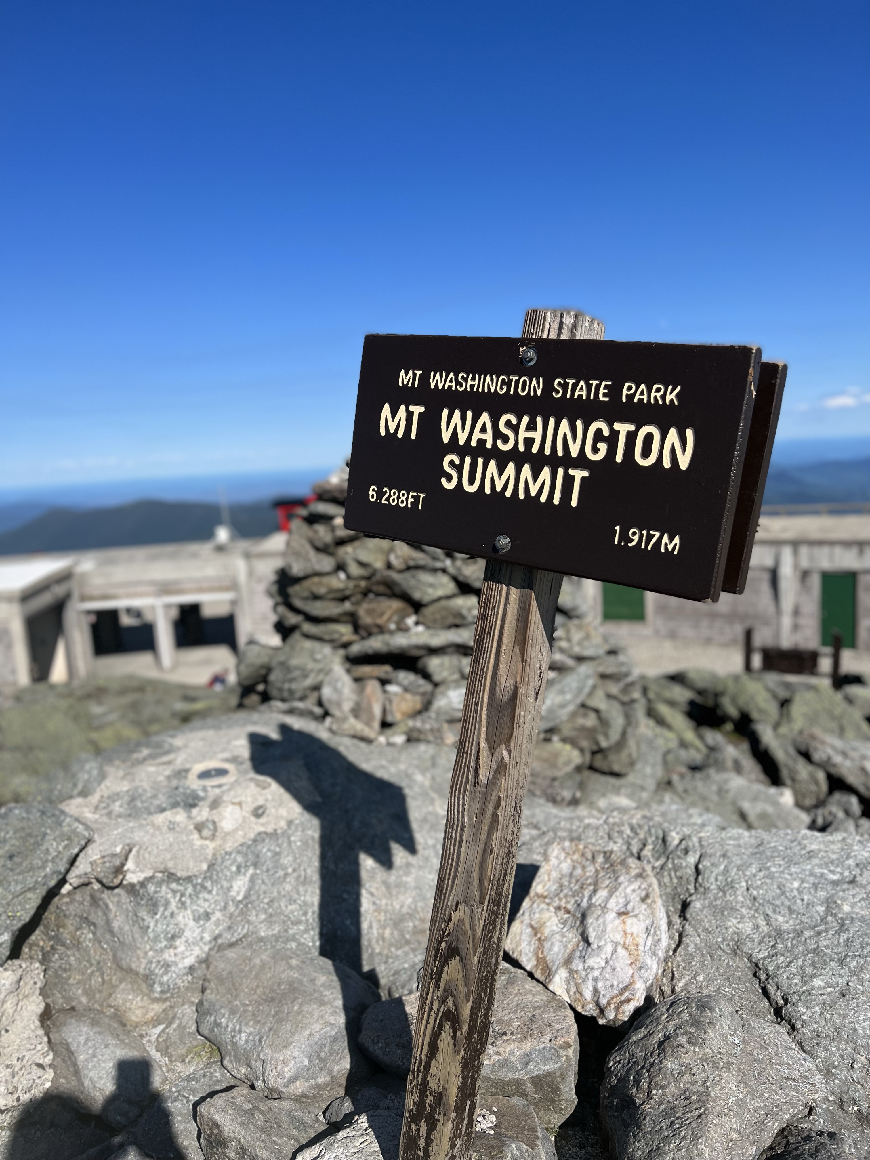
I arrived at the summit at 5pm, 10 hours and 7,500 feet of elevation gain behind me. It was such a relief to know that it was downhill from here. The Tuckerman Ravine descent was a bit of an unknown but I knew it had to be doable. I made my way to the summit sign and then down a bit to the Sherman Adams building. Just inside I found a bench with electricity beside it. I took my pack off, dug through and found some food and a charger and sat down. I got plugged in and charged stuff while eating another PB&J and chips.
I noticed I was getting cold. I started to shiver. It was a different shiver, not like I had felt before. Very intense, deep. Three fingers on my right hand were turning yellow and getting numb. I was concerned. I added another mid-layer and a top layer. I wrapped my legs in my windbreaker. I stopped short of putting my pants on but I did have some. I was starting to warm but still shivering and my fingers were concerning me. I knew I had early signs of hypothermia. I had to take this seriously. I got up and walked deeper into the building, away from the wind that was blowing at 40mph outside. It was 75 at the base but up here it was only 43. The sweat on my clothes, the sudden wind, and the cold combined to cool me way too fast. Getting a ride down did cross my mind but I decided I warmed enough and was on track to get even warmer, so after a 45 minute break and focus on warming it was time to head out. I packed up and headed out into the wind.
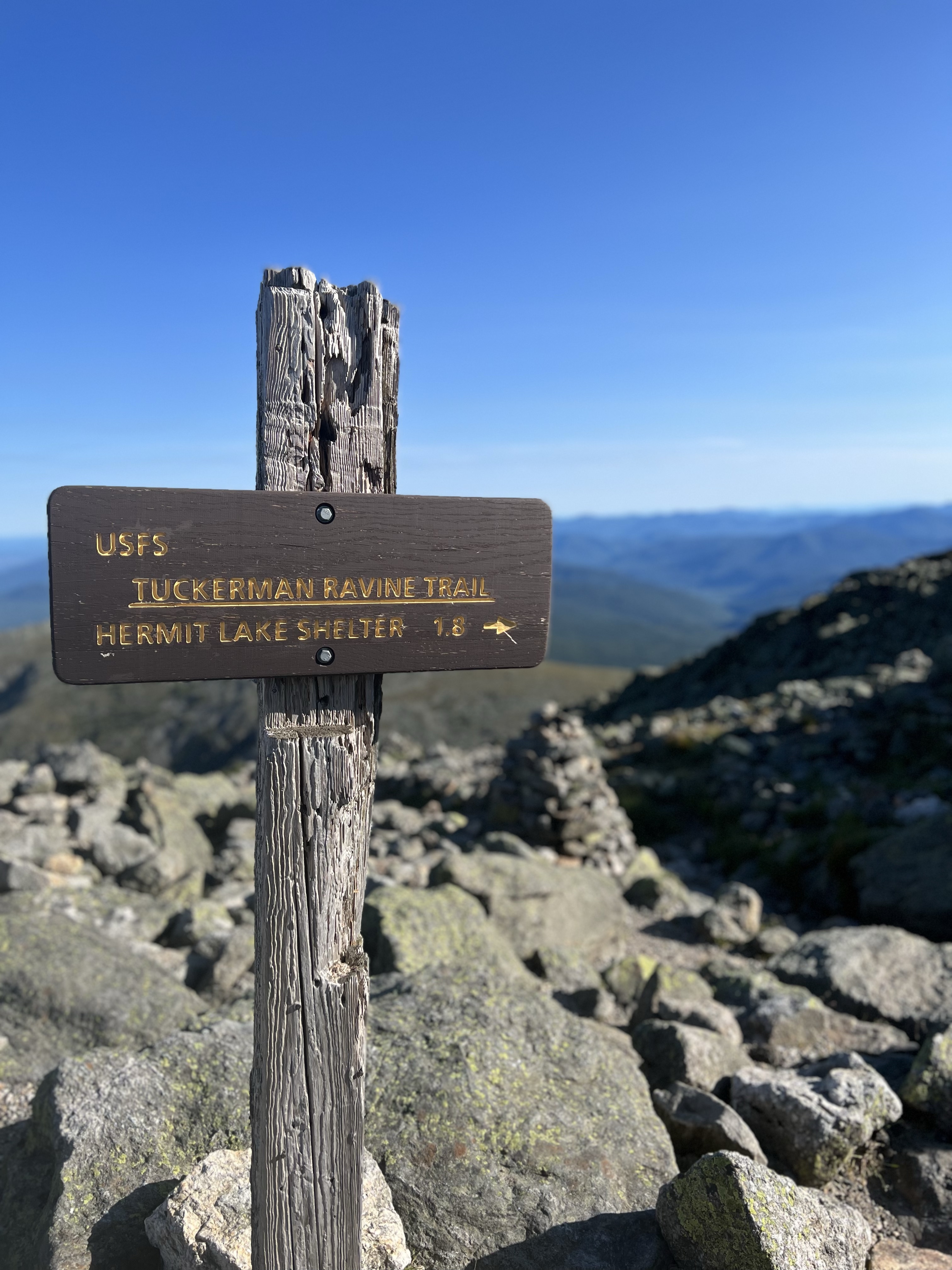
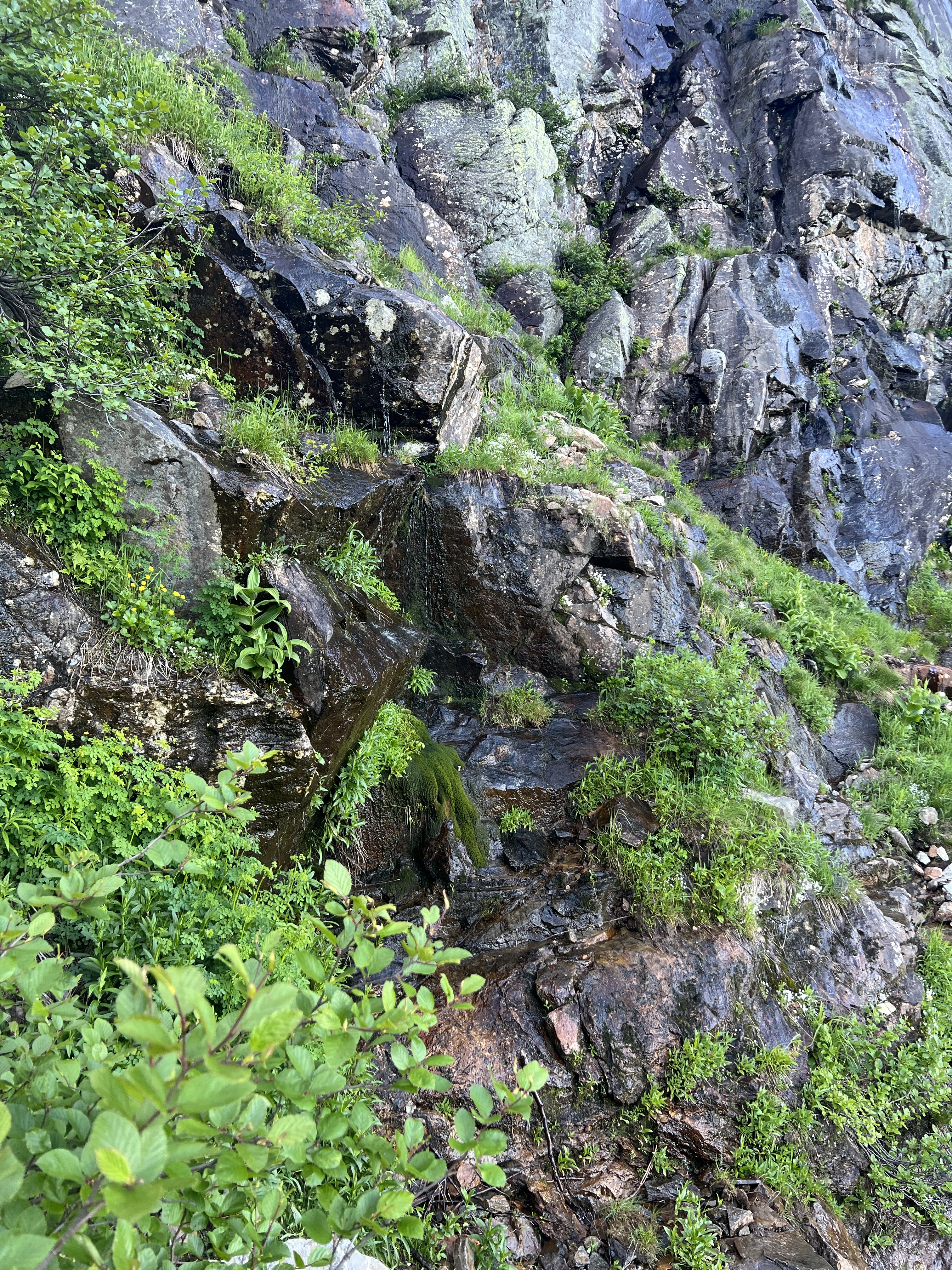
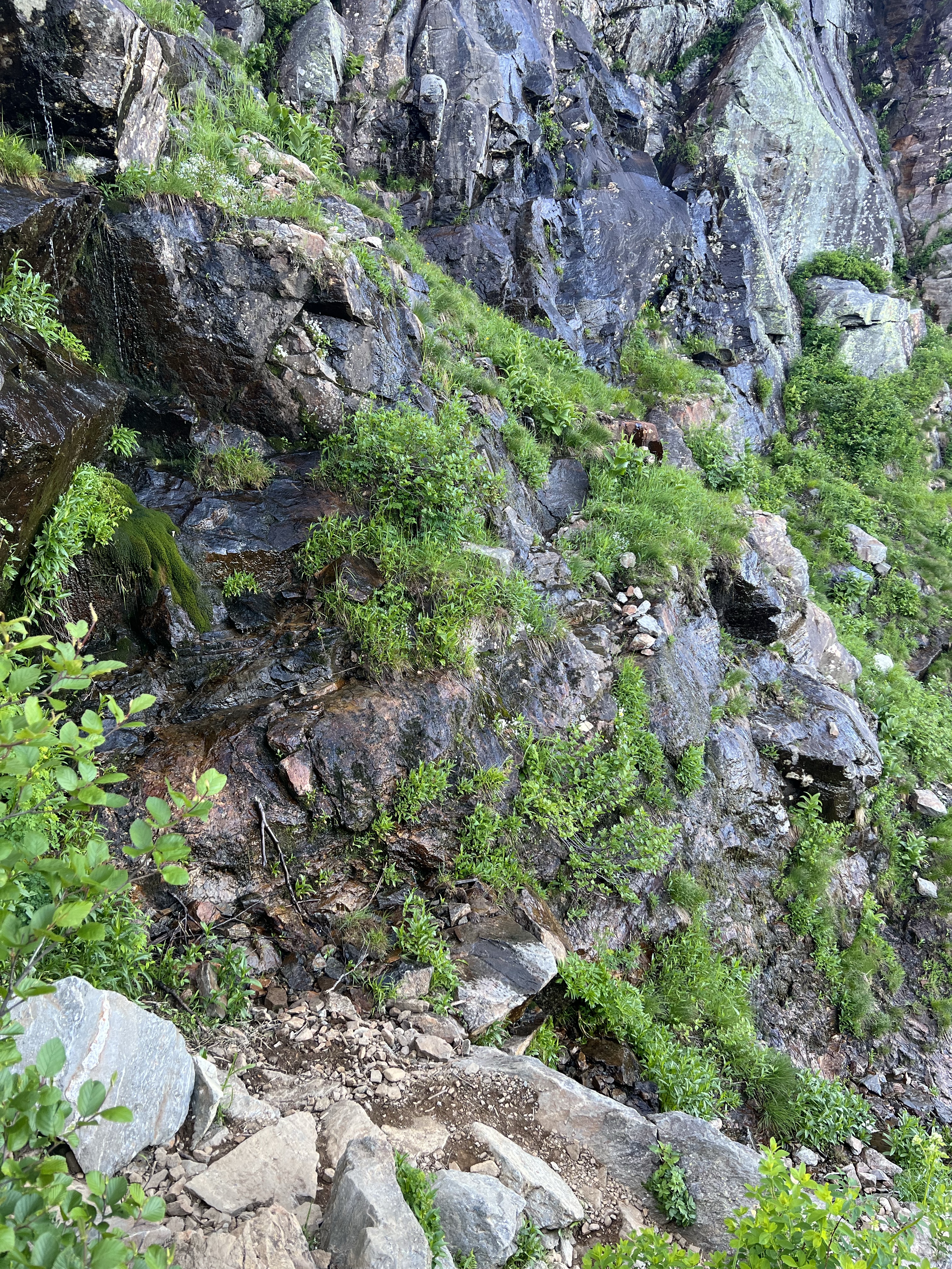
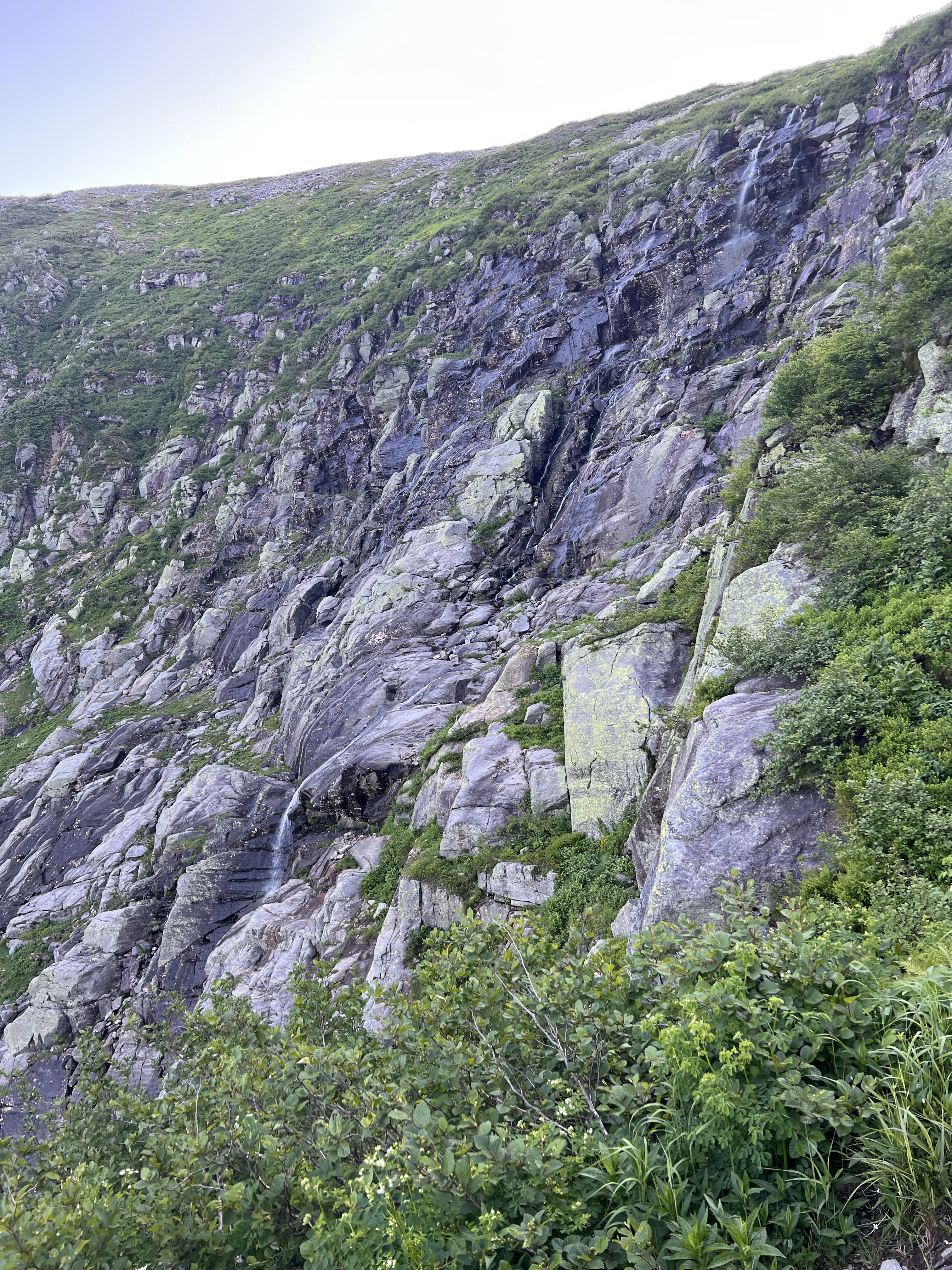
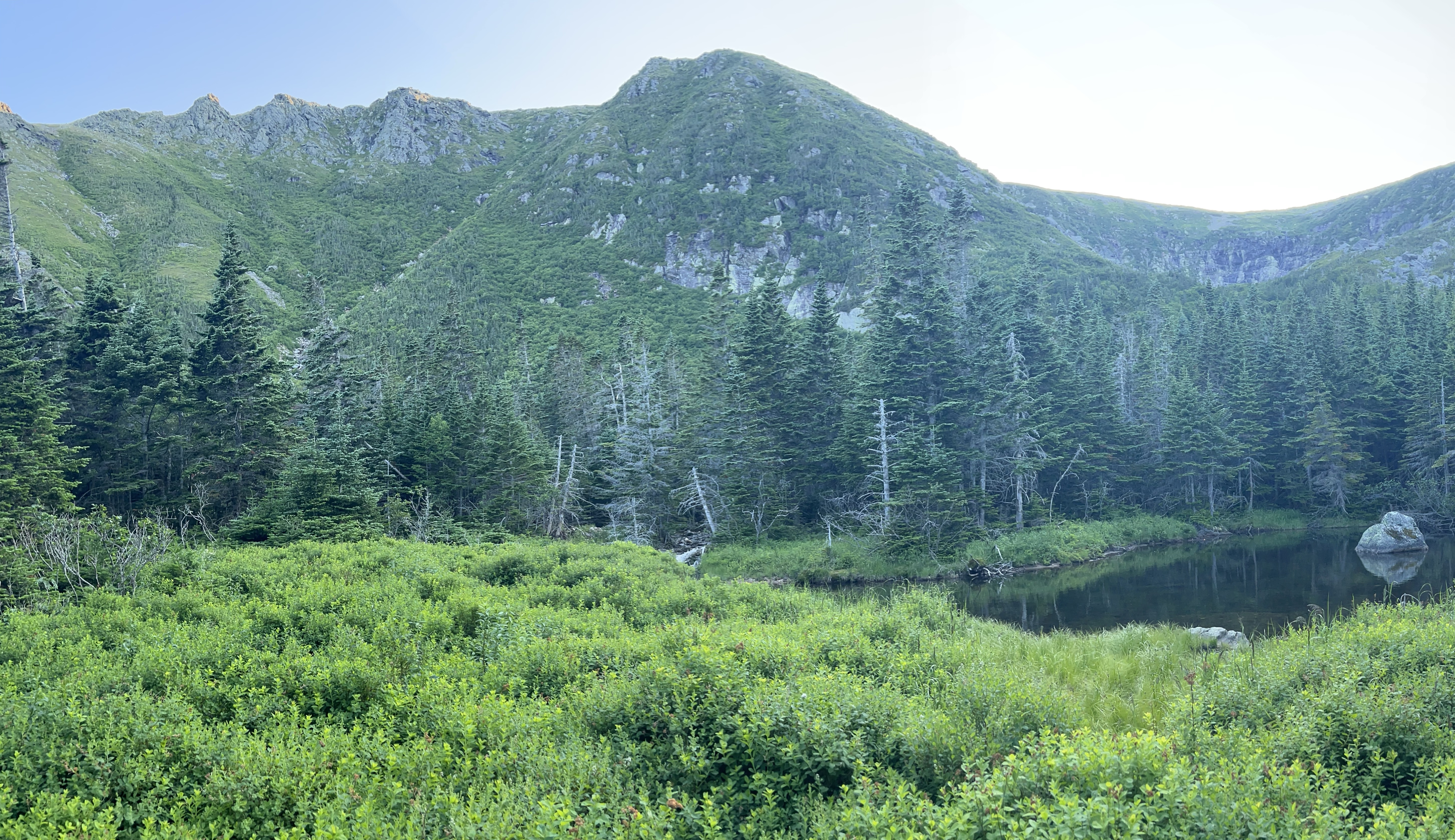
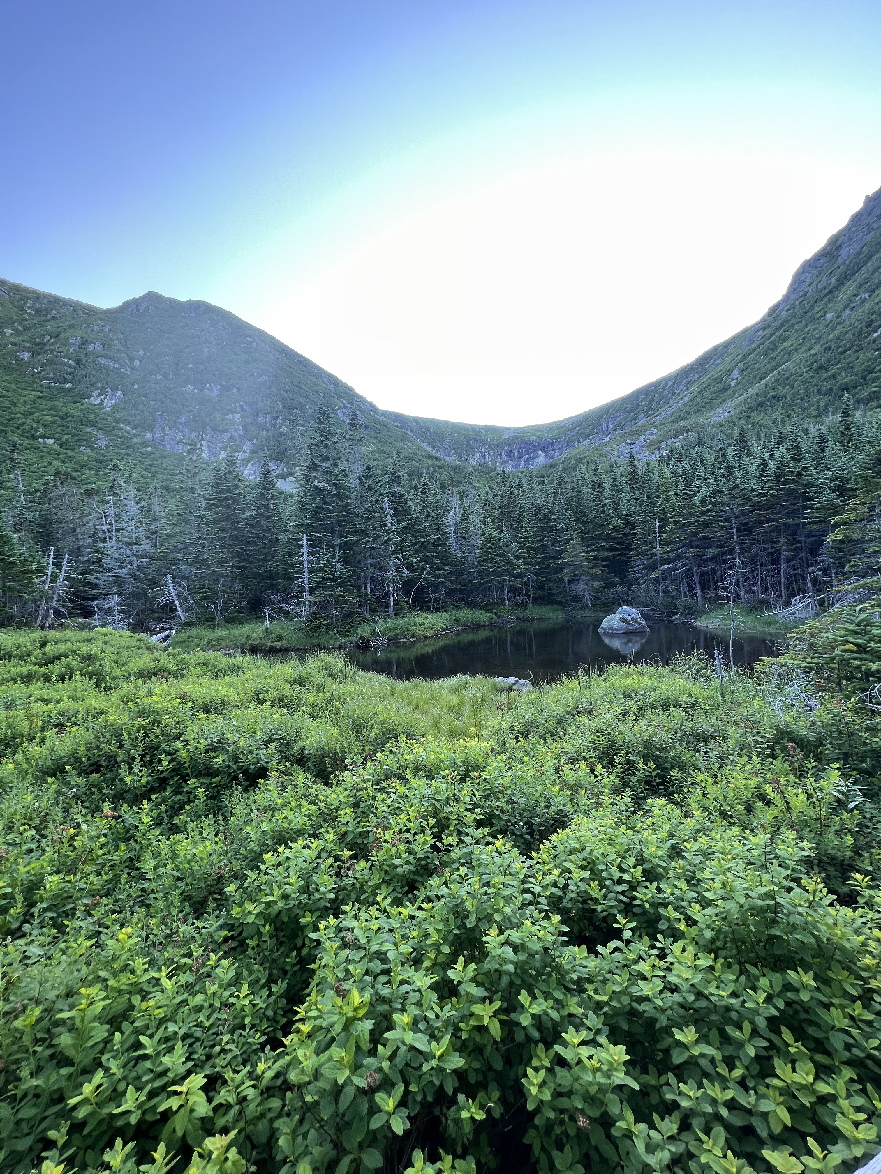
It took about a half hour to descend Tuckerman Ravine Trail to the headwall. On this descent, the color returned to my fingers and the numbness went away. I was warm. That section of trail was gorgeous but also very annoying. Maybe it was exhaustion but I had had enough of the careful foot placement on loose boulders for one day. I was ready for some dirt path after HOURS of ankle breaking rocks. I arrived at the headwall where things started to get more green with bushes and grass. Still rock hopping from time to time but better. I was noticing the trail getting much more steep and wet. Before I knew it there was a small stream on either side of me. Then a third stream. They were combining into a more substation flow. I made my way to the side of the trail where there was dry footing.
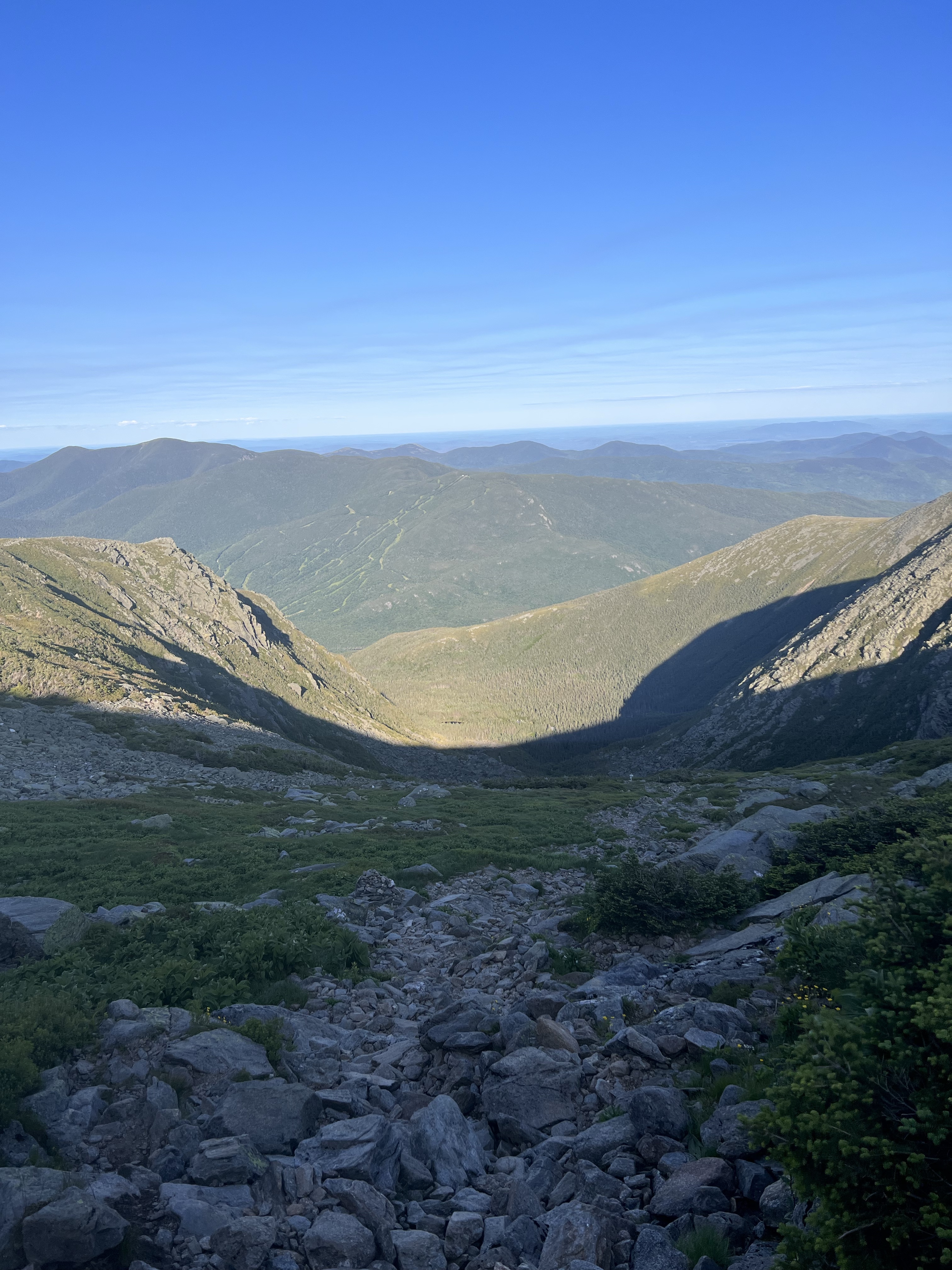
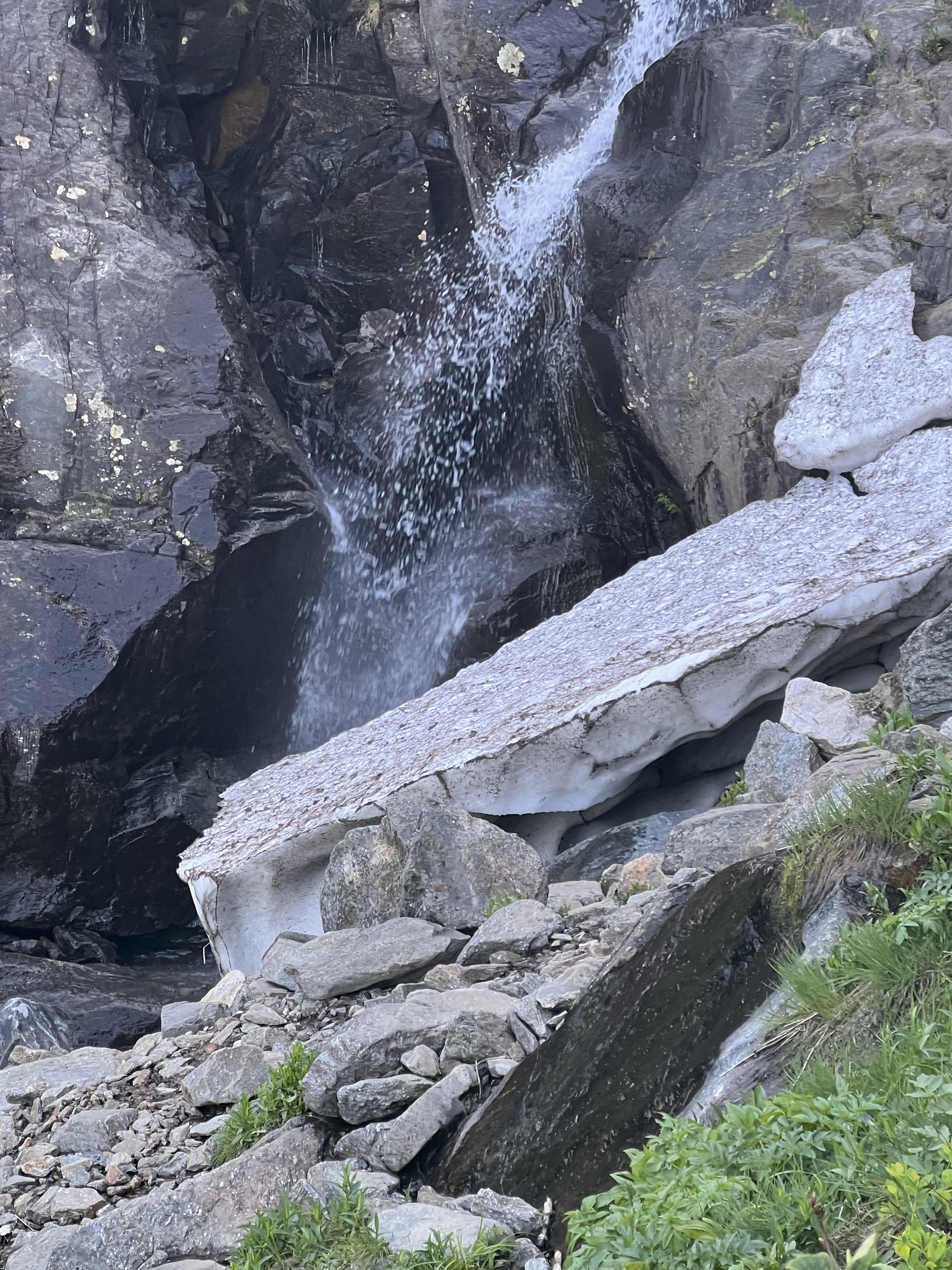
As the trail continued at a steep descent I looked ahead and the stream was even bigger. I was getting nervous that I was going to have to navigate this water through some very rough terrain. I approached what turned out to be a waterfall. Where do I go? Bushwhack? Down a ravine? I dropped my pack and got my map out. The map seemed to indicate that the trail crosses the top of the waterfall and then continues to traverse the side of the ravine before wrapping back on a switch back. I was relieved to learn this. I made my way across the stream and down some very steep ledges to another stream crossing. I navigated this and then the trail turned sharply down. I rock hopped my way to the base of the ravine and a trail that was becoming more and more dirt. Finally.
It was easy from here. From Hermit Lake Shelter back the parking lot at Pinkham Notch the trail was like an old dirt road. Smooth sailing. I think I walked out of the woods around 8:15. Just over 11 hours.
A truly epic day. I feel ready to take on the full traverse which I anticipate will take around 14 hours. it adds Mount Monroe, Mt Eisenhower, Mt Pierce and Mt Jackson. The southern Prezis are not as rugged and difficult as the northern. I am thankful for my health that allows me to experience hikes like this. The mountains are where I belong. It’s where I’m most happy.

You are so amazing❣️Your guts and determination are outstanding. You go for what you want and get it❣️But please be careful…the life you save may be your own. You are also a great writer. Mostly I feel pain when I read these but I feel gratitude for you being able to achieve your dreams. What a great feeling it must be.♥️We are so pround that mt mike is our son❣️
LikeLike