

It had been several weeks since my last 4000 footer hike and I was getting itchy. A good friend of mine had mentioned car camping in the past, I never gave it much thought previously. I decided to take a couple days off and do an overnight. Initially, I was thinking I’d do Mt Moosilauke on day 1 and then North and South Kinsman on day 2. After looking at the weather for Thursday I decided to skip Moose for now and hit 2 more presidentials. Mt Monroe and Mt Washington.
The plan was to get on the road early and get to the Ammonoosuc Ravine Trail trailhead and start hiking by 7:30. 4 miles or so to Lakes of the Clouds Hut where I take the Monroe Summit Loop up and down Monroe then back to the hut. I would then continue from the hut on Crawford Path to the summit of Mt Washington about 1.5 miles away. From there I would take the Gulfside Trail to the Jewel Trail which would bring me back to my car, about another 5.5 miles.
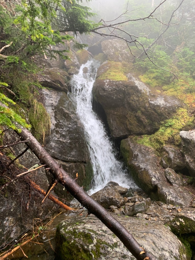
I arrived and hit the Ravine trail by 7:30 as planned and made my way over the gently rolling trail to the river. Many waterfalls along this section of the trail and I enjoyed the sound of the water. The trail remained pretty docile for a couple of miles. I started this pursuit of the 4000 footers amid the COVID-19 pandemic and have yet to encounter an open hut, an experience I am looking forward to.


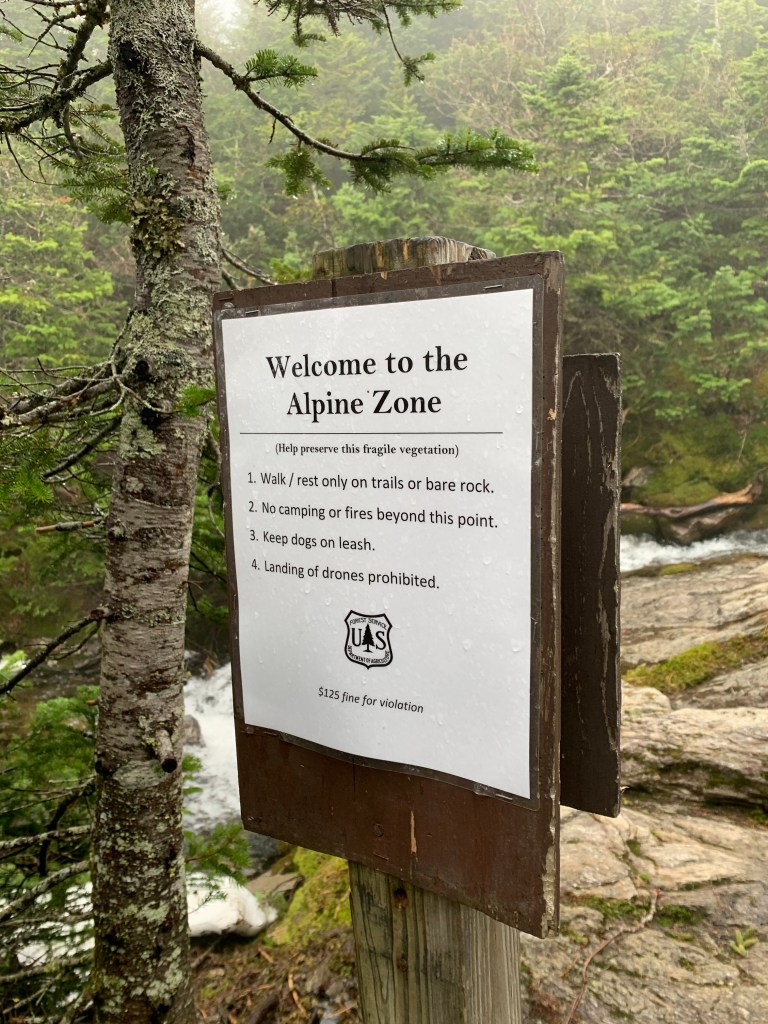
The Ammo trail then turned slightly south then east then more sharply south and STRAIGHT UP. To this point, the trail was a little wet with dense mud in spots but not very ledgy or rocky. That changed. The next 2 miles to the hut and Mt Monroe were very steep, ledgy and wet. The ravine at times is just feet away with water falling 50 or 60 feet in rolling cascades of falls. Very beautiful but a little unsettling given the wet ledge I was navigating.


The steeps continue with several water crossings. As I got up higher on the mountain the wind began to increase noticeably. The wind, wet and steep reduced to me crawling one 20 or 30 foot section rather than standing on the exposed ledge. Steep is one thing when in the woods. The trees can provide a sense of stability. The same steep on exposed ledge is different. Feeling that exposed on a face so steep with no handholds can be a little scary. I was progressing, getting closer to the hut.


Once at the hut, I was fully exposed to the wind which was steady at 45 with higher gusts. From here I was to take the Monroe Summit Loop to the top of Monroe, then return to the hut. I stepped out into the wind and followed the trail a bit south for the short, steep trip to the summit. The wind on the ascent of Monroe was steady at 55-60mh with higher gusts.
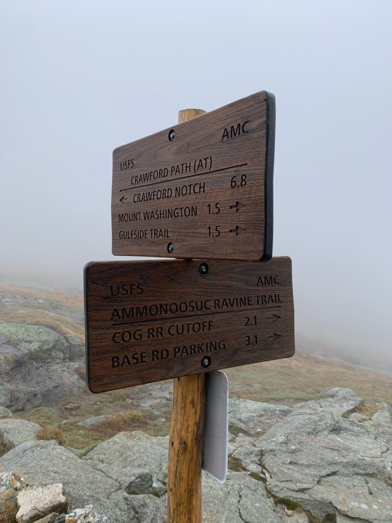
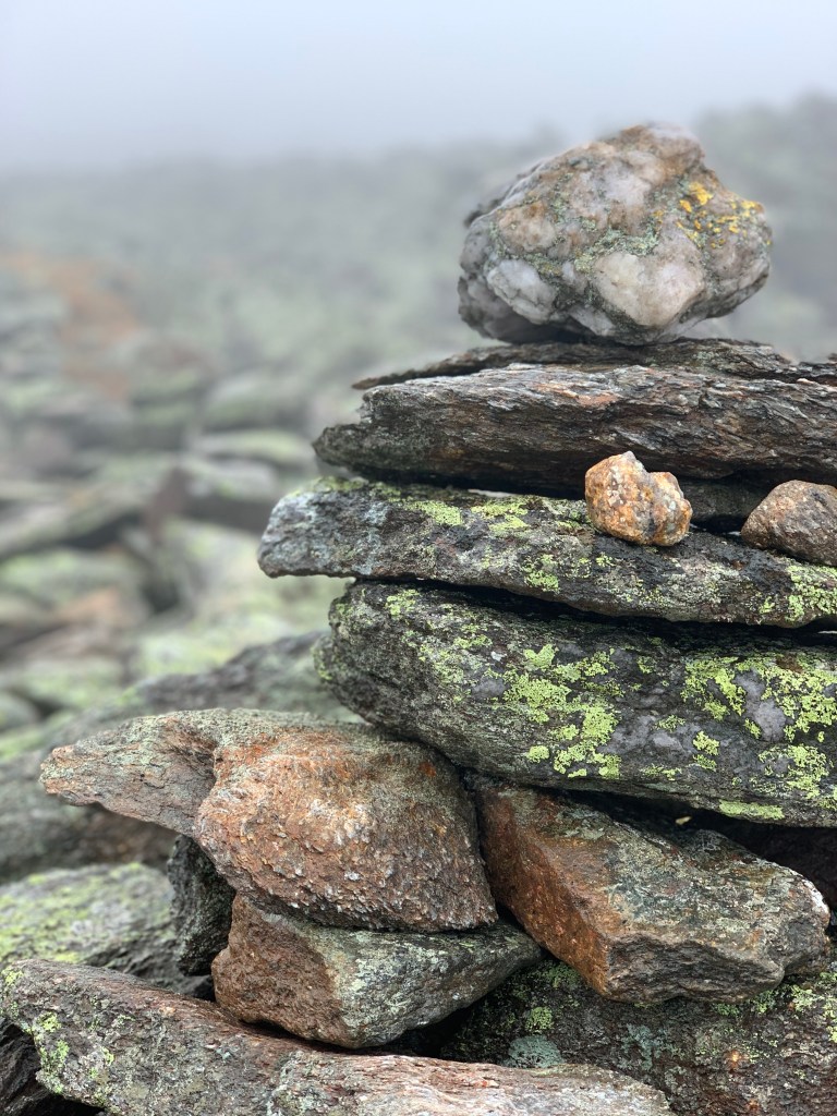
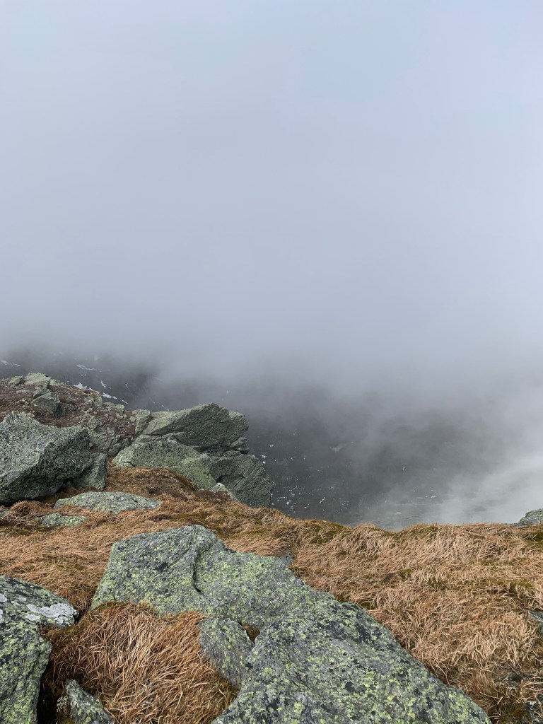
I hadn’t checked my phone battery before heading up Monroe and it died just before I touched the summit cairn. When I returned to the hut I dug my backup battery out, ran the wire through my shirt, and charged my phone as I left the hut on Crawford path to Mt Washington. This was all new territory to me. The weather forecast I used was thus far 100% wrong. Supposed to be windy and clear. It’s extremely windy and I have been in the clouds since the Ammo trail went straight up. I got to a cairn near one of the lakes and it was unclear where the trail went. I ventured to the south a bit and found a snowfield with no footprints. Wrong way. I went back to the lake and walked along the edge of it where I found the trail resuming to the north. It was clearly marked with cairns. I could see about 100 feet through the clouds and relied heavily on the cairns for navigation.

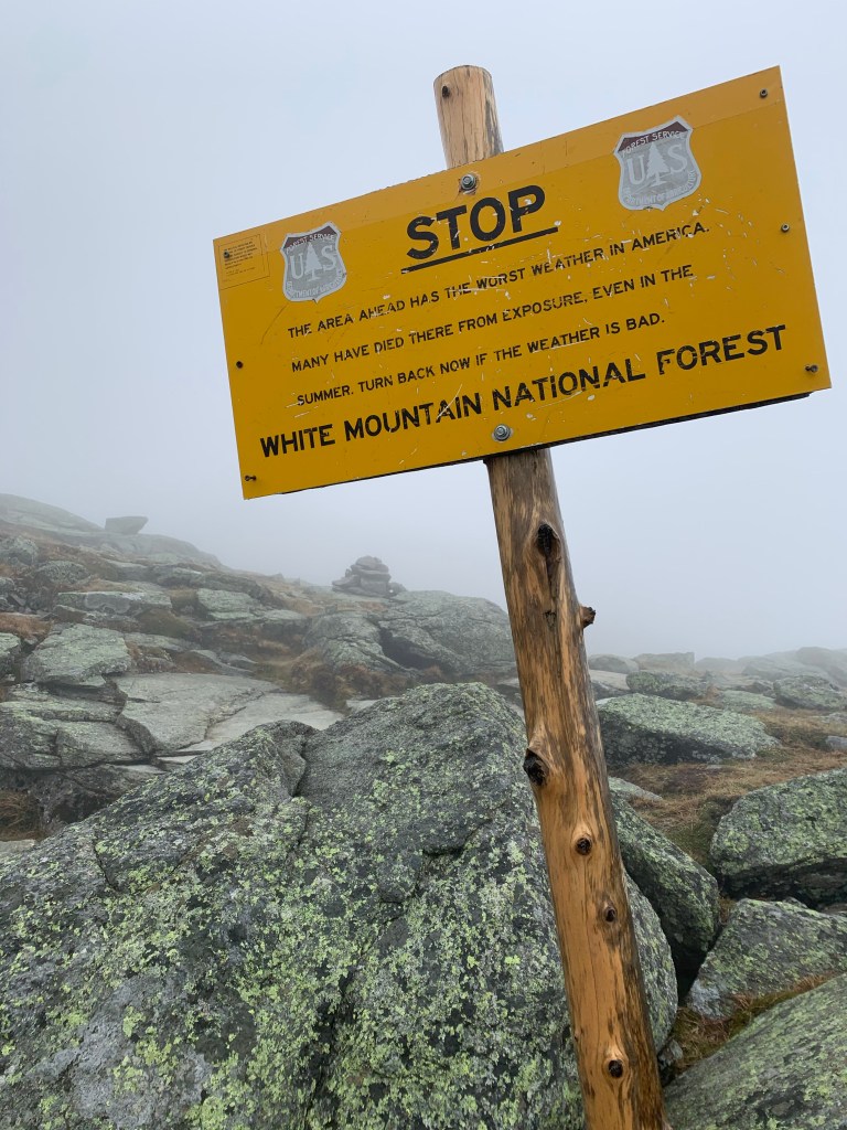

I think it was around noon that I reached the Gulfside Trail junction and turned toward the summit of Washington. The walk to this point seemed to take forever. The dense cloud cover obscured all landmarks. I had no idea how close I was to the summit until a very brief clearing swept by revealing a creepy ghost-like view of a summit antenna. When I saw that I realized that the roar I was hearing was the summit wind. I was shocked at how fierce the wind became as I walked the last hundred yards winding my way to the summit. The summit of Mt Washington is a bit crowded with buildings and even people on a nice day. I love to see people out enjoying NH no matter how they got up there. The Cog railway and the auto road will get you there. I have yet to take either of those but have walked up a few times. I look forward to a train ride to the top.
I estimated the wind to be at least 70mph on the summit. I later looked at the MWOBS and found that at noon, when I was there, the wind was between 70 and 75mph sustained. The average wind for the day was 49 with top speed of 87mph. If you have never expreienced wind like this, it is very impressive and daunting. It can be hard to catch your breath when facing the wind.

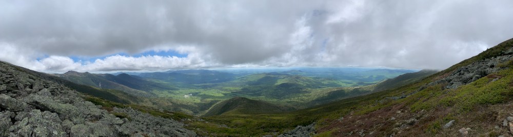
After eating a sandhich, clementine, and a Cliff bar, I packed up and headed off the summit of Washington. I went back down Crawford Path back to the junction with Gulfside. It was nice to be in the mild wind at 25mph. Gulfside to the Jewel Junction was a gradual descent past Great Gulf. Even with the limited views, the gulf beside me felt more like an abyss. Steep, rocky, and foreboding. The descent down Jewel Trail is beautiful. I was sure to take it all in as it was the first time all day I could see anything besides the inside of clouds.


I would recommend this hike to many. Ammo Trail can be tough when wet and probably is not for the faint of heart when dry. Once at the Hut, it is a pretty easy hike the rest of the way.
| Distance | Elev Gain | Time |
| 11 Miles | 4,564′ | 7:17 |
