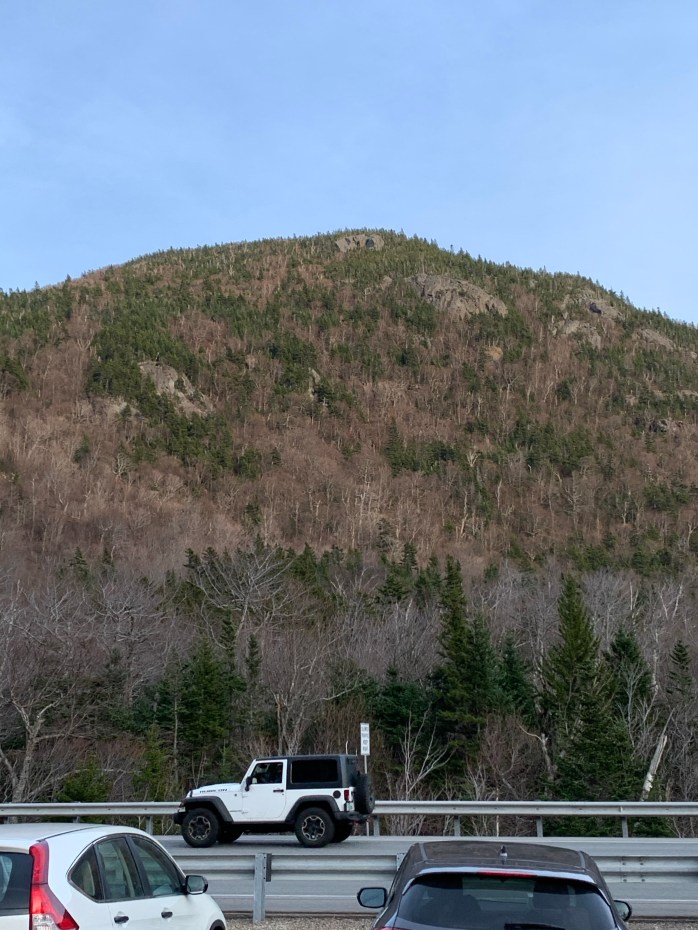
Wildcat ‘D’, (#4) Wildcat ‘A’ and Wildcat Ridge")
Wildcat Ridge consists of 4 peaks and include 2 official 4000 Footers. Wildcat D (4,070 Feet) and Wildcat A (4,422 Feet) are separated by peaks B and C which are not official 4000 footers.
I started at the Glen Ellis Falls trailhead. There is easy access to the Wildcat Ridge Trail from this parking lot. After walking under rt 16 via the pedestrian tunnel, Wildcat is to the left. Its worth the exta 30 minutes to take a right and check out Glen Ellis Falls. After winding down a well maintained moderately steep decent, the reward is one of the best water falls I have encountered in the White Mountains.
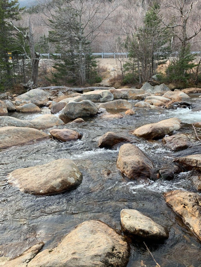
After taking that in, head back up to where you can catch the Wildcat Ridge Trail at the pedestrian underpass. Head toward the river where you find the only water crossing of any significance on this trek. When I went the water was not a high level and boulder hoping was not very difficult. Once across the river, follow the trail until you meet the Lost Pond trail junction. Taking a left will take you along the Lost Pond trail to the AMC camp at Pinkham Notch. I went straight on the Wildcat Ridge trail.
The trail immediately went virtually straight up. It was not anything I had seen before on other hikes. Beautiful wooded boulder hopping for about a half mile. Then at .4 miles in I encountered my first substantial obstacle. I climbed up a 10′ or so granite step to find myself on a ledge. It was about 18 inches wide with a 30 or so foot drop on my left. The 18 inch ledge was flat for about 15 feet, then inclined up sharply at about 60 degrees over loose dirt and small boulders.
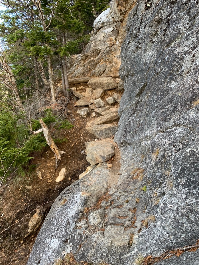
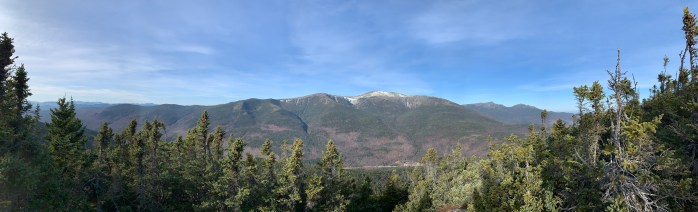
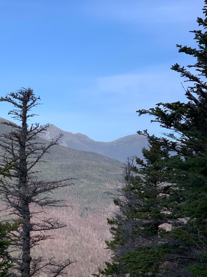
It was at this point that I first questioned if I should go on. I actually stopped by route tracking and hung my feet over the granite step that got me there considering leaving and heading for a different hike. I then thought that things cant get much worse than this and decided to suck it up and forge ahead. Ignoring my vertigo, I inched across the ledge and then used my hands as much as my feet to scale the incline. I gathered myself and moved on confident that I had the worst behind me. The very steep incline continued with a lot of bouldering along the way, but nothing like what I had encountered previously. The views of the presidential range along this section are second to none. Boot Spur, the summit of Mt Washington, Tuckerman and Huntington ravines are close enough to seemingly touch.
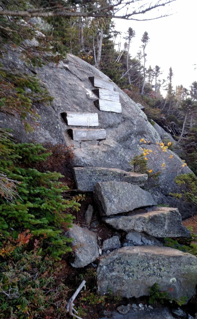
So, as I was thinking the worst was behind me and trudging along the ridge, I encountered an outcropping of lede that had a few wood steps bolted to it. The steps seemed to get to over a difficult part only leave me at a more difficult part. Of course I was already on edge from the first steep scramble. I knew I could turn not turn around as I did not want to descend that first obstacle. Had to do this one also. I climed the steps to where they ended and then had to get low and crawl up about 20 feet with very little to hold on to. If I was to slip, I would slide down 50 feet or so, likely getting hurt. It turns out this is a class 4 obstacle requiring some mountaineering skills to navigate.
I did feel a great sense of accomplishment at this point. After those 2 encounters I was feeling I could do any hike in the Whites. From this point it was steep but smooth to the summit of Wildcat ‘D’ at 4,062 feet. Wildcat ‘D’ is home to Wildcat Ski Area. Just below the official summit of ‘D’ is a chair lift endpoint with truly awe inspiring views of Mt Washington, Adams and Maddison.